Bu fayl "Vikimedia Commons"dadır və digər layihələrdə istifadə edilə bilər.
Faylın təsvir səhifəsinə get
The boundaries on this map show the de facto situation. This is just one of several different views on the subject (see COM:NPOV).
Xülasə
İzahIndia location map2.svg
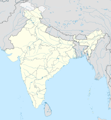
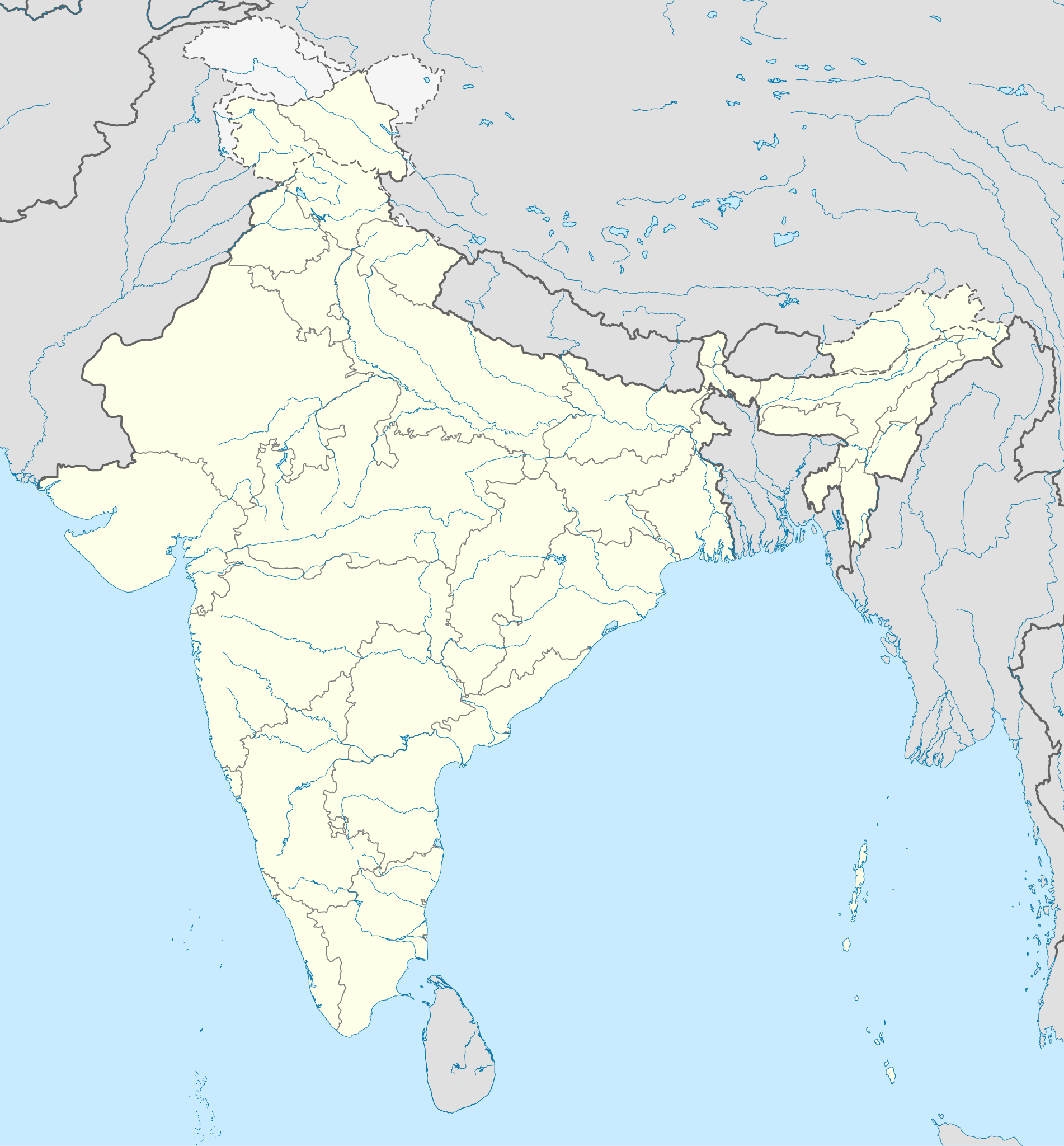
English: Location map of India. Equirectangular projection. Strechted by 106.0%. Geographic limits of the map: * N: 37.5° N * S: 5.0° N * W: 67.0° E * E: 99.0° E Made with Natural Earth. Free vector and raster map data @ naturalearthdata.com.
Tarix
Mənbə
Own work based on: File:India location map.svg by Uwe Dedering at de:Wp
Müəllif
AshwiniKalantri
Digər versiyalar
[redaktə]
English: Location map (Kashmir as part of India)(PNG)
English: Equivalent physical map (JPG)
SVG genesis
InfoField
The SVG code is valid.
This locator map was created with Adobe Illustrator,
and with Inkscape.
Lisenziya
I, the copyright holder of this work, hereby publish it under the following licenses:
Bu fayl Creative Commons Attribution-Share Alike 3.0 Sinqapur lisenziyası altında yayımlanır.
Azadsınız:
paylaşmaq – əsəri köçürmək, paylamaq və ötürmək üçün
remiks etmək – əsəri adaptasiya etmək
Aşağıdakı şərtlərə riayət etməklə:
istinad – Müvafiq kredit verməlisiniz, lisenziyaya bir keçid verməlisiniz və dəyişikliklərin olub olmadığını bildirməlisiniz. Bunu hər hansı bir ağlabatan şəkildə edə bilərsiniz, ancaq lisenziyalaşdırıcının sizi və ya istifadənizi təsdiqləməsini təklif edən bir şəkildə deyil.
bənzər paylaşma – Əsəri remix edirsinizsə, dəyişdirirsinizsə və ya üzərində iş aparırsınızsa, öz töhfələrinizi orijinalda olduğu kimi eyni və ya uyğun lisenziya altında yayımlamalısınız.
Bu fayl Creative Commons Attribution-Share Alike 3.0 Almaniya lisenziyası altında yayımlanır.
Azadsınız:
paylaşmaq – əsəri köçürmək, paylamaq və ötürmək üçün
remiks etmək – əsəri adaptasiya etmək
Aşağıdakı şərtlərə riayət etməklə:
istinad – Müvafiq kredit verməlisiniz, lisenziyaya bir keçid verməlisiniz və dəyişikliklərin olub olmadığını bildirməlisiniz. Bunu hər hansı bir ağlabatan şəkildə edə bilərsiniz, ancaq lisenziyalaşdırıcının sizi və ya istifadənizi təsdiqləməsini təklif edən bir şəkildə deyil.
bənzər paylaşma – Əsəri remix edirsinizsə, dəyişdirirsinizsə və ya üzərində iş aparırsınızsa, öz töhfələrinizi orijinalda olduğu kimi eyni və ya uyğun lisenziya altında yayımlamalısınız.
Bu sənədi GNU Azad Sənədləşdirmə Lisenziyası, Versiya 1.2 və ya Azad Proqram Fondu tərəfindən nəşr olunan hər hansı sonrakı versiya şərtlərinə əsasən dəyişməz bölmələr, ön qapaq mətnləri və arxa qapaq mətnləri olmadan köçürmək, yayımlamaq və / və ya dəyişdirmək üçün icazə verilir; Lisenziyanın bir nüsxəsi GNU Azad Sənədləşdirmə Lisenziyası adlı hissəyə daxil edilmişdir.http://www.gnu.org/copyleft/fdl.htmlGFDLGNU Free Documentation Licensetruetrue
İstədiyiniz lisenziyanı seçə bilərsiniz.
Orijinal yükləmə gündəliyi
This image is a derivative work of the following images:
File:India location map.svg licensed with Cc-by-sa-3.0, Cc-by-sa-3.0-de, GFDL
2011-01-18T16:10:27Z Uwe Dedering 1500x1615 (2478400 Bytes) Reverted to version as of 15:50, 17 January 2011 and again, layer structure destroyed, and first discuss this!
2011-01-17T19:04:20Z AshwiniKalantri 1500x1615 (1593649 Bytes) The disputed land of Kashmir are shown in a different shade.
2011-01-17T15:50:03Z Uwe Dedering 1500x1615 (2478400 Bytes) Reverted to version as of 11:34, 22 September 2010 vandalism
2011-01-16T23:30:30Z AshwiniKalantri 1500x1615 (2104259 Bytes) {{Information |Description=Location Map of India |Source= |Date= |Author= |Permission= |other_versions= }}
2010-09-22T11:34:41Z BishkekRocks 1500x1615 (2478400 Bytes) The area north of the Siachen Glacier is also part of Chinese-controlled Kashmir.
2010-08-31T16:36:47Z Uwe Dedering 1500x1615 (2412750 Bytes) Coloured Pakistani-controlled parts of Kashmir in dark grey & Chinese-controlled Kashmir also. no reason to treat them differently.
2010-08-31T11:26:31Z AnonyLog 1500x1615 (2104259 Bytes) A lighter shade is used for uniformity with other maps of India and Pakistan on Wikipedia.
2010-05-05T16:44:39Z Uwe Dedering 1500x1615 (2412750 Bytes) Reverted to version as of 12:26, 3 March 2010 make them dark-grey if you wish....
2010-05-05T15:43:19Z BishkekRocks 1500x1615 (2104259 Bytes) Coloured Pakistani-controlled parts of Kashmir in light grey (like Chinese-controlled Kashmir). Alternatively colour both in dark grey, no reason to treat them differently.
2010-03-03T12:26:13Z Uwe Dedering 1500x1615 (2412750 Bytes) {{Information |Description={{en|Location map of India. Equirectangular projection. Strechted by 106.0%. Geographic limits of the map: * N: 37.5° N * S: 5.0° N * W: 67.0° E * E: 99.0° E Made with Natural Earth. Free vector
Uploaded with derivativeFX
Captions
Add a one-line explanation of what this file represents
Positionskarte Indiens
Items portrayed in this file
təsvir edir
Şimla
copyright status ingilis
copyrighted ingilis
lisenziya
Creative Commons Attribution-ShareAlike 3.0 Unported ingilis
Creative Commons Attribution-ShareAlike 3.0 Germany ingilis
GNU Free Documentation License, version 1.2 or lateral ingilis
yaranma tarixi
25 fevral 2011
Faylın tarixçəsi
Faylın əvvəlki versiyasını görmək üçün gün/tarix bölməsindəki tarixlərə klikləyin.
{{Information |Description={{en|Location map of India. Equirectangular projection. Strechted by 106.0%. Geographic limits of the map: * N: 37.5° N * S: 5.0° N * W: 67.0° E * E: 99.0° E Made with Natural Earth. Free vector and raster map data @ natural
Bu faylda fotoaparat və ya skanerlə əlavə olunmuş məlumatlar var. Əgər fayl sonradan redaktə olunubsa, bəzi parametrlər bu şəkildə göstərilənlərdən fərqli ola bilər.
Genişlik
1500px
Hündürlük
1614.844px
İyun 11, 2023
fayl, india, location, map2, fayl, faylın, tarixçəsi, fayl, keçidləri, faylın, qlobal, istifadəsi, metaməlumatlarbu, faylın, formatındakı, görünüşünün, ölçüsü, piksel, digər, ölçülər, piksel, piksel, piksel, piksel, piksel, piksel, faylın, orijinalı, 8206, fay. Fayl Faylin tarixcesi Fayl kecidleri Faylin qlobal istifadesi MetamelumatlarBu SVG faylin PNG formatindaki bu gorunusunun olcusu 557 600 piksel Diger olculer 223 240 piksel 446 480 piksel 713 768 piksel 951 1 024 piksel 1 902 2 048 piksel 1 500 1 615 piksel Faylin orijinali 8206 SVG fayli nominal olaraq 1 500 1 615 piksel faylin olcusu 1 69 MB Bu fayl Vikimedia Commons dadirve diger layihelerde istifade edile biler Faylin tesvir sehifesine get The boundaries on this map show the de facto situation This is just one of several different views on the subject see COM NPOV Xulase IzahIndia location map2 svg English Location map of India Equirectangular projection Strechted by 106 0 Geographic limits of the map N 37 5 N S 5 0 N W 67 0 E E 99 0 E Made with Natural Earth Free vector and raster map data naturalearthdata com Tarix 25 fevral 2011 Menbe Own work based on File India location map svg nbsp by Uwe Dedering at de Wp Muellif AshwiniKalantri Diger versiyalar redakte English Location map Kashmir as part of India PNG English Equivalent physical map JPG SVG nbsp genesisInfoField nbsp The SVG code is valid nbsp This locator map was created with Adobe Illustrator nbsp and with Inkscape Lisenziya I the copyright holder of this work hereby publish it under the following licenses Bu fayl Creative Commons Attribution Share Alike 3 0 Sinqapur lisenziyasi altinda yayimlanir Azadsiniz paylasmaq eseri kocurmek paylamaq ve oturmek ucun remiks etmek eseri adaptasiya etmek Asagidaki sertlere riayet etmekle istinad Muvafiq kredit vermelisiniz lisenziyaya bir kecid vermelisiniz ve deyisikliklerin olub olmadigini bildirmelisiniz Bunu her hansi bir aglabatan sekilde ede bilersiniz ancaq lisenziyalasdiricinin sizi ve ya istifadenizi tesdiqlemesini teklif eden bir sekilde deyil benzer paylasma Eseri remix edirsinizse deyisdirirsinizse ve ya uzerinde is aparirsinizsa oz tohfelerinizi orijinalda oldugu kimi eyni ve ya uygun lisenziya altinda yayimlamalisiniz https creativecommons org licenses by sa 3 0 CC BY SA 3 0 Creative Commons Attribution Share Alike 3 0 true trueBu fayl Creative Commons Attribution Share Alike 3 0 Almaniya lisenziyasi altinda yayimlanir Azadsiniz paylasmaq eseri kocurmek paylamaq ve oturmek ucun remiks etmek eseri adaptasiya etmek Asagidaki sertlere riayet etmekle istinad Muvafiq kredit vermelisiniz lisenziyaya bir kecid vermelisiniz ve deyisikliklerin olub olmadigini bildirmelisiniz Bunu her hansi bir aglabatan sekilde ede bilersiniz ancaq lisenziyalasdiricinin sizi ve ya istifadenizi tesdiqlemesini teklif eden bir sekilde deyil benzer paylasma Eseri remix edirsinizse deyisdirirsinizse ve ya uzerinde is aparirsinizsa oz tohfelerinizi orijinalda oldugu kimi eyni ve ya uygun lisenziya altinda yayimlamalisiniz https creativecommons org licenses by sa 3 0 de deed en CC BY SA 3 0 de Creative Commons Attribution Share Alike 3 0 de true true Bu senedi GNU Azad Senedlesdirme Lisenziyasi Versiya 1 2 ve ya Azad Proqram Fondu terefinden nesr olunan her hansi sonraki versiya sertlerine esasen deyismez bolmeler on qapaq metnleri ve arxa qapaq metnleri olmadan kocurmek yayimlamaq ve ve ya deyisdirmek ucun icaze verilir Lisenziyanin bir nusxesi GNU Azad Senedlesdirme Lisenziyasi adli hisseye daxil edilmisdir http www gnu org copyleft fdl html GFDL GNU Free Documentation License true trueIstediyiniz lisenziyani sece bilersiniz Orijinal yukleme gundeliyi This image is a derivative work of the following images File India location map svg licensed with Cc by sa 3 0 Cc by sa 3 0 de GFDL 2011 01 18T16 10 27Z Uwe Dedering 1500x1615 2478400 Bytes Reverted to version as of 15 50 17 January 2011 and again layer structure destroyed and first discuss this 2011 01 17T19 04 20Z AshwiniKalantri 1500x1615 1593649 Bytes The disputed land of Kashmir are shown in a different shade 2011 01 17T15 50 03Z Uwe Dedering 1500x1615 2478400 Bytes Reverted to version as of 11 34 22 September 2010 vandalism 2011 01 16T23 30 30Z AshwiniKalantri 1500x1615 2104259 Bytes Information Description Location Map of India Source Date Author Permission other versions 2010 09 22T11 34 41Z BishkekRocks 1500x1615 2478400 Bytes The area north of the Siachen Glacier is also part of Chinese controlled Kashmir 2010 08 31T16 36 47Z Uwe Dedering 1500x1615 2412750 Bytes Coloured Pakistani controlled parts of Kashmir in dark grey amp Chinese controlled Kashmir also no reason to treat them differently 2010 08 31T11 26 31Z AnonyLog 1500x1615 2104259 Bytes A lighter shade is used for uniformity with other maps of India and Pakistan on Wikipedia 2010 05 05T16 44 39Z Uwe Dedering 1500x1615 2412750 Bytes Reverted to version as of 12 26 3 March 2010 make them dark grey if you wish 2010 05 05T15 43 19Z BishkekRocks 1500x1615 2104259 Bytes Coloured Pakistani controlled parts of Kashmir in light grey like Chinese controlled Kashmir Alternatively colour both in dark grey no reason to treat them differently 2010 03 03T12 26 13Z Uwe Dedering 1500x1615 2412750 Bytes Information Description en Location map of India Equirectangular projection Strechted by 106 0 Geographic limits of the map N 37 5 N S 5 0 N W 67 0 E E 99 0 E Made with Natural Earth Free vector Uploaded with derivativeFXCaptionsazerbaycancaAdd a one line explanation of what this file representsalmanPositionskarte IndiensItems portrayed in this filetesvir edirSimlacopyright status nbsp ingiliscopyrighted nbsp ingilislisenziyaCreative Commons Attribution ShareAlike 3 0 Unported nbsp ingilisCreative Commons Attribution ShareAlike 3 0 Germany nbsp ingilisGNU Free Documentation License version 1 2 or lateral nbsp ingilisyaranma tarixi25 fevral 2011 Faylin tarixcesi Faylin evvelki versiyasini gormek ucun gun tarix bolmesindeki tarixlere klikleyin Tarix VaxtKicik sekilOlculerIstifadeciSerh indiki13 48 14 oktyabr 20201 500 1 615 1 69 MB NordNordWestupd Telangana Andhra Pradesh 10 58 2 noyabr 20191 500 1 615 1 65 MB NordNordWestupd Jammu and Kashmir 08 59 3 iyun 20141 500 1 615 1 63 MB NordNordWest Telangana 12 58 11 iyun 20121 500 1 615 1 54 MB NordNordWestadding waterbodies 20 30 25 fevral 20111 500 1 615 1 57 MB AshwiniKalantri Information Description en Location map of India Equirectangular projection Strechted by 106 0 Geographic limits of the map N 37 5 N S 5 0 N W 67 0 E E 99 0 E Made with Natural Earth Free vector and raster map data natural Fayl kecidleri Bu sekile olan kecidler Asiya olkelerinin siyahisi Cenubi Asiya olkelerinin siyahisi Faylin qlobal istifadesi Bu fayl asagidaki vikilerde istifade olunur als wikipedia org layihesinde istifadesi Chemiekatastrophe von Bhopal Vorlage Positionskarte Indien Vorlage Infobox Ort in Indien Neu Delhi Kalkutta Mumbai Benutzer Avernarius Calicut bh wikipedia org layihesinde istifadesi 2023 आईप एल Module Location map data India2 Module Location map data India2 doc de wikipedia org layihesinde istifadesi Indien Varanasi Bhopal Taj Mahal Rajgir Dharamsala Neu Delhi Mumbai Kalkutta Darjeeling Stadt Prayagraj Ahmedabad Chandigarh Amritsar Chennai Bengaluru Tharangambadi Qadian Hyderabad Indien Kozhikode Agartala Pune Agra Auroville Hampi Sarnath Jaipur Leh Katastrophe von Bhopal Mahe Indien Deoband Srinagar Vrindavan Velha Goa Patna Bodhgaya Madurai Kanpur Surat Lucknow Bu faylin qlobal istifadesine baxin Metamelumatlar Bu faylda fotoaparat ve ya skanerle elave olunmus melumatlar var Eger fayl sonradan redakte olunubsa bezi parametrler bu sekilde gosterilenlerden ferqli ola biler Genislik1500pxHundurluk1614 844px Menbe https az wikipedia org wiki Fayl India location map2 svg, wikipedia, oxu, kitab, kitabxana, axtar, tap, hersey,
ne axtarsan burda
, en yaxsi meqale sayti, meqaleler, kitablar, oyrenmek, wiki, bilgi, tarix, seks, porno, indir, yukle, sex, azeri sex, azeri, seks yukle, sex yukle, izle, seks izle, porno izle, mobil seks, telefon ucun, chat, azeri chat, tanisliq, tanishliq, azeri tanishliq, sayt, medeni, medeni saytlar, chatlar, mekan, tanisliq mekani, mekanlari, yüklə, pulsuz, pulsuz yüklə, mp3, video, mp4, 3gp, jpg, jpeg, gif, png, şəkil, muisiqi, mahnı, kino, film, kitab, oyun, oyunlar.