Bu fayl "Vikimedia Commons"dadır və digər layihələrdə istifadə edilə bilər.
Faylın təsvir səhifəsinə get
Xülasə
İzahCongo physical map.svg
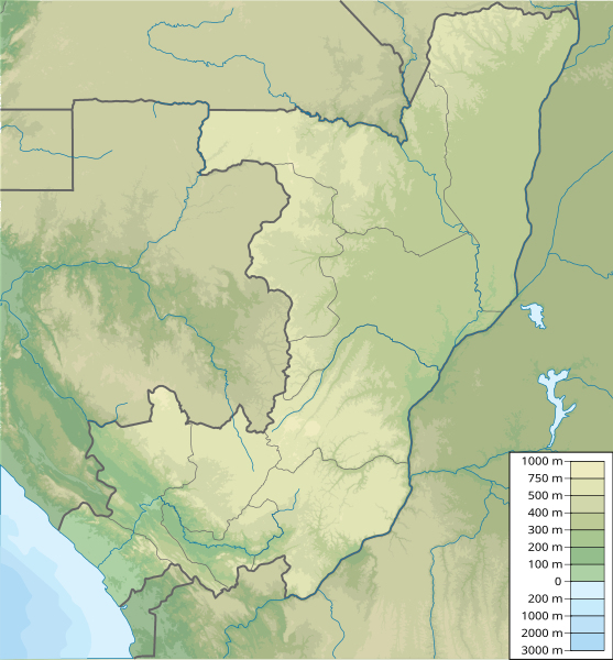
Map of the Republic of the Congo, parameters equivalent to File:Congo location map.svg
Tarix
Mənbə
Öz işi
Müəllif
Urutseg
Lisenziya
I, the copyright holder of this work, hereby publish it under the following license:
This file is made available under the Creative Commons CC0 1.0 Universal Public Domain Dedication.
The person who associated a work with this deed has dedicated the work to the public domain by waiving all of their rights to the work worldwide under copyright law, including all related and neighboring rights, to the extent allowed by law. You can copy, modify, distribute and perform the work, even for commercial purposes, all without asking permission.
http://creativecommons.org/publicdomain/zero/1.0/deed.enCC0Creative Commons Zero, Public Domain Dedicationfalsefalse
Captions
Add a one-line explanation of what this file represents
fayl, congo, physical, fayl, faylın, tarixçəsi, istifadə, edilən, səhifələr, faylın, qlobal, istifadəsibu, faylın, formatındakı, görünüşünün, ölçüsü, piksel, digər, ölçülər, piksel, piksel, piksel, piksel, piksel, piksel, faylın, orijinalı, 8206, faylı, nomina. Fayl Faylin tarixcesi Istifade edilen sehifeler Faylin qlobal istifadesiBu SVG faylin PNG formatindaki bu gorunusunun olcusu 557 600 piksel Diger olculer 223 240 piksel 446 480 piksel 713 768 piksel 951 1 024 piksel 1 903 2 048 piksel 851 916 piksel Faylin orijinali 8206 SVG fayli nominal olaraq 851 916 piksel faylin olcusu 2 26 MB Bu fayl Vikimedia Commons dadirve diger layihelerde istifade edile biler Faylin tesvir sehifesine get Xulase IzahCongo physical map svg Map of the Republic of the Congo parameters equivalent to File Congo location map svgTarix 11 mart 2011Menbe Oz isiMuellif Urutseg Lisenziya I the copyright holder of this work hereby publish it under the following license This file is made available under the Creative Commons CC0 1 0 Universal Public Domain Dedication The person who associated a work with this deed has dedicated the work to the public domain by waiving all of their rights to the work worldwide under copyright law including all related and neighboring rights to the extent allowed by law You can copy modify distribute and perform the work even for commercial purposes all without asking permission http creativecommons org publicdomain zero 1 0 deed en CC0 Creative Commons Zero Public Domain Dedication false falseCaptionsazerbaycancaAdd a one line explanation of what this file representsItems portrayed in this filetesvir ediryaradiciSome value without a Vikiverilenler itemmuellifin qisa adi UrutsegWikimedia username ingilis UrutsegURL ingilis http commons wikimedia org wiki User Urutsegcopyright status ingiliscopyrighted dedicated to the public domain by copyright holder ingilislisenziyaCC0 ingilisyaranma tarixi11 mart 2011source of file ingilisoriginal creation by uploader ingilis Faylin tarixcesi Faylin evvelki versiyasini gormek ucun gun tarix bolmesindeki tarixlere klikleyin Tarix VaxtKicik sekilOlculerIstifadeciSerh indiki07 16 12 mart 2011851 916 2 26 MB Urutseg Istifade edilen sehifeler Bu sekile olan kecidler Konqo Respublikasi Tele golu Sablon Yer xeritesi Konqo Respublikasi Faylin qlobal istifadesi Bu fayl asagidaki vikilerde istifade olunur ar wikipedia org layihesinde istifadesi تفجيرات برازافيل 2012 قالب خريطة مواقع جمهورية الكونغو ast wikipedia org layihesinde istifadesi Modulu Minimapa data El Congu Modulu Minimapa data El Congu usu avk wikipedia org layihesinde istifadesi Kongoa ba wikipedia org layihesinde istifadesi Ҡalyp PozKarta Kongo Respublikaһy be tarask wikipedia org layihesinde istifadesi Shablyon Lyakalizacyjnaya mapa Respubliki Konga bg wikipedia org layihesinde istifadesi Etumbi Brazavil Shablon PK Republika Kongo Mbinda Ojo Republika Kongo Poant Noar Sanga reka Kuilu reka Malebo bn wikipedia org layihesinde istifadesi মড উল অবস থ ন ম নচ ত র উপ ত ত কঙ গ প রজ তন ত র মড উল অবস থ ন ম নচ ত র উপ ত ত কঙ গ প রজ তন ত র নথ bs wikipedia org layihesinde istifadesi Sablon Lokacijska karta Republika Kongo ceb wikipedia org layihesinde istifadesi Plantilya Location map Republic of the Congo ce wikipedia org layihesinde istifadesi Kep Mettigan karta Respublika Kongo ckb wikipedia org layihesinde istifadesi داڕێژە Location map Republic of the Congo cs wikipedia org layihesinde istifadesi Sablona LocMap Konzska republika Mont Nabemba da wikipedia org layihesinde istifadesi Skabelon Kortpositioner Republikken Congo de wikipedia org layihesinde istifadesi Republik Kongo Pool Malebo Tele See Kouilou See Vorlage Positionskarte Republik Kongo Mont Nabebe Liste von Kraftwerken in der Republik Kongo Talsperre Imboulou Benutzer Shi Annan Moukoukoulou Dam Bouloukombo Nioundou Bombo Republik Kongo Pic Kiama Tembo Republik Kongo Mont Obima Montagnes Tobo Monts Kinoumbou Kimbonga Monts Kinoumbou Moudzanga Monts de Pangala Monts Kanga de wikivoyage org layihesinde istifadesi Brazzaville Modul Location map data cg Modul Location map data cg Doku el wikipedia org layihesinde istifadesi Protypo Location map Dhmokratia toy Kongko en wikipedia org layihesinde istifadesi Brazzaville Bu faylin qlobal istifadesine baxin Menbe https az wikipedia org wiki Fayl Congo physical map svg, wikipedia, oxu, kitab, kitabxana, axtar, tap, hersey,
ne axtarsan burda
, en yaxsi meqale sayti, meqaleler, kitablar, oyrenmek, wiki, bilgi, tarix, seks, porno, indir, yukle, sex, azeri sex, azeri, seks yukle, sex yukle, izle, seks izle, porno izle, mobil seks, telefon ucun, chat, azeri chat, tanisliq, tanishliq, azeri tanishliq, sayt, medeni, medeni saytlar, chatlar, mekan, tanisliq mekani, mekanlari, yüklə, pulsuz, pulsuz yüklə, mp3, video, mp4, 3gp, jpg, jpeg, gif, png, şəkil, muisiqi, mahnı, kino, film, kitab, oyun, oyunlar.