Bu fayl "Vikimedia Commons"dadır və digər layihələrdə istifadə edilə bilər.
Faylın təsvir səhifəsinə get
Xülasə
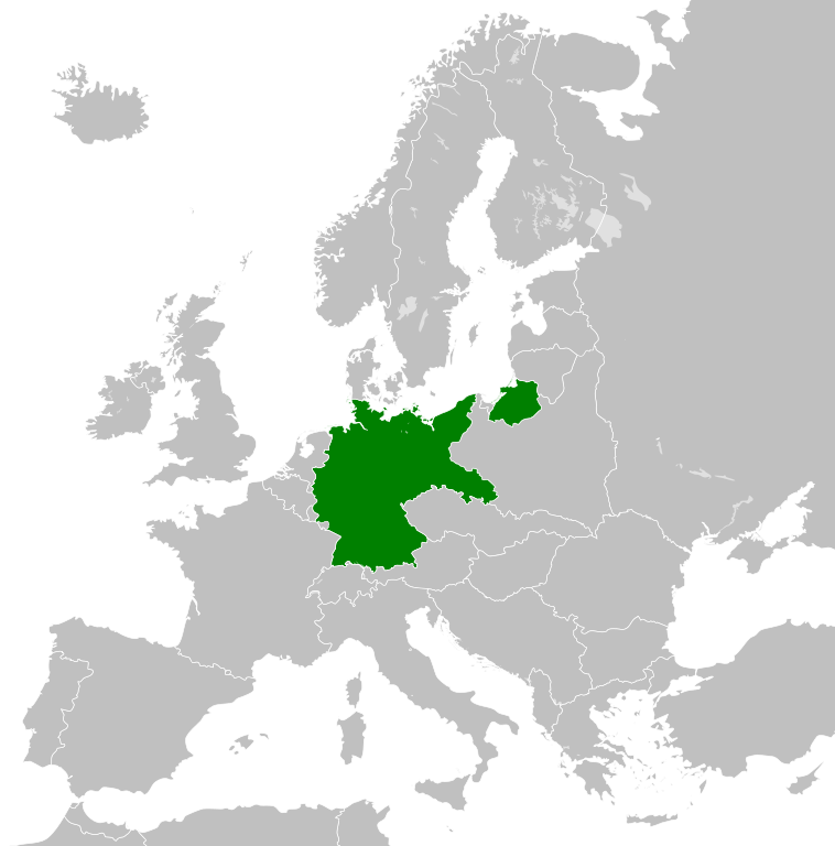
İzahWeimar Republic 1930.svg
Deutsch: Karte der Weimarer Republik/Deutsches Reich innerhalb Europa, ca. 1930
English: Map of the Weimar Republic within Europe circa 1930.
Українська: Карта Веймарської республіки в Європі, 1930 рік.
Tarix
(UTC)
Mənbə
Blank_map_of_Europe.svg
Müəllif
Blank_map_of_Europe.svg: maix¿?
derivative work: Alphathon /'æl.f'æ.ðɒn/ (talk)
Digər versiyalar
Derivative works of this file:
Holocaustdeathtoll%.png
Holocaustdeathtoll%.svg
English: This map is part of a series of historical political maps of Europe. All maps by Alphathon and based upon Blank map of Europe.svg unless otherwise stated.
Deutsch: Diese Karte ist Teil einer Serie historischer politischer Europakarten. Solange nicht anders angegeben, wurden alle Karten durch Alphathon auf Basis von Blank map of Europe.svg erstellt, sofern nicht anders angegeben.
Français : Cette carte fait partie d'une série de cartes historiques et politiques d'Europe. Toutes les cartes ont été créées par Alphathon et basées sur Blank map of Europe.svg sauf indication contraire.
Evolution of specific states
Greece/Byzantine Empire
Byzantine Empire: ca. 330 – 1204; 1261 – 1453
Byzantine Empire – 814
Byzantine Empire – 1190
1453 – 1832 Between 1453 and 1832 there was no independent Greek state. During this period the region was ruled by the Byzantine Empire's Turkish successor: the Ottoman Empire.
Greece: 1832 – Today
Kingdom of Greece – 1890
Kingdom of Greece – 1914
Second Hellenic Republic – 1935
Hellenic State – 1942
Kingdom of Greece – 1973
France
Frankish Empire – 814
West Francia – 843
Kingdom of France – 1000
Kingdom of France – 1097
Kingdom of France – 1190
Kingdom of France – 1789
First French Empire – 1812
Kingdom of France – 1815
Kingdom of France – 1839
French Third Republic – 1914
French Third Republic – 1939
French State(Vichy France) – 1942
Provisional Government of the French Republic – 1945-1949
French Fourth Republic – 1946-1957
See also:French State (incl. occupation zone) – 1942, Military Administration in France – 1942, Military Administration inBelgium and Northern France – 1942
Germany/Holy Roman Empire
Frankish Empire – 814
East Francia – 843
Holy Roman Empire – 1000
Holy Roman Empire – 1004
Holy Roman Empire – 1097
Holy Roman Empire – 1190
Holy Roman Empire – 1789
See also:Kingdom of Germany – 1000
See also:Kingdom of Germany – 1004
1806
Confederation of the Rhine – 1812
German Confederation – 1815
North German Confederation – 1870
A confederation of German client-states of the First French Empire
An attempted partial resurrection of the Holy Roman Empire after the Napoleonic wars
A Prussian-dominated successor to the German Confederation following the 1866 Austro-Prussian War
1871
German Empire – 1914
Weimar Republic – 1930
German Reich – November 1938-March 1939
German Reich – Mar-Sep 1939
Greater German Reich – 1942
Federal Republic of Germany(West Germany) – 1956-90
German Democratic Republic(East Germany) – 1956-90
Austria
Habsburg Monarchy – 1714
Habsburg Monarchy – 1789
Austrian Empire – 1812
Austrian Empire – 1815
Austria-Hungary – 1914
Federal State of Austria – 1938
See also:Austrian Empire excluding Lombardy-Venetia – 1815, Kingdom of Lombardy-Venetia – 1815
Hungary
Approx. territory of the Mayars in 814
Kingdom of Hungary – 1000
Kingdom of Hungary – 1097
Kingdom of Hungary – 1190
Habsburg Monarchy – 1714
Habsburg Monarchy – 1789
Austrian Empire – 1812
Austrian Empire – 1815
Austria-Hungary – 1914
Kingdom of Hungary – 1929-1938
Kingdom of Hungary – 1942
Second Hungarian Republic – 1945-1949
See also: Austrian Empire excluding Lombardy-Venetia – 1815, Kingdom of Lombardy-Venetia – 1815
Hungarian People's Republic – 1956-1990
Italy
Northern Italy
774 – ≈1176 /1805
Frankish Empire – 814
Middle Francia – 843
Kingdom of Italy(Holy Roman Empire) – 1000
1805 – 1814
Kingdom of Italy (Napoleonic) – 1812
Southern Italy
774 – 1860
Norman possessions in southern Italy – 1097
Norman Kingdom of Sicily – 1190
Kingdom of the Two Sicilies – 1839
Risorgimento
1860 – 20xx
Kingdom of Sardinia – 1860
Kingdom of Italy – 1861
Kingdom of Italy – 1870
Kingdom of Italy – 1914
Kingdom of Italy – 1936
Kingdom of Italy – 1943
Italian Social Republic – 1943
Poland
Duchy of Poland – 1000
Kingdom of Poland – 1097
Kingdom of Poland – 1190
Polish-Lithuanian Commonwealth – 1714
Polish-Lithuanian Commonwealth – 1789
Duchy of Warsaw – 1812
Congress Poland – 1815
Second Polish Republic – 1930
General Government – 1942
Polish People's Republic – 1956-90
See also:Free City of Danzig – 1812
See also:Free City of Danzig – 1930
Brandenburg, the Teutonic Order and Prussia
Kingdom of Prussia – 1714
Kingdom of Prussia – 1789
Kingdom of Prussia – 1815
Kingdom of Prussia – 1815
Kingdom of Prussia – 1870
9th Century
814
Blank map of Europe 814.svg
Francia/Frankish Empire/Carolingian Empire
Byzantine (East Roman) Empire
First Bulgarian Empire
Kingdom of Asturias
Approx. territory of the Magyars
843
Blank map of Europe 843.svg
West Francia
Middle Francia
East Francia
11th Century
1000
Blank map of Europe 1000.svg
Holy Roman Empire
Kingdom of Germany
Kingdom of Italy
Kingdom of Arles/Arelat/Burgundy
Kingdom of France
Kingdom of Hungary
Duchy of Poland
Duchy of Bohemia
1004
Blank map of Europe 1004.svg
Holy Roman Empire
Kingdom of Germany
1097
Blank map of Europe 1097.svg
Holy Roman Empire
Kingdom of France
Kingdom of Hungary
Kingdoms of Castile and León
Norman possessions in Southern Italy
12th Century
1190
Blank map of Europe 1190.svg
Holy Roman Empire
Byzantine (East Roman) Empire
Angevin Empire (England)
Kingdom of France
Kingdom of Hungary
Kingdom of Poland
(Norman) Kingdom of Sicily
Kingdom of Aragon
Kingdoms of Castile and León
Kingdom of Portugal
18th Century
1714
Blank map of Europe 1714.svg
Kingdom of Prussia
Habsburg Monarchy
Polish-Lithuanian Commonwealth
Swiss Confederacy
1789
Europe 1789.svg
Holy Roman Empire
(Alternative version excluding extra-imperial Prussian and Habsburg territory derivative work by TRAJAN 117)
Habsburg Monarchy
(alternative file: Habsburg Hereditary Lands derivative work by TRAJAN 117)
Austrian Netherlands
Duchy of Milan
Kingdom of Prussia
Electorate of Brunswick-Lüneburg
Electorate of Bavaria
Electorate of Saxony
Duchy of Württemberg
Duchy of Mecklenburg-Schwerin
Duchy of Holstein
Landgraviate of Hesse-Kassel
Ecclesiastical lands of the Holy Roman Empire
Republic of Venice
Papal States
Grand Duchy of Tuscany
Kingdom of Sardinia
Republic of Genoa
Polish-Lithuanian Commonwealth
Kingdom of Sweden
Kingdom of Great Britain
Kingdom of Ireland derivative work by Elevatorrailfan
Kingdom of France derivative work by TRAJAN 117
(Cropped version derivative work by Dbachmann)
Dutch Republic derivative work by TRAJAN 117
Kingdom of Spain derivative work by TRAJAN 117
Voivodeship of Wallachia derivative work by TRAJAN 117
Voivodeship of Moldavia derivative work by TRAJAN 117
19th Century
1812
Europe at the height of Napoleon's power.
Blank map of Europe 1812.svg
First French Empire and its satellite states
French Empire derivative work by TRAJAN 117
Confederation of the Rhine derivative work by TRAJAN 117
Austrian Empire derivative work by TRAJAN 117
Kingdom of Bavaria
Kingdom of Westphalia
Kingdom of Saxony
Principality of Erfurt derivative work by OwenBlacker
Free City of Danzig derivative work by TRAJAN 117
Duchy of Warsaw derivative work by TRAJAN 117
Prince-Bishopric of Montenegro derivative work by TRAJAN 117
Territory of the First Serbian Uprising derivative work by TRAJAN 117
Voivodeship of Wallachia derivative work by TRAJAN 117
Voivodeship of Moldavia derivative work by TRAJAN 117
Kingdom of Italy derivative work by TRAJAN 117
Kingdom of Spain derivative work by TRAJAN 117
1815
Europe following the Congress of Vienna, which restored much of the old order following the Napoleonic wars.
Blank map of Europe 1815.svg
German Confederation
German Confederation(alt. colour scheme)derivative work by TRAJAN 117
Austrian Empire
Austrian Empire(incl. Lombardy-Venetia)derivative work by TRAJAN 117
Kingdom of Lombardy-Venetia
Kingdom of Prussia
Kingdom of Bavaria
Kingdom of Hanover
Kingdom of Württemberg
Kingdom of Saxony
Grand Duchy of Baden
United Kingdom of the Netherlands
Grand Duchy of Luxembourg
Kingdom of Sardinia
Free, Independent, and Strictly Neutral City of Kraków
Congress Poland
Kingdom of France derivative work by TRAJAN 117
1839
Blank map of Europe 1839.svg derivative work by ArnoldPlaton
Kingdom of France derivative work by Elevatorrailfan
Kingdom of the Two Sicilies derivative work by Elevatorrailfan
1860
Blank map of Europe 1860.svg
Kingdom of Sardinia
1861
Blank map of Europe 1861.svg
Kingdom of Italy
1870
Blank map of Europe 1870.svg
North German Confederation
Kingdom of Prussia
Kingdom of Italy
1890
Blank map of Europe 1890.svg
Principality of Bulgaria derivative work by TRAJAN 117
Kingdom of Greece derivative work by TRAJAN 117
Principality of Montenegro derivative work by TRAJAN 117
Kingdom of Portugal derivative work by TRAJAN 117
Kingdom of Romania derivative work by TRAJAN 117
20th Century
1914
Blank map of Europe 1914.svg
German Empire
Province of Pomerania
Austria-Hungary derivative work by TRAJAN 117
French Third Republicderivative work by Sémhur
Grand Duchy/Principality of Finland derivative work by TRAJAN 117
Kingdom of Italy derivative work by WindEwriX
Kingdom of Bulgaria derivative work by TRAJAN 117
Kingdom of Greece derivative work by TRAJAN 117
Kingdom of Serbia derivative work by TRAJAN 117
Kingdom of Montenegro derivative work by TRAJAN 117
Kingdom of Romania derivative work by TRAJAN 117
1929-1938
Blank map of Europe 1929-1938.svg
The Weimar Republic
Czechoslovakia/Czechoslovak Republic derivative work by TRAJAN 117
Free City of Danzig
Albanian Kingdom derivative work by TRAJAN 117
Second Polish Republic
Second Hellenic Republic (Greece) derivative work by TRAJAN 117
Second Spanish Republic derivative work by TRAJAN 117
Kingdom of Yugoslavia derivative work by TRAJAN 117
Kingdom of Italy derivative work by TRAJAN 117
Spanish Morocco derivative work by TRAJAN 117
The Little Entente derivative work by Tschechoslowakei
Irish Free State derivative work by Elevatorrailfan
Federal State of Austria derivative work by TRAJAN 117
Kingdom of Hungary
October 1938 - March 1939
Blank map of Europe October 1938 - March 1939.svg
German Reich (Nazi Germany) derivative work by TRAJAN 117
(First) Czechoslovak Republic (Czechoslovakia) derivative work by TRAJAN 117
Kingdom of Romania derivative work by TRAJAN 117
Albanian Kingdom derivative work by TRAJAN 117
March - September 1939
Blank map of Europe March - September 1939.svg derivative work by Goran tek-en
German Reich (Nazi Germany) derivative work by DIREKTOR
French Third Republicderivative work by DIREKTOR
1942
Europe 1942.svg
Europe in 1942 (coloured, with legend and labels) derivative work by Goran tek-en
Europe in 1942 (coloured, with key) derivative work by Goran tek-en
Europe in 1942 (coloured, no key) derivative work by Goran tek-en
Axis Occupation of Europe (1942) derivative work by TRAJAN 117
German Reich + occupations derivative work by DIREKTOR
11-19 November derivative work by DIREKTOR
Greater German Reich (Nazi Germany) derivative work by TRAJAN 117
(Alternative file derivative work by DIREKTOR)
General Government (Poland) derivative work by TRAJAN 117
Protectorate of Bohemia and Moravia derivative work by TRAJAN 117
French State (incl. occupation zone) derivative work by TRAJAN 117
French State (excl. occupation zone) derivative work by DIREKTOR
Militärverwaltung in Frankreichderivative work by TRAJAN 117
Militärverwaltung in Belgien und Nordfrankreichderivative work by TRAJAN 117
Reichskommissariat Niederlandederivative work by TRAJAN 117
Reichskommissariat Norwegenderivative work by TRAJAN 117
Reichskommissariat Ostlandderivative work by TRAJAN 117
Reichskommissariat Ukraine derivative work by TRAJAN 117
General District of Crimea derivative work by TRAJAN 117
Republic of Finland derivative work by TRAJAN 117
Kingdom of Hungary derivative work by TRAJAN 117
Kingdom of Romania derivative work by TRAJAN 117
Kingdom of Bulgaria derivative work by TRAJAN 117
Albanian Kingdom derivative work by TRAJAN 117
Kingdom of Iceland derivative work by TRAJAN 117
Hellenic State (Greece) derivative work by TRAJAN 117
Territory of the Military Commander in Serbia (Occupied Serbia)
Independent State of Croatia derivative work by TRAJAN 117
Slovak State/First Slovak Republic derivative work by TRAJAN 117
Italian Governorate (or Kingdom) of Montenegro derivative work by TRAJAN 117
Italian Social Republic derivative work by Elevatorrailfan
Italian Social Republic in 1943 derivative work by Elevatorrailfan
Ireland derivative work by Elevatorrailfan
1956-1990
Blank map of Europe 1956-1990.svg
People's Socialist Republic of Albania derivative work by StalwartUK
People's Republic of Bulgaria derivative work by StalwartUK
Czechoslovakia
East Germany/German Democratic Republic derivative work by StalwartUK
West Germany/Federal Republic of Germany derivative work by StalwartUK
Kingdom of Greece derivative work by TRAJAN 117
People's Republic of Hungary derivative work by StalwartUK
Polish People's Republic derivative work by StalwartUK
People's/Socialist Republic of Romania derivative work by StalwartUK
Socialist Federal Republic of Yugoslavia derivative work by StalwartUK
Francoist Spain derivative work by TRAJAN 117
NATO and the Warsaw Pact circa 1973
Lisenziya
Bu fayl Creative Commons Attribution-Share Alike 3.0 Sinqapur lisenziyası altında yayımlanır.
Azadsınız:
paylaşmaq – əsəri köçürmək, paylamaq və ötürmək üçün
remiks etmək – əsəri adaptasiya etmək
Aşağıdakı şərtlərə riayət etməklə:
istinad – Müvafiq kredit verməlisiniz, lisenziyaya bir keçid verməlisiniz və dəyişikliklərin olub olmadığını bildirməlisiniz. Bunu hər hansı bir ağlabatan şəkildə edə bilərsiniz, ancaq lisenziyalaşdırıcının sizi və ya istifadənizi təsdiqləməsini təklif edən bir şəkildə deyil.
bənzər paylaşma – Əsəri remix edirsinizsə, dəyişdirirsinizsə və ya üzərində iş aparırsınızsa, öz töhfələrinizi orijinalda olduğu kimi eyni və ya uyğun lisenziya altında yayımlamalısınız.
2011-08-23T10:26:48Z Heb 680x520 (604212 Bytes) Added [[:en:Bornholm]] (taken from [[:File:Denmark blank map.svg]])
2011-04-12T00:40:40Z Alphathon 680x520 (602549 Bytes) Upgraded Sicily based on "File:Freeworldmaps-sicily.jpg". Upgraded Malta based on "File:Map of Malta 2.png". Simplified Croatian borders.
2011-04-10T21:43:04Z Alphathon 680x520 (607359 Bytes) Upgraded Croatia, Bosnia & Herzegovina, Slovenia and surrounding countries based on data from "File:Kroatien - Politische Gliederung (Karte).png"
2011-04-10T20:05:09Z Alphathon 680x520 (568373 Bytes) Improved Serbia, Montenegro and surrounding countries using data from "File:Serbia Map.png". Fixed Serbia-Montenegro border. Added Kosovo (using dashed border, since it is not a universally recognised nation, and left the lan
2011-04-10T15:55:02Z Alphathon 680x520 (524980 Bytes) Tweaked Ukraine and surrounding countries based on data from "File:Up-map.png"
2011-04-10T04:02:09Z Alphathon 680x520 (511168 Bytes) Improved Greece, Albania, F.Y.R. Macedonia and Bulgaria based on "File:Greece topo.jpg"
2011-04-10T02:48:52Z Alphathon 680x520 (505569 Bytes) Tweaked Germany and surrounding countries based on info from "File:Germany_general_map.png"
2011-04-10T01:54:05Z Alphathon 680x520 (493733 Bytes) Converted all lakes back to separate layer. Added Finish lakes and tweaked Finland shape based on "File:Finland 1996 CIA map.jpg". Added Swiss lakes based on "File:Suisse cantons.svg". Tweaked Scotland and added Lochs.
2011-04-10T00:07:54Z Alphathon 680x520 (450120 Bytes) Improved England outline and added Isle of Wight based on "File:England Regions - Blank.svg". Improved Denmark based on "File:2 digit postcode danmark.png". Improved Sweden based on "File:Map of Sweden, CIA, 1996.jpg"
2011-04-08T15:53:07Z Alphathon 680x520 (438878 Bytes) Upgraded/fixed various parts of the map. Details: *Some minor fixes to Ireland and added some of the larger lakes based on [[:File:Ireland_trad_counties_named.svg]] *Pretty major fixes to Scotland (mainly the west coast and i
2008-09-17T09:50:25Z F7 680x520 (531491 Bytes) '
2008-09-17T09:42:57Z F7 680x520 (2353 Bytes) '
2008-05-26T19:04:07Z Collard 680x520 (531491 Bytes) uploading on behalf of [[User:Checkit]], direct complaints to him plox: 'Moved countries out of the "outlines" group, removed "outlines" style class, remove separate style information for Russia'
2008-04-30T01:38:52Z TimothyBourke 680x520 (531767 Bytes) Changed the country code of Serbia to RS per [http://en.wikipedia.org/wiki/Serbian_country_codes] and the file [http://www.iso.org/iso/iso3166_en_code_lists.txt].
2007-07-10T11:47:59Z MrWeeble 680x520 (533112 Bytes) Updated to include British Crown Dependencies as seperate entities and regroup them as "British Islands", with some simplifications to the XML and CSS
2007-05-14T17:17:34Z Zirland 680x520 (540659 Bytes) serbia and montenegro
2007-03-30T20:40:49Z W!B: 680x520 (538830 Bytes) minor corr: update nl:Ijsselmeer, del fi:lakes (all small), add ru:lake Oneka (all ref maps.google), glued northern irland back to ie ;)
2007-02-04T15:07:29Z Maix 680x520 (538310 Bytes) {{Information |Description=A blank Map of Europe in SVG format. Every country has an id which is its ISO-3116-1-ALPHA2 code in lower case for easy coloring. |Source=Image based on [[Image:Europe_countries.svg|]] by [[User:Ti
Uploaded with derivativeFX
Captions
Add a one-line explanation of what this file represents
Green:Germany
Items portrayed in this file
təsvir edir
copyright status ingilis
copyrighted ingilis
lisenziya
Creative Commons Attribution-ShareAlike 3.0 Unported ingilis
yaranma tarixi
27 oktyabr 2011
Faylın tarixçəsi
Faylın əvvəlki versiyasını görmək üçün gün/tarix bölməsindəki tarixlərə klikləyin.
== {{int:filedesc}} == {{Information |Description={{en|A Map of the Weimar Republic within Europe circa 1930.}} |Source=*File:Blank_map_of_Europe.svg |Date=2011-10-27 02:10 (UTC) |Author=*File:Blank_map_of_Europe.svg: maix<sup>[[
Bu faylda fotoaparat və ya skanerlə əlavə olunmuş məlumatlar var. Əgər fayl sonradan redaktə olunubsa, bəzi parametrlər bu şəkildə göstərilənlərdən fərqli ola bilər.
Şəkil başlığı
A blank Map of Europe. Every country has an id which is its ISO-3166-1-ALPHA2 code in lower case.
Members of the EU have a class="eu", countries in europe (which I found turkey to be but russia not) have a class="europe". Certain countries are further subdivided the United Kingdom has gb-gbn for Great Britain and gb-nir for Northern Ireland. Russia is divided into ru-kgd for the Kaliningrad Oblast and ru-main for the Main body of Russia. There is the additional grouping #xb for the "British Islands" (the UK with its Crown Dependencies - Jersey, Guernsey and the Isle of Man) Contributors. Original Image: (http://commons.wikimedia.org/wiki/Image:Europe_countries.svg) Júlio Reis (http://commons.wikimedia.org/wiki/User:Tintazul). Recolouring and tagging with country codes: Marian "maix" Sigler (http://commons.wikimedia.org/wiki/User:Maix) Improved geographical features: http://commons.wikimedia.org/wiki/User:W!B: Updated to reflect dissolution of Serbia & Montenegro: http://commons.wikimedia.org/wiki/User:Zirland Updated to include British Crown Dependencies as seperate entities and regroup them as "British Islands", with some simplifications to the XML and CSS: James Hardy (http://commons.wikimedia.org/wiki/User:MrWeeble)
fayl, weimar, republic, 1930, fayl, faylın, tarixçəsi, istifadə, edilən, səhifələr, faylın, qlobal, istifadəsi, metaməlumatlarbu, faylın, formatındakı, görünüşünün, ölçüsü, piksel, digər, ölçülər, piksel, piksel, piksel, piksel, piksel, faylın, orijinalı, 8206. Fayl Faylin tarixcesi Istifade edilen sehifeler Faylin qlobal istifadesi MetamelumatlarBu SVG faylin PNG formatindaki bu gorunusunun olcusu 450 456 piksel Diger olculer 237 240 piksel 474 480 piksel 758 768 piksel 1 011 1 024 piksel 2 021 2 048 piksel Faylin orijinali 8206 SVG fayli nominal olaraq 450 456 piksel faylin olcusu 483 KB Bu fayl Vikimedia Commons dadirve diger layihelerde istifade edile biler Faylin tesvir sehifesine get Xulase IzahWeimar Republic 1930 svg Deutsch Karte der Weimarer Republik Deutsches Reich innerhalb Europa ca 1930 English Map of the Weimar Republic within Europe circa 1930 Ukrayinska Karta Vejmarskoyi respubliki v Yevropi 1930 rik Tarix 27 oktyabr 2011 02 10 UTC Menbe Blank map of Europe svgMuellif Blank map of Europe svg maix derivative work Alphathon ael f ae dɒn talk Diger versiyalar Derivative works of this file Holocaustdeathtoll png Holocaustdeathtoll svgEnglish This map is part of a series of historical political maps of Europe All maps by Alphathon and based upon Blank map of Europe svg unless otherwise stated Deutsch Diese Karte ist Teil einer Serie historischer politischer Europakarten Solange nicht anders angegeben wurden alle Karten durch Alphathon auf Basis von Blank map of Europe svg erstellt sofern nicht anders angegeben Francais Cette carte fait partie d une serie de cartes historiques et politiques d Europe Toutes les cartes ont ete creees par Alphathon et basees sur Blank map of Europe svg sauf indication contraire Evolution of specific statesGreece Byzantine Empire Byzantine Empire ca 330 1204 1261 1453Byzantine Empire 814 Byzantine Empire 11901453 1832Between 1453 and 1832 there was no independent Greek state During this period the region was ruled by the Byzantine Empire s Turkish successor the Ottoman Empire Greece 1832 TodayKingdom of Greece 1890 Kingdom of Greece 1914 Second Hellenic Republic 1935 Hellenic State 1942 Kingdom of Greece 1973 France Frankish Empire 814 West Francia 843 Kingdom of France 1000 Kingdom of France 1097 Kingdom of France 1190Kingdom of France 1789 First French Empire 1812 Kingdom of France 1815 Kingdom of France 1839 French Third Republic 1914French Third Republic 1939 French State Vichy France 1942 Provisional Government of the French Republic 1945 1949 French Fourth Republic 1946 1957See also French State incl occupation zone 1942 Military Administration in France 1942 Military Administration in Belgium and Northern France 1942 Germany Holy Roman Empire Frankish Empire 814 East Francia 843 Holy Roman Empire 1000 Holy Roman Empire 1004 Holy Roman Empire 1097 Holy Roman Empire 1190 Holy Roman Empire 1789See also Kingdom of Germany 1000 See also Kingdom of Germany 10041806Confederation of the Rhine 1812 German Confederation 1815 North German Confederation 1870A confederation of German client states of the First French Empire An attempted partial resurrection of the Holy Roman Empire after the Napoleonic wars A Prussian dominated successor to the German Confederation following the 1866 Austro Prussian War1871German Empire 1914 Weimar Republic 1930 German Reich November 1938 March 1939 German Reich Mar Sep 1939 Greater German Reich 1942 Federal Republic of Germany West Germany 1956 90 German Democratic Republic East Germany 1956 90 Austria Habsburg Monarchy 1714 Habsburg Monarchy 1789 Austrian Empire 1812 Austrian Empire 1815 Austria Hungary 1914 Federal State of Austria 1938See also Austrian Empire excluding Lombardy Venetia 1815 Kingdom of Lombardy Venetia 1815 Hungary Approx territory of the Mayars in 814 Kingdom of Hungary 1000 Kingdom of Hungary 1097 Kingdom of Hungary 1190 Habsburg Monarchy 1714 Habsburg Monarchy 1789Austrian Empire 1812 Austrian Empire 1815 Austria Hungary 1914 Kingdom of Hungary 1929 1938 Kingdom of Hungary 1942 Second Hungarian Republic 1945 1949See also Austrian Empire excluding Lombardy Venetia 1815 Kingdom of Lombardy Venetia 1815Hungarian People s Republic 1956 1990 Italy Northern Italy774 1176 1805Frankish Empire 814 Middle Francia 843 Kingdom of Italy Holy Roman Empire 10001805 1814Kingdom of Italy Napoleonic 1812Southern Italy774 1860Norman possessions in southern Italy 1097 Norman Kingdom of Sicily 1190 Kingdom of the Two Sicilies 1839Risorgimento1860 20xxKingdom of Sardinia 1860 Kingdom of Italy 1861 Kingdom of Italy 1870 Kingdom of Italy 1914 Kingdom of Italy 1936 Kingdom of Italy 1943 Italian Social Republic 1943 Poland Duchy of Poland 1000 Kingdom of Poland 1097 Kingdom of Poland 1190 Polish Lithuanian Commonwealth 1714 Polish Lithuanian Commonwealth 1789Duchy of Warsaw 1812 Congress Poland 1815 Second Polish Republic 1930 General Government 1942 Polish People s Republic 1956 90See also Free City of Danzig 1812 See also Free City of Danzig 1930 Brandenburg the Teutonic Order and Prussia Kingdom of Prussia 1714 Kingdom of Prussia 1789 Kingdom of Prussia 1815 Kingdom of Prussia 1815 Kingdom of Prussia 1870 9th Century814 Blank map of Europe 814 svg Francia Frankish Empire Carolingian Empire Byzantine East Roman Empire First Bulgarian Empire Kingdom of Asturias Approx territory of the Magyars 843 Blank map of Europe 843 svg West Francia Middle Francia East Francia 11th Century1000 Blank map of Europe 1000 svg Holy Roman Empire Kingdom of Germany Kingdom of Italy Kingdom of Arles Arelat Burgundy Kingdom of France Kingdom of Hungary Duchy of Poland Duchy of Bohemia 1004 Blank map of Europe 1004 svg Holy Roman Empire Kingdom of Germany 1097 Blank map of Europe 1097 svg Holy Roman Empire Kingdom of France Kingdom of Hungary Kingdoms of Castile and Leon Norman possessions in Southern Italy 12th Century1190 Blank map of Europe 1190 svg Holy Roman Empire Byzantine East Roman Empire Angevin Empire England Kingdom of France Kingdom of Hungary Kingdom of Poland Norman Kingdom of Sicily Kingdom of Aragon Kingdoms of Castile and Leon Kingdom of Portugal 18th Century1714 Blank map of Europe 1714 svg Kingdom of Prussia Habsburg Monarchy Polish Lithuanian Commonwealth Swiss Confederacy 1789 Europe 1789 svg Holy Roman Empire Alternative version excluding extra imperial Prussian and Habsburg territory derivative work by TRAJAN 117 Habsburg Monarchy alternative file Habsburg Hereditary Lands derivative work by TRAJAN 117 Austrian Netherlands Duchy of Milan Kingdom of Prussia Electorate of Brunswick Luneburg Electorate of Bavaria Electorate of Saxony Duchy of Wurttemberg Duchy of Mecklenburg Schwerin Duchy of Holstein Landgraviate of Hesse Kassel Ecclesiastical lands of the Holy Roman Empire Republic of Venice Papal States Grand Duchy of Tuscany Kingdom of Sardinia Republic of Genoa Polish Lithuanian Commonwealth Kingdom of Sweden Kingdom of Great Britain Kingdom of Ireland derivative work by Elevatorrailfan Kingdom of France derivative work by TRAJAN 117 Cropped version derivative work by Dbachmann Dutch Republic derivative work by TRAJAN 117 Kingdom of Spain derivative work by TRAJAN 117 Voivodeship of Wallachia derivative work by TRAJAN 117 Voivodeship of Moldavia derivative work by TRAJAN 117 19th Century1812 Europe at the height of Napoleon s power Blank map of Europe 1812 svg First French Empire and its satellite states French Empire derivative work by TRAJAN 117 Confederation of the Rhine derivative work by TRAJAN 117 Austrian Empire derivative work by TRAJAN 117 Kingdom of Bavaria Kingdom of Westphalia Kingdom of Saxony Principality of Erfurt derivative work by OwenBlacker Free City of Danzig derivative work by TRAJAN 117 Duchy of Warsaw derivative work by TRAJAN 117 Prince Bishopric of Montenegro derivative work by TRAJAN 117 Territory of the First Serbian Uprising derivative work by TRAJAN 117 Voivodeship of Wallachia derivative work by TRAJAN 117 Voivodeship of Moldavia derivative work by TRAJAN 117 Kingdom of Italy derivative work by TRAJAN 117 Kingdom of Spain derivative work by TRAJAN 117 1815 Europe following the Congress of Vienna which restored much of the old order following the Napoleonic wars Blank map of Europe 1815 svg German Confederation German Confederation alt colour scheme derivative work by TRAJAN 117 Austrian Empire Austrian Empire incl Lombardy Venetia derivative work by TRAJAN 117 Kingdom of Lombardy Venetia Kingdom of Prussia Kingdom of Bavaria Kingdom of Hanover Kingdom of Wurttemberg Kingdom of Saxony Grand Duchy of Baden United Kingdom of the Netherlands Grand Duchy of Luxembourg Kingdom of Sardinia Free Independent and Strictly Neutral City of Krakow Congress Poland Kingdom of France derivative work by TRAJAN 117 1839 Blank map of Europe 1839 svgderivative work by ArnoldPlaton Kingdom of France derivative work by Elevatorrailfan Kingdom of the Two Sicilies derivative work by Elevatorrailfan 1860 Blank map of Europe 1860 svg Kingdom of Sardinia 1861 Blank map of Europe 1861 svg Kingdom of Italy 1870 Blank map of Europe 1870 svg North German Confederation Kingdom of Prussia Kingdom of Italy 1890 Blank map of Europe 1890 svg Principality of Bulgaria derivative work by TRAJAN 117 Kingdom of Greece derivative work by TRAJAN 117 Principality of Montenegro derivative work by TRAJAN 117 Kingdom of Portugal derivative work by TRAJAN 117 Kingdom of Romania derivative work by TRAJAN 117 20th Century1914 Blank map of Europe 1914 svg German Empire Province of Pomerania Austria Hungary derivative work by TRAJAN 117 French Third Republic derivative work by Semhur Grand Duchy Principality of Finland derivative work by TRAJAN 117 Kingdom of Italy derivative work by WindEwriX Kingdom of Bulgaria derivative work by TRAJAN 117 Kingdom of Greece derivative work by TRAJAN 117 Kingdom of Serbia derivative work by TRAJAN 117 Kingdom of Montenegro derivative work by TRAJAN 117 Kingdom of Romania derivative work by TRAJAN 117 1929 1938 Blank map of Europe 1929 1938 svg The Weimar Republic Czechoslovakia Czechoslovak Republic derivative work by TRAJAN 117 Free City of Danzig Albanian Kingdom derivative work by TRAJAN 117 Second Polish Republic Second Hellenic Republic Greece derivative work by TRAJAN 117 Second Spanish Republic derivative work by TRAJAN 117 Kingdom of Yugoslavia derivative work by TRAJAN 117 Kingdom of Italy derivative work by TRAJAN 117 Spanish Morocco derivative work by TRAJAN 117 The Little Entente derivative work by Tschechoslowakei Irish Free State derivative work by Elevatorrailfan Federal State of Austria derivative work by TRAJAN 117 Kingdom of Hungary October 1938 March 1939 Blank map of Europe October 1938 March 1939 svg German Reich Nazi Germany derivative work by TRAJAN 117 First Czechoslovak Republic Czechoslovakia derivative work by TRAJAN 117 Kingdom of Romania derivative work by TRAJAN 117 Albanian Kingdom derivative work by TRAJAN 117 March September 1939 Blank map of Europe March September 1939 svgderivative work by Goran tek en German Reich Nazi Germany derivative work by DIREKTOR French Third Republic derivative work by DIREKTOR 1942 Europe 1942 svg Europe in 1942 coloured with legend and labels derivative work by Goran tek en Europe in 1942 coloured with key derivative work by Goran tek en Europe in 1942 coloured no key derivative work by Goran tek en Axis Occupation of Europe 1942 derivative work by TRAJAN 117 German Reich occupations derivative work by DIREKTOR 11 19 November derivative work by DIREKTOR Greater German Reich Nazi Germany derivative work by TRAJAN 117 Alternative file derivative work by DIREKTOR General Government Poland derivative work by TRAJAN 117 Protectorate of Bohemia and Moravia derivative work by TRAJAN 117 French State incl occupation zone derivative work by TRAJAN 117 French State excl occupation zone derivative work by DIREKTOR Militarverwaltung in Frankreich derivative work by TRAJAN 117 Militarverwaltung in Belgien und Nordfrankreich derivative work by TRAJAN 117 Reichskommissariat Niederlande derivative work by TRAJAN 117 Reichskommissariat Norwegen derivative work by TRAJAN 117 Reichskommissariat Ostland derivative work by TRAJAN 117 Reichskommissariat Ukraine derivative work by TRAJAN 117 General District of Crimea derivative work by TRAJAN 117 Republic of Finland derivative work by TRAJAN 117 Kingdom of Hungary derivative work by TRAJAN 117 Kingdom of Romania derivative work by TRAJAN 117 Kingdom of Bulgaria derivative work by TRAJAN 117 Albanian Kingdom derivative work by TRAJAN 117 Kingdom of Iceland derivative work by TRAJAN 117 Hellenic State Greece derivative work by TRAJAN 117 Territory of the Military Commander in Serbia Occupied Serbia Independent State of Croatia derivative work by TRAJAN 117 Slovak State First Slovak Republic derivative work by TRAJAN 117 Italian Governorate or Kingdom of Montenegro derivative work by TRAJAN 117 Italian Social Republic derivative work by Elevatorrailfan Italian Social Republic in 1943 derivative work by Elevatorrailfan Ireland derivative work by Elevatorrailfan 1956 1990 Blank map of Europe 1956 1990 svg People s Socialist Republic of Albania derivative work by StalwartUK People s Republic of Bulgaria derivative work by StalwartUK Czechoslovakia East Germany German Democratic Republic derivative work by StalwartUK West Germany Federal Republic of Germany derivative work by StalwartUK Kingdom of Greece derivative work by TRAJAN 117 People s Republic of Hungary derivative work by StalwartUK Polish People s Republic derivative work by StalwartUK People s Socialist Republic of Romania derivative work by StalwartUK Socialist Federal Republic of Yugoslavia derivative work by StalwartUK Francoist Spain derivative work by TRAJAN 117 NATO and the Warsaw Pact circa 1973 Lisenziya Bu fayl Creative Commons Attribution Share Alike 3 0 Sinqapur lisenziyasi altinda yayimlanir Azadsiniz paylasmaq eseri kocurmek paylamaq ve oturmek ucun remiks etmek eseri adaptasiya etmek Asagidaki sertlere riayet etmekle istinad Muvafiq kredit vermelisiniz lisenziyaya bir kecid vermelisiniz ve deyisikliklerin olub olmadigini bildirmelisiniz Bunu her hansi bir aglabatan sekilde ede bilersiniz ancaq lisenziyalasdiricinin sizi ve ya istifadenizi tesdiqlemesini teklif eden bir sekilde deyil benzer paylasma Eseri remix edirsinizse deyisdirirsinizse ve ya uzerinde is aparirsinizsa oz tohfelerinizi orijinalda oldugu kimi eyni ve ya uygun lisenziya altinda yayimlamalisiniz https creativecommons org licenses by sa 3 0 CC BY SA 3 0 Creative Commons Attribution Share Alike 3 0 true true Orijinal yukleme gundeliyi This image is a derivative work of the following images File Blank map of Europe svg licensed with Cc by sa 2 5 2011 09 19T22 57 58Z Alphathon 680x520 603759 Bytes Added North Northern Cyprus 2011 08 23T10 26 48Z Heb 680x520 604212 Bytes Added en Bornholm taken from File Denmark blank map svg 2011 04 12T00 40 40Z Alphathon 680x520 602549 Bytes Upgraded Sicily based on File Freeworldmaps sicily jpg Upgraded Malta based on File Map of Malta 2 png Simplified Croatian borders 2011 04 10T21 43 04Z Alphathon 680x520 607359 Bytes Upgraded Croatia Bosnia amp Herzegovina Slovenia and surrounding countries based on data from File Kroatien Politische Gliederung Karte png 2011 04 10T20 05 09Z Alphathon 680x520 568373 Bytes Improved Serbia Montenegro and surrounding countries using data from File Serbia Map png Fixed Serbia Montenegro border Added Kosovo using dashed border since it is not a universally recognised nation and left the lan 2011 04 10T15 55 02Z Alphathon 680x520 524980 Bytes Tweaked Ukraine and surrounding countries based on data from File Up map png 2011 04 10T04 02 09Z Alphathon 680x520 511168 Bytes Improved Greece Albania F Y R Macedonia and Bulgaria based on File Greece topo jpg 2011 04 10T02 48 52Z Alphathon 680x520 505569 Bytes Tweaked Germany and surrounding countries based on info from File Germany general map png 2011 04 10T01 54 05Z Alphathon 680x520 493733 Bytes Converted all lakes back to separate layer Added Finish lakes and tweaked Finland shape based on File Finland 1996 CIA map jpg Added Swiss lakes based on File Suisse cantons svg Tweaked Scotland and added Lochs 2011 04 10T00 07 54Z Alphathon 680x520 450120 Bytes Improved England outline and added Isle of Wight based on File England Regions Blank svg Improved Denmark based on File 2 digit postcode danmark png Improved Sweden based on File Map of Sweden CIA 1996 jpg 2011 04 08T15 53 07Z Alphathon 680x520 438878 Bytes Upgraded fixed various parts of the map Details Some minor fixes to Ireland and added some of the larger lakes based on File Ireland trad counties named svg Pretty major fixes to Scotland mainly the west coast and i 2008 09 17T09 50 25Z F7 680x520 531491 Bytes 2008 09 17T09 42 57Z F7 680x520 2353 Bytes 2008 05 26T19 04 07Z Collard 680x520 531491 Bytes uploading on behalf of User Checkit direct complaints to him plox Moved countries out of the outlines group removed outlines style class remove separate style information for Russia 2008 04 30T01 38 52Z TimothyBourke 680x520 531767 Bytes Changed the country code of Serbia to RS per http en wikipedia org wiki Serbian country codes and the file http www iso org iso iso3166 en code lists txt 2008 02 08T22 44 37Z CarolSpears 680x520 531767 Bytes validated 2007 07 10T11 47 59Z MrWeeble 680x520 533112 Bytes Updated to include British Crown Dependencies as seperate entities and regroup them as British Islands with some simplifications to the XML and CSS 2007 05 14T17 17 34Z Zirland 680x520 540659 Bytes serbia and montenegro 2007 03 30T20 40 49Z W B 680x520 538830 Bytes minor corr update nl Ijsselmeer del fi lakes all small add ru lake Oneka all ref maps google glued northern irland back to ie 2007 02 05T18 44 32Z Maix 680x520 538295 Bytes cropped 2007 02 04T15 07 29Z Maix 680x520 538310 Bytes Information Description A blank Map of Europe in SVG format Every country has an id which is its ISO 3116 1 ALPHA2 code in lower case for easy coloring Source Image based on Image Europe countries svg by User TiUploaded with derivativeFXCaptionsazerbaycancaAdd a one line explanation of what this file representsingilisGreen GermanyItems portrayed in this filetesvir edircopyright status ingiliscopyrighted ingilislisenziyaCreative Commons Attribution ShareAlike 3 0 Unported ingilisyaranma tarixi27 oktyabr 2011 Faylin tarixcesi Faylin evvelki versiyasini gormek ucun gun tarix bolmesindeki tarixlere klikleyin Tarix VaxtKicik sekilOlculerIstifadeciSerh indiki03 47 24 aprel 2018450 456 483 KB TRAJAN 117Update 08 00 12 avqust 2013450 456 483 KB AlphathonFixed Yugoslav Hungarian border see main file 16 12 25 iyul 2013450 456 469 KB AlphathonRemoved the Flevoland polders Netherlands which were not completed until 1942 1968 03 00 27 oktyabr 2011450 456 469 KB AlphathonMinor tweak 02 49 27 oktyabr 2011450 456 469 KB AlphathonTweaked Romanian borders 02 30 27 oktyabr 2011450 456 465 KB AlphathonA few minor fixes Malta grouped with UK North Cyprus removed a few Greek islands moved to Italy per 1930 ownership 02 10 27 oktyabr 2011450 456 466 KB Alphathon int filedesc Information Description en A Map of the Weimar Republic within Europe circa 1930 Source File Blank map of Europe svg Date 2011 10 27 02 10 UTC Author File Blank map of Europe svg maix lt sup gt Istifade edilen sehifeler Bu sekile olan kecidler Veymar Respublikasi Faylin qlobal istifadesi Bu fayl asagidaki vikilerde istifade olunur af wikipedia org layihesinde istifadesi Republiek van Weimar ar wikipedia org layihesinde istifadesi جمهورية فايمار arz wikipedia org layihesinde istifadesi جمهورية فايمار ast wikipedia org layihesinde istifadesi Republica de Weimar azb wikipedia org layihesinde istifadesi وایمار جومهوریتی ba wikipedia org layihesinde istifadesi Vejmar respublikaһy bg wikipedia org layihesinde istifadesi Vajmarska republika bxr wikipedia org layihesinde istifadesi Vajmaraj bүgede najramdaha ulas ca wikipedia org layihesinde istifadesi Republica de Weimar cs wikipedia org layihesinde istifadesi Vymarska republika el wikipedia org layihesinde istifadesi Dhmokratia ths Baimarhs en wikipedia org layihesinde istifadesi Weimar Republic German nationality law User Falcaorib User Tombricks sandbox Third Reich Germany Yugoslavia relations User TheVoltigeur fakecountry germanstate es wikipedia org layihesinde istifadesi Republica de Weimar fa wikipedia org layihesinde istifadesi جمهوری وایمار fi wikipedia org layihesinde istifadesi Weimarin tasavalta fr wikipedia org layihesinde istifadesi Republique de Weimar ga wikipedia org layihesinde istifadesi Poblacht Weimar gd wikipedia org layihesinde istifadesi Poblachd Weimar gv wikipedia org layihesinde istifadesi Pobblaght Weimar he wikipedia org layihesinde istifadesi רפובליקת ויימאר hi wikipedia org layihesinde istifadesi व इमर गणर ज य ia wikipedia org layihesinde istifadesi Republica de Weimar id wikipedia org layihesinde istifadesi Republik Weimar incubator wikimedia org layihesinde istifadesi Wp krl Weimarin tasavalta io wikipedia org layihesinde istifadesi Weimar Republiko it wikipedia org layihesinde istifadesi Repubblica di Weimar Stati della Repubblica di Weimar ja wikipedia org layihesinde istifadesi ヴァイマル共和政 カップ一揆 kk wikipedia org layihesinde istifadesi Vejmar Respublikasy km wikipedia org layihesinde istifadesi ស ធ រណរដ ឋវ ម ko wikipedia org layihesinde istifadesi 바이마르 공화국 틀 바이마르 공화국 표 ky wikipedia org layihesinde istifadesi Vejmar Respublikasy lt wikipedia org layihesinde istifadesi Veimaro Respublika mg wikipedia org layihesinde istifadesi Repoblikan i Weimar mn wikipedia org layihesinde istifadesi Vajmaryn Bүgd Najramdah Uls mr wikipedia org layihesinde istifadesi व यम र प रज सत त क ms wikipedia org layihesinde istifadesi Republik Weimar pap wikipedia org layihesinde istifadesi Republika di Weimar pl wikipedia org layihesinde istifadesi Republika Weimarska Wikipedysta Malarz pl szablony Panstwo infobox 8 pnb wikipedia org layihesinde istifadesi جمہوریہ وایمار ps wikipedia org layihesinde istifadesi د وايمار جمهوريت pt wikipedia org layihesinde istifadesi Republica de Weimar Bu faylin qlobal istifadesine baxin Metamelumatlar Bu faylda fotoaparat ve ya skanerle elave olunmus melumatlar var Eger fayl sonradan redakte olunubsa bezi parametrler bu sekilde gosterilenlerden ferqli ola biler Sekil basligiA blank Map of Europe Every country has an id which is its ISO 3166 1 ALPHA2 code in lower case Members of the EU have a class eu countries in europe which I found turkey to be but russia not have a class europe Certain countries are further subdivided the United Kingdom has gb gbn for Great Britain and gb nir for Northern Ireland Russia is divided into ru kgd for the Kaliningrad Oblast and ru main for the Main body of Russia There is the additional grouping xb for the British Islands the UK with its Crown Dependencies Jersey Guernsey and the Isle of Man Contributors Original Image http commons wikimedia org wiki Image Europe countries svg Julio Reis http commons wikimedia org wiki User Tintazul Recolouring and tagging with country codes Marian maix Sigler http commons wikimedia org wiki User Maix Improved geographical features http commons wikimedia org wiki User W B Updated to reflect dissolution of Serbia amp Montenegro http commons wikimedia org wiki User Zirland Updated to include British Crown Dependencies as seperate entities and regroup them as British Islands with some simplifications to the XML and CSS James Hardy http commons wikimedia org wiki User MrWeeble Released under CreativeCommons Attribution ShareAlike http creativecommons org licenses by sa 2 5 Genislik450Hundurluk456 Menbe https az wikipedia org wiki Fayl Weimar Republic 1930 svg, wikipedia, oxu, kitab, kitabxana, axtar, tap, hersey,
ne axtarsan burda
, en yaxsi meqale sayti, meqaleler, kitablar, oyrenmek, wiki, bilgi, tarix, seks, porno, indir, yukle, sex, azeri sex, azeri, seks yukle, sex yukle, izle, seks izle, porno izle, mobil seks, telefon ucun, chat, azeri chat, tanisliq, tanishliq, azeri tanishliq, sayt, medeni, medeni saytlar, chatlar, mekan, tanisliq mekani, mekanlari, yüklə, pulsuz, pulsuz yüklə, mp3, video, mp4, 3gp, jpg, jpeg, gif, png, şəkil, muisiqi, mahnı, kino, film, kitab, oyun, oyunlar.