Bu fayl "Vikimedia Commons"dadır və digər layihələrdə istifadə edilə bilər.
Faylın təsvir səhifəsinə get
Xülasə
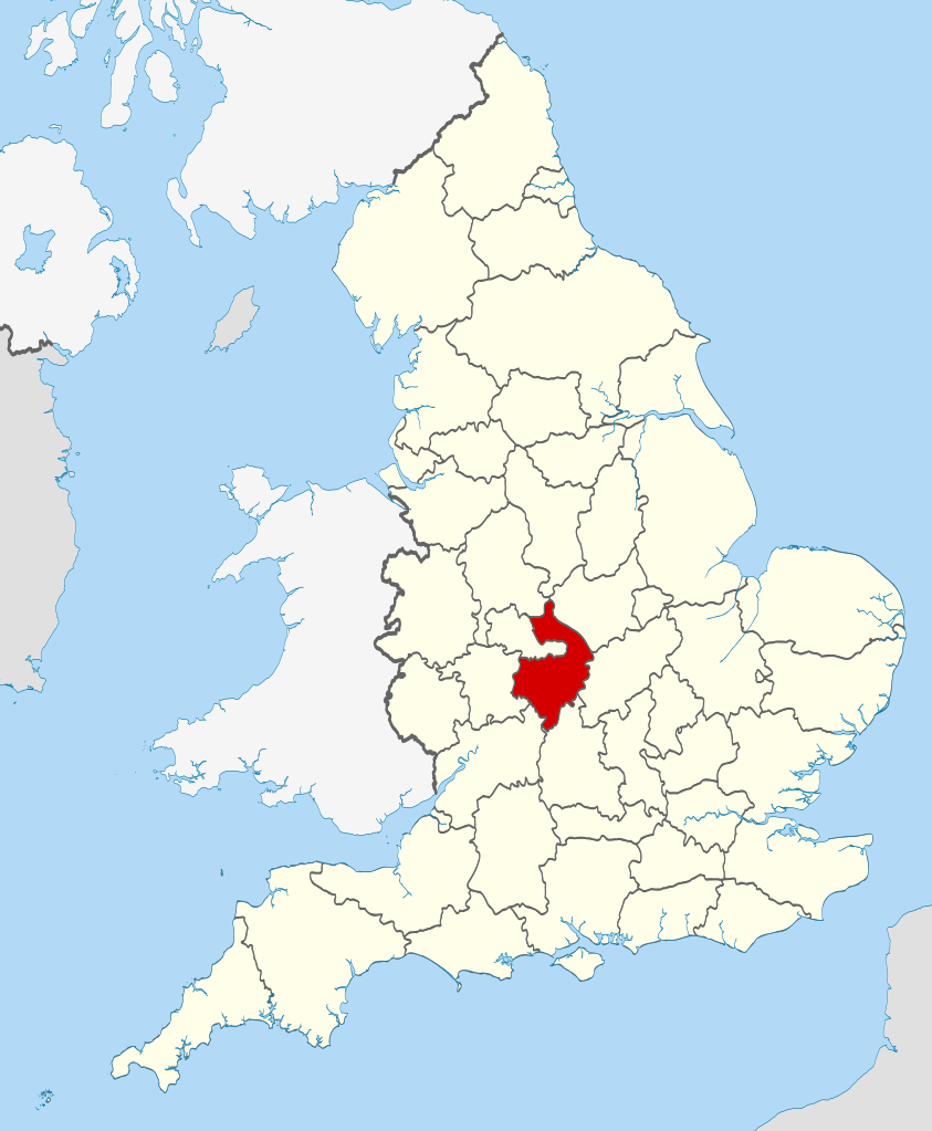
İzahWarwickshire UK locator map 2010.svg
Location of the ceremonial county of Warwickshire within England.
Tarix
Mənbə
Ordnance Survey OpenData:
County boundaries and GB coastline
National Geospatial-Intelligence Agency
Irish, French and Isle of Man coastlines, Lough Neagh and Irish border
Müəllif
Nilfanion
Lisenziya
I, the copyright holder of this work, hereby publish it under the following licenses:
Bu fayl Creative Commons Attribution-Share Alike 3.0 Sinqapur lisenziyası altında yayımlanır.
Azadsınız:
paylaşmaq – əsəri köçürmək, paylamaq və ötürmək üçün
remiks etmək – əsəri adaptasiya etmək
Aşağıdakı şərtlərə riayət etməklə:
istinad – Müvafiq kredit verməlisiniz, lisenziyaya bir keçid verməlisiniz və dəyişikliklərin olub olmadığını bildirməlisiniz. Bunu hər hansı bir ağlabatan şəkildə edə bilərsiniz, ancaq lisenziyalaşdırıcının sizi və ya istifadənizi təsdiqləməsini təklif edən bir şəkildə deyil.
bənzər paylaşma – Əsəri remix edirsinizsə, dəyişdirirsinizsə və ya üzərində iş aparırsınızsa, öz töhfələrinizi orijinalda olduğu kimi eyni və ya uyğun lisenziya altında yayımlamalısınız.
Bu sənədi GNU Azad Sənədləşdirmə Lisenziyası, Versiya 1.2 və ya Azad Proqram Fondu tərəfindən nəşr olunan hər hansı sonrakı versiya şərtlərinə əsasən dəyişməz bölmələr, ön qapaq mətnləri və arxa qapaq mətnləri olmadan köçürmək, yayımlamaq və / və ya dəyişdirmək üçün icazə verilir; Lisenziyanın bir nüsxəsi GNU Azad Sənədləşdirmə Lisenziyası adlı hissəyə daxil edilmişdir.http://www.gnu.org/copyleft/fdl.htmlGFDLGNU Free Documentation Licensetruetrue
İstədiyiniz lisenziyanı seçə bilərsiniz.
This is one of the images forming part of the Valued image set: Locator maps of the Ceremonial counties of England on Wikimedia Commons. The image set has been assessed under the valued image set criteria and is considered the most valued set on Commons within the scope:
Locator maps of the Ceremonial counties of England
You can see its nomination at Commons:Valued image candidates/Locator maps of English ceremonial counties.
Captions
Add a one-line explanation of what this file represents
== Summary == {{Information |Description=Location of the ceremonial county of Warwickshire within England. |Source=Ordnance Survey [https://www.ordnancesurvey.co.uk/opendatadownload/products.html OpenData]: *County
fayl, warwickshire, locator, 2010, fayl, faylın, tarixçəsi, fayl, keçidləri, faylın, qlobal, istifadəsibu, faylın, formatındakı, görünüşünün, ölçüsü, piksel, digər, ölçülər, piksel, piksel, piksel, piksel, piksel, piksel, faylın, orijinalı, 8206, faylı, nomina. Fayl Faylin tarixcesi Fayl kecidleri Faylin qlobal istifadesiBu SVG faylin PNG formatindaki bu gorunusunun olcusu 494 600 piksel Diger olculer 198 240 piksel 395 480 piksel 633 768 piksel 843 1 024 piksel 1 687 2 048 piksel 1 108 1 345 piksel Faylin orijinali 8206 SVG fayli nominal olaraq 1 108 1 345 piksel faylin olcusu 302 KB Bu fayl Vikimedia Commons dadirve diger layihelerde istifade edile biler Faylin tesvir sehifesine get Xulase IzahWarwickshire UK locator map 2010 svg Location of the ceremonial county of Warwickshire within England Tarix 23 noyabr 2010 Menbe Ordnance Survey OpenData County boundaries and GB coastline National Geospatial Intelligence Agency Irish French and Isle of Man coastlines Lough Neagh and Irish border Muellif Nilfanion Lisenziya I the copyright holder of this work hereby publish it under the following licenses Bu fayl Creative Commons Attribution Share Alike 3 0 Sinqapur lisenziyasi altinda yayimlanir Azadsiniz paylasmaq eseri kocurmek paylamaq ve oturmek ucun remiks etmek eseri adaptasiya etmek Asagidaki sertlere riayet etmekle istinad Muvafiq kredit vermelisiniz lisenziyaya bir kecid vermelisiniz ve deyisikliklerin olub olmadigini bildirmelisiniz Bunu her hansi bir aglabatan sekilde ede bilersiniz ancaq lisenziyalasdiricinin sizi ve ya istifadenizi tesdiqlemesini teklif eden bir sekilde deyil benzer paylasma Eseri remix edirsinizse deyisdirirsinizse ve ya uzerinde is aparirsinizsa oz tohfelerinizi orijinalda oldugu kimi eyni ve ya uygun lisenziya altinda yayimlamalisiniz https creativecommons org licenses by sa 3 0 CC BY SA 3 0 Creative Commons Attribution Share Alike 3 0 true true Bu senedi GNU Azad Senedlesdirme Lisenziyasi Versiya 1 2 ve ya Azad Proqram Fondu terefinden nesr olunan her hansi sonraki versiya sertlerine esasen deyismez bolmeler on qapaq metnleri ve arxa qapaq metnleri olmadan kocurmek yayimlamaq ve ve ya deyisdirmek ucun icaze verilir Lisenziyanin bir nusxesi GNU Azad Senedlesdirme Lisenziyasi adli hisseye daxil edilmisdir http www gnu org copyleft fdl html GFDL GNU Free Documentation License true trueIstediyiniz lisenziyani sece bilersiniz This is one of the images forming part of the Valued image set Locator maps of the Ceremonial counties of England on Wikimedia Commons The image set has been assessed under the valued image set criteria and is considered the most valued set on Commons within the scope Locator maps of the Ceremonial counties of England You can see its nomination at Commons Valued image candidates Locator maps of English ceremonial counties CaptionsazerbaycancaAdd a one line explanation of what this file representsItems portrayed in this filetesvir ediryaradiciSome value without a Vikiverilenler itemmuellifin qisa adi NilfanionWikimedia username nbsp ingilis NilfanionURL nbsp ingilis https commons wikimedia org wiki user Nilfanioncopyright status nbsp ingiliscopyrighted nbsp ingilislisenziyaGNU Free Documentation License version 1 2 or later nbsp ingilisCreative Commons Attribution ShareAlike 3 0 Unported nbsp ingilisyaranma tarixi23 noyabr 2010 Faylin tarixcesi Faylin evvelki versiyasini gormek ucun gun tarix bolmesindeki tarixlere klikleyin Tarix VaxtKicik sekilOlculerIstifadeciSerh indiki22 46 23 noyabr 20101 108 1 345 302 KB Nilfanion Summary Information Description Location of the ceremonial county of Warwickshire within England Source Ordnance Survey https www ordnancesurvey co uk opendatadownload products html OpenData County Fayl kecidleri Bu sekile olan kecidler Vorviksir Faylin qlobal istifadesi Bu fayl asagidaki vikilerde istifade olunur af wikipedia org layihesinde istifadesi Warwickshire arz wikipedia org layihesinde istifadesi وركشير ast wikipedia org layihesinde istifadesi Warwickshire be tarask wikipedia org layihesinde istifadesi Ўoryikshyr be wikipedia org layihesinde istifadesi Uorykshyr bg wikipedia org layihesinde istifadesi Uorikshr ca wikipedia org layihesinde istifadesi Warwickshire Llista de comtats cerimonials d Anglaterra ceb wikipedia org layihesinde istifadesi Warwickshire cs wikipedia org layihesinde istifadesi Warwickshire el wikipedia org layihesinde istifadesi Oyoriksair en wikipedia org layihesinde istifadesi Warwickshire Grade I listed buildings in Warwickshire Grade II listed buildings in Warwickshire Fielding surname eo wikipedia org layihesinde istifadesi Warwickshire es wikipedia org layihesinde istifadesi Warwickshire Anexo Condados ceremoniales de Inglaterra fa wikipedia org layihesinde istifadesi واریک شر fi wikipedia org layihesinde istifadesi Warwickshire Englannin muodolliset kreivikunnat fr wiktionary org layihesinde istifadesi Warwickshire ga wikipedia org layihesinde istifadesi Warwickshire hu wikipedia org layihesinde istifadesi Warwickshire ia wikipedia org layihesinde istifadesi Warwickshire ja wikipedia org layihesinde istifadesi ウォリックシャー Category ウォリックシャー Category ウォリックシャー出身の人物 ko wikipedia org layihesinde istifadesi 워릭셔주 la wikipedia org layihesinde istifadesi Warwicensis comitatus lld wikipedia org layihesinde istifadesi Warwickshire lt wikipedia org layihesinde istifadesi Voriksyras lv wikipedia org layihesinde istifadesi Voriksira Apvienotas Karalistes administrativais iedalijums mr wikipedia org layihesinde istifadesi व रव कश यर oc wikipedia org layihesinde istifadesi Comtats ceremonials d Anglaterra os wikipedia org layihesinde istifadesi Uorikshir pl wikipedia org layihesinde istifadesi Warwickshire pl wikivoyage org layihesinde istifadesi Warwickshire pl wiktionary org layihesinde istifadesi Warwickshire pnb wikipedia org layihesinde istifadesi واروکشائر pt wikipedia org layihesinde istifadesi Warwickshire sh wikipedia org layihesinde istifadesi Warwickshire sr wikipedia org layihesinde istifadesi Vorikshir sv wikipedia org layihesinde istifadesi Anvandare Lsjbot Dubletter Warwickshire grevskap i Storbritannien tg wikipedia org layihesinde istifadesi Uorikshir tr wikipedia org layihesinde istifadesi Warwickshire ur wikipedia org layihesinde istifadesi وارکشائر vi wikipedia org layihesinde istifadesi Warwickshire war wikipedia org layihesinde istifadesi Warwickshire Bu faylin qlobal istifadesine baxin Menbe https az wikipedia org wiki Fayl Warwickshire UK locator map 2010 svg, wikipedia, oxu, kitab, kitabxana, axtar, tap, hersey,
ne axtarsan burda
, en yaxsi meqale sayti, meqaleler, kitablar, oyrenmek, wiki, bilgi, tarix, seks, porno, indir, yukle, sex, azeri sex, azeri, seks yukle, sex yukle, izle, seks izle, porno izle, mobil seks, telefon ucun, chat, azeri chat, tanisliq, tanishliq, azeri tanishliq, sayt, medeni, medeni saytlar, chatlar, mekan, tanisliq mekani, mekanlari, yüklə, pulsuz, pulsuz yüklə, mp3, video, mp4, 3gp, jpg, jpeg, gif, png, şəkil, muisiqi, mahnı, kino, film, kitab, oyun, oyunlar.