Bu fayl "Vikimedia Commons"dadır və digər layihələrdə istifadə edilə bilər.
Faylın təsvir səhifəsinə get
Xülasə
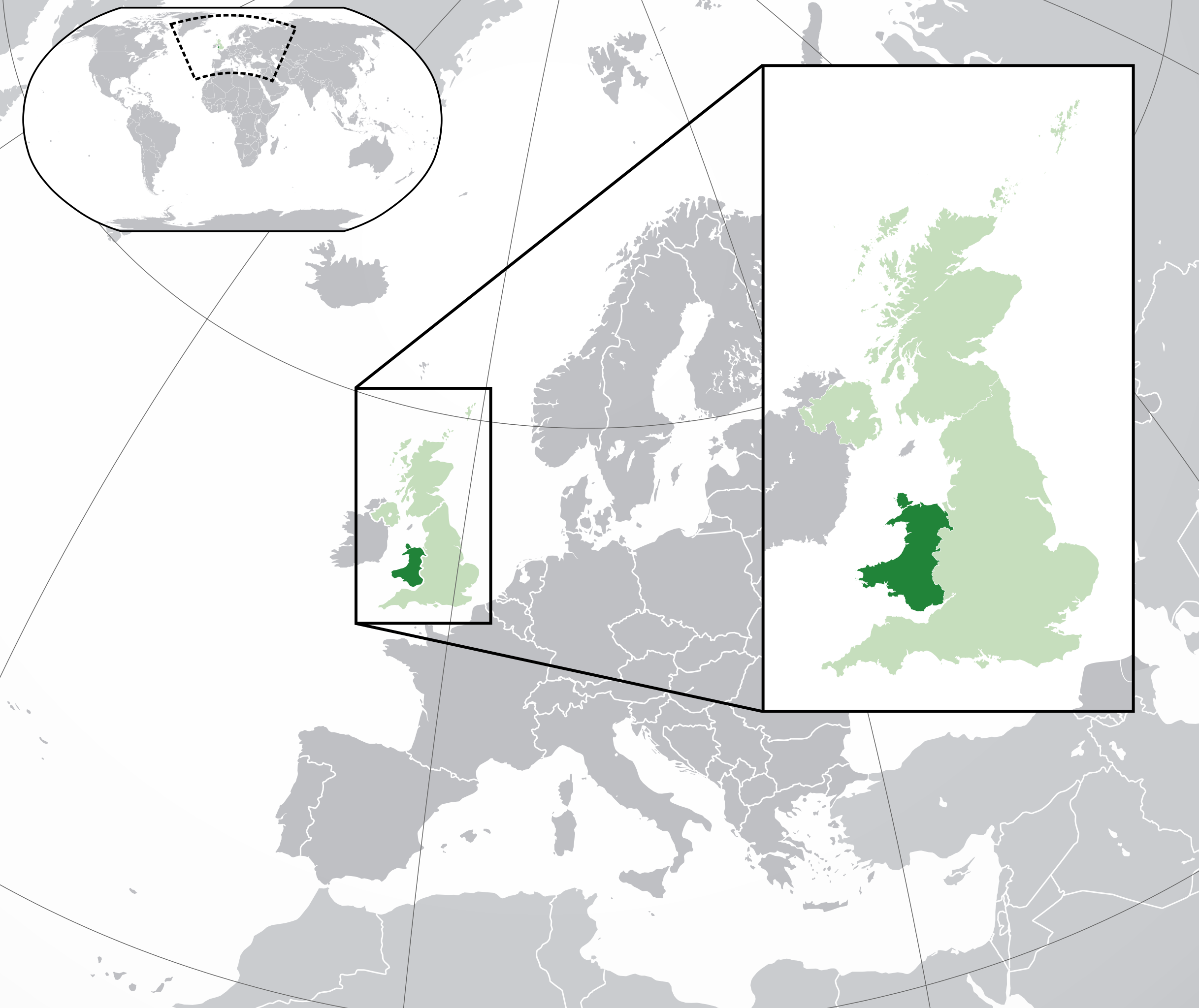
İzahWales in the UK and Europe.svg
English: A map of Wales within the United Kingdom and Europe. The map is a polar orthographic projection.
Wales
United Kingdom (except Wales)
Europe (except UK)
Français : Une carte du Pays de Galles au sein du Royaume-Uni et en Europe. La carte est un polair projection orthographique.
Pays de Galles
Royaume-Uni (sauf le Pays de Galles)
Europe (sauf le Royaume-Uni)
Deutsch: Eine Karte der Wales drinnen das Vereinigtes Königreich und drinnen Europa. Die Karte ist ein polare orthografische Azimutalprojektion.
Wales
Vereinigtes Königreich (außer Wales)
Europa (außer das Vereinigtes Königreich)
Cymraeg:
Cymru
Y Deyrnas Unedig
Ewrop
Gàidhlig:
A' Chuimrigh
An Rìoghachd Aonaichte
An Roinn-Eòrpa
Gaeilge:
An Bhreatain Bheag
An Ríocht Aontaithe
An Eoraip
Kernowek:
Kembra
Ruwvaneth Unys
Europa
Tarix
(UTC)
Mənbə
This file was derived from: Blank map of Europe (with disputed regions).svg:
Müəllif
Blank map of Europe (with disputed regions).svg: maix
derivative work Alphathon /'æɫfə.θɒn/
Digər versiyalar
English: England
Kernowek: Pow Sows
Gàidhlig: Sasainn
Gaeilge: Sasana
Cymraeg: Lloegr
Deutsch: England
English: Northern Ireland
Gaeilge: Tuaisceart Éireann
Gàidhlig: Èirinn a Tuath
Cymraeg: Gogledd Iwerddon
Deutsch: Nordirland
English: Scotland
Gàidhlig: Alba
Gaeilge: Albain
Cymraeg: Yr Alban
Deutsch: Schottland
Français : Écosse
SVG genesis
InfoField
The source code of this large SVG is invalid due to 201 errors.
This oversized W3C-invalid map was created with Inkscape, or with something else.
This huge SVG map contains embedded raster graphics.[1] Such images are liable to produce inferior results when scaled to different sizes (as well as possibly being very inefficient in file size). If appropriate to do so, they should be replaced with images created using vector graphics. Note: This template is only supposed to be used if the SVG file mixes vector and raster graphics. If the SVG file only contains raster graphics {{FakeSVG}} is supposed to be used. See also {{TopoSVG}}.
Lisenziya
Bu fayl Creative Commons Attribution-Share Alike 3.0 Sinqapur lisenziyası altında yayımlanır.
Azadsınız:
paylaşmaq – əsəri köçürmək, paylamaq və ötürmək üçün
remiks etmək – əsəri adaptasiya etmək
Aşağıdakı şərtlərə riayət etməklə:
istinad – Müvafiq kredit verməlisiniz, lisenziyaya bir keçid verməlisiniz və dəyişikliklərin olub olmadığını bildirməlisiniz. Bunu hər hansı bir ağlabatan şəkildə edə bilərsiniz, ancaq lisenziyalaşdırıcının sizi və ya istifadənizi təsdiqləməsini təklif edən bir şəkildə deyil.
bənzər paylaşma – Əsəri remix edirsinizsə, dəyişdirirsinizsə və ya üzərində iş aparırsınızsa, öz töhfələrinizi orijinalda olduğu kimi eyni və ya uyğun lisenziya altında yayımlamalısınız.
2011-08-23T10:26:48Z Heb 680x520 (604212 Bytes) Added [[:en:Bornholm]] (taken from [[:File:Denmark blank map.svg]])
2011-04-12T00:40:40Z Alphathon 680x520 (602549 Bytes) Upgraded Sicily based on "File:Freeworldmaps-sicily.jpg". Upgraded Malta based on "File:Map of Malta 2.png". Simplified Croatian borders.
2011-04-10T21:43:04Z Alphathon 680x520 (607359 Bytes) Upgraded Croatia, Bosnia & Herzegovina, Slovenia and surrounding countries based on data from "File:Kroatien - Politische Gliederung (Karte).png"
2011-04-10T20:05:09Z Alphathon 680x520 (568373 Bytes) Improved Serbia, Montenegro and surrounding countries using data from "File:Serbia Map.png". Fixed Serbia-Montenegro border. Added Kosovo (using dashed border, since it is not a universally recognised nation, and left the lan
2011-04-10T15:55:02Z Alphathon 680x520 (524980 Bytes) Tweaked Ukraine and surrounding countries based on data from "File:Up-map.png"
2011-04-10T04:02:09Z Alphathon 680x520 (511168 Bytes) Improved Greece, Albania, F.Y.R. Macedonia and Bulgaria based on "File:Greece topo.jpg"
2011-04-10T02:48:52Z Alphathon 680x520 (505569 Bytes) Tweaked Germany and surrounding countries based on info from "File:Germany_general_map.png"
2011-04-10T01:54:05Z Alphathon 680x520 (493733 Bytes) Converted all lakes back to separate layer. Added Finish lakes and tweaked Finland shape based on "File:Finland 1996 CIA map.jpg". Added Swiss lakes based on "File:Suisse cantons.svg". Tweaked Scotland and added Lochs.
2011-04-10T00:07:54Z Alphathon 680x520 (450120 Bytes) Improved England outline and added Isle of Wight based on "File:England Regions - Blank.svg". Improved Denmark based on "File:2 digit postcode danmark.png". Improved Sweden based on "File:Map of Sweden, CIA, 1996.jpg"
2011-04-08T15:53:07Z Alphathon 680x520 (438878 Bytes) Upgraded/fixed various parts of the map. Details: *Some minor fixes to Ireland and added some of the larger lakes based on [[:File:Ireland_trad_counties_named.svg]] *Pretty major fixes to Scotland (mainly the west coast and i
2008-09-17T09:50:25Z F7 680x520 (531491 Bytes)
2008-09-17T09:42:57Z F7 680x520 (2353 Bytes)
2008-05-26T19:04:07Z Collard 680x520 (531491 Bytes) uploading on behalf of [[User:Checkit]], direct complaints to him plox: 'Moved countries out of the "outlines" group, removed "outlines" style class, remove separate style information for Russia'
2008-04-30T01:38:52Z TimothyBourke 680x520 (531767 Bytes) Changed the country code of Serbia to RS per [http://en.wikipedia.org/wiki/Serbian_country_codes] and the file [http://www.iso.org/iso/iso3166_en_code_lists.txt].
2007-07-10T11:47:59Z MrWeeble 680x520 (533112 Bytes) Updated to include British Crown Dependencies as seperate entities and regroup them as "British Islands", with some simplifications to the XML and CSS
2007-05-14T17:17:34Z Zirland 680x520 (540659 Bytes) serbia and montenegro
2007-03-30T20:40:49Z W!B: 680x520 (538830 Bytes) minor corr: update nl:Ijsselmeer, del fi:lakes (all small), add ru:lake Oneka (all ref maps.google), glued northern irland back to ie ;)
2007-02-04T15:07:29Z Maix 680x520 (538310 Bytes) {{Information |Description=A blank Map of Europe in SVG format. Every country has an id which is its ISO-3116-1-ALPHA2 code in lower case for easy coloring. |Source=Image based on [[Image:Europe_countries.svg|]] by [[User:Ti
Uploaded with derivativeFX
Captions
Birləşmiş Krallıq və Avropadakı Galler xəritəsi. Xəritə polar bir orfoqrafik proyeksiyadır.
== {{int:filedesc}} == {{Information |Description={{en|A map of Wales (dark green) within the United Kingdom (dark and light green) and Europe (dark green, light green and darker grey).}} |Source={{Derived from|Blank_map_of_Europe.svg|display=50}} |Dat...
Bu faylda fotoaparat və ya skanerlə əlavə olunmuş məlumatlar var. Əgər fayl sonradan redaktə olunubsa, bəzi parametrlər bu şəkildə göstərilənlərdən fərqli ola bilər.
Genişlik
2045
Hündürlük
1720
Fevral 24, 2023
fayl, wales, europe, fayl, faylın, tarixçəsi, fayl, keçidləri, faylın, qlobal, istifadəsi, metaməlumatlarbu, faylın, formatındakı, görünüşünün, ölçüsü, piksel, digər, ölçülər, piksel, piksel, piksel, piksel, piksel, piksel, faylın, orijinalı, 8206, faylı, nomi. Fayl Faylin tarixcesi Fayl kecidleri Faylin qlobal istifadesi MetamelumatlarBu SVG faylin PNG formatindaki bu gorunusunun olcusu 713 600 piksel Diger olculer 285 240 piksel 571 480 piksel 913 768 piksel 1 218 1 024 piksel 2 435 2 048 piksel 2 045 1 720 piksel Faylin orijinali 8206 SVG fayli nominal olaraq 2 045 1 720 piksel faylin olcusu 7 84 MB Bu fayl Vikimedia Commons dadirve diger layihelerde istifade edile biler Faylin tesvir sehifesine get Xulase IzahWales in the UK and Europe svg English A map of Wales within the United Kingdom and Europe The map is a polar orthographic projection nbsp Wales nbsp United Kingdom except Wales nbsp Europe except UK Francais nbsp Une carte du Pays de Galles au sein du Royaume Uni et en Europe La carte est un polair projection orthographique nbsp Pays de Galles nbsp Royaume Uni sauf le Pays de Galles nbsp Europe sauf le Royaume Uni Deutsch Eine Karte der Wales drinnen das Vereinigtes Konigreich und drinnen Europa Die Karte ist ein polare orthografische Azimutalprojektion nbsp Wales nbsp Vereinigtes Konigreich ausser Wales nbsp Europa ausser das Vereinigtes Konigreich Cymraeg nbsp Cymru nbsp Y Deyrnas Unedig nbsp Ewrop Gaidhlig nbsp A Chuimrigh nbsp An Rioghachd Aonaichte nbsp An Roinn Eorpa Gaeilge nbsp An Bhreatain Bheag nbsp An Riocht Aontaithe nbsp An Eoraip Kernowek nbsp Kembra nbsp Ruwvaneth Unys nbsp Europa Tarix 25 fevral 2012 22 33 UTC Menbe This file was derived from Blank map of Europe with disputed regions svg nbsp Muellif Blank map of Europe with disputed regions svg maix derivative work Alphathon nbsp aeɫfe 8ɒn nbsp Diger versiyalar English EnglandKernowek Pow SowsGaidhlig SasainnGaeilge SasanaCymraeg LloegrDeutsch England English Northern IrelandGaeilge Tuaisceart EireannGaidhlig Eirinn a TuathCymraeg Gogledd IwerddonDeutsch Nordirland English ScotlandGaidhlig AlbaGaeilge AlbainCymraeg Yr AlbanDeutsch SchottlandFrancais nbsp Ecosse SVG nbsp genesisInfoField nbsp The source code of this large SVG is invalid due to 201 errors nbsp This oversized W3C invalid map was created with Inkscape or with something else This huge SVG map contains embedded raster graphics 1 Such images are liable to produce inferior results when scaled to different sizes as well as possibly being very inefficient in file size If appropriate to do so they should be replaced with images created using vector graphics Note This template is only supposed to be used if the SVG file mixes vector and raster graphics If the SVG file only contains raster graphics FakeSVG is supposed to be used See also TopoSVG Lisenziya Bu fayl Creative Commons Attribution Share Alike 3 0 Sinqapur lisenziyasi altinda yayimlanir Azadsiniz paylasmaq eseri kocurmek paylamaq ve oturmek ucun remiks etmek eseri adaptasiya etmek Asagidaki sertlere riayet etmekle istinad Muvafiq kredit vermelisiniz lisenziyaya bir kecid vermelisiniz ve deyisikliklerin olub olmadigini bildirmelisiniz Bunu her hansi bir aglabatan sekilde ede bilersiniz ancaq lisenziyalasdiricinin sizi ve ya istifadenizi tesdiqlemesini teklif eden bir sekilde deyil benzer paylasma Eseri remix edirsinizse deyisdirirsinizse ve ya uzerinde is aparirsinizsa oz tohfelerinizi orijinalda oldugu kimi eyni ve ya uygun lisenziya altinda yayimlamalisiniz https creativecommons org licenses by sa 3 0 CC BY SA 3 0 Creative Commons Attribution Share Alike 3 0 true true Orijinal yukleme gundeliyi This image is a derivative work of the following images File Blank map of Europe svg licensed with Cc by sa 2 5 2012 02 21T16 27 27Z Alphathon 680x520 614699 Bytes Updated Metadata and the boarders coastlines along the western coast of the Black Sea 2011 09 19T22 57 58Z Alphathon 680x520 603759 Bytes Added North Northern Cyprus 2011 08 23T10 26 48Z Heb 680x520 604212 Bytes Added en Bornholm taken from File Denmark blank map svg 2011 04 12T00 40 40Z Alphathon 680x520 602549 Bytes Upgraded Sicily based on File Freeworldmaps sicily jpg Upgraded Malta based on File Map of Malta 2 png Simplified Croatian borders 2011 04 10T21 43 04Z Alphathon 680x520 607359 Bytes Upgraded Croatia Bosnia amp Herzegovina Slovenia and surrounding countries based on data from File Kroatien Politische Gliederung Karte png 2011 04 10T20 05 09Z Alphathon 680x520 568373 Bytes Improved Serbia Montenegro and surrounding countries using data from File Serbia Map png Fixed Serbia Montenegro border Added Kosovo using dashed border since it is not a universally recognised nation and left the lan 2011 04 10T15 55 02Z Alphathon 680x520 524980 Bytes Tweaked Ukraine and surrounding countries based on data from File Up map png 2011 04 10T04 02 09Z Alphathon 680x520 511168 Bytes Improved Greece Albania F Y R Macedonia and Bulgaria based on File Greece topo jpg 2011 04 10T02 48 52Z Alphathon 680x520 505569 Bytes Tweaked Germany and surrounding countries based on info from File Germany general map png 2011 04 10T01 54 05Z Alphathon 680x520 493733 Bytes Converted all lakes back to separate layer Added Finish lakes and tweaked Finland shape based on File Finland 1996 CIA map jpg Added Swiss lakes based on File Suisse cantons svg Tweaked Scotland and added Lochs 2011 04 10T00 07 54Z Alphathon 680x520 450120 Bytes Improved England outline and added Isle of Wight based on File England Regions Blank svg Improved Denmark based on File 2 digit postcode danmark png Improved Sweden based on File Map of Sweden CIA 1996 jpg 2011 04 08T15 53 07Z Alphathon 680x520 438878 Bytes Upgraded fixed various parts of the map Details Some minor fixes to Ireland and added some of the larger lakes based on File Ireland trad counties named svg Pretty major fixes to Scotland mainly the west coast and i 2008 09 17T09 50 25Z F7 680x520 531491 Bytes 2008 09 17T09 42 57Z F7 680x520 2353 Bytes 2008 05 26T19 04 07Z Collard 680x520 531491 Bytes uploading on behalf of User Checkit direct complaints to him plox Moved countries out of the outlines group removed outlines style class remove separate style information for Russia 2008 04 30T01 38 52Z TimothyBourke 680x520 531767 Bytes Changed the country code of Serbia to RS per http en wikipedia org wiki Serbian country codes and the file http www iso org iso iso3166 en code lists txt 2008 02 08T22 44 37Z CarolSpears 680x520 531767 Bytes validated 2007 07 10T11 47 59Z MrWeeble 680x520 533112 Bytes Updated to include British Crown Dependencies as seperate entities and regroup them as British Islands with some simplifications to the XML and CSS 2007 05 14T17 17 34Z Zirland 680x520 540659 Bytes serbia and montenegro 2007 03 30T20 40 49Z W B 680x520 538830 Bytes minor corr update nl Ijsselmeer del fi lakes all small add ru lake Oneka all ref maps google glued northern irland back to ie nbsp 2007 02 05T18 44 32Z Maix 680x520 538295 Bytes cropped 2007 02 04T15 07 29Z Maix 680x520 538310 Bytes Information Description A blank Map of Europe in SVG format Every country has an id which is its ISO 3116 1 ALPHA2 code in lower case for easy coloring Source Image based on Image Europe countries svg by User Ti Uploaded with derivativeFXCaptionsazerbaycancaBirlesmis Kralliq ve Avropadaki Galler xeritesi Xerite polar bir orfoqrafik proyeksiyadir ruskarta Uelsa tyomnozelyonnym karta ostalnoj Velikobritanii svktlozelyonnym Items portrayed in this filetesvir edirUelscografi xeritecopyright status nbsp ingiliscopyrighted nbsp ingilislisenziyaCreative Commons Attribution ShareAlike 3 0 Unported nbsp ingilisyaranma tarixi25 fevral 2012 Faylin tarixcesi Faylin evvelki versiyasini gormek ucun gun tarix bolmesindeki tarixlere klikleyin Tarix VaxtKicik sekilOlculerIstifadeciSerh indiki20 00 6 avqust 20142 045 1 720 7 84 MB Rob984Improved version More accurate coastline borders etc Added Gradient and Longitude and latitude lines Zoom insert centred on UK 14 58 21 fevral 2014680 520 2 48 MB Rob984White background so that the edge of the map is clear Consistency with other European countries 039 maps also 18 35 19 yanvar 2013680 520 2 46 MB AlphathonAdded Robinson projection to the top left corner 23 37 26 fevral 2012680 520 941 KB AlphathonFixed XML 23 35 26 fevral 2012680 520 941 KB AlphathonMore detailed British Isles 00 35 26 fevral 2012680 520 790 KB AlphathonAdded missing parts of Belgium and the Netherlands 22 36 25 fevral 2012680 520 806 KB Alphathon int filedesc Information Description en A map of Wales dark green within the United Kingdom dark and light green and Europe dark green light green and darker grey Source Derived from Blank map of Europe svg display 50 Dat Fayl kecidleri Bu sekile olan kecidler Uels Faylin qlobal istifadesi Bu fayl asagidaki vikilerde istifade olunur af wikipedia org layihesinde istifadesi Wallis af wiktionary org layihesinde istifadesi Wallis am wikipedia org layihesinde istifadesi ዌልስ ar wikipedia org layihesinde istifadesi ويلز arz wikipedia org layihesinde istifadesi ويلز be wikipedia org layihesinde istifadesi Uels bg wikipedia org layihesinde istifadesi Uels bh wikipedia org layihesinde istifadesi व ल स bn wikipedia org layihesinde istifadesi ওয ল স br wikipedia org layihesinde istifadesi Kembre bs wikipedia org layihesinde istifadesi Vels bxr wikipedia org layihesinde istifadesi Uels cdo wikipedia org layihesinde istifadesi Ŭi i se ṳ chy wikipedia org layihesinde istifadesi United Kingdom ckb wikipedia org layihesinde istifadesi وێڵز csb wikipedia org layihesinde istifadesi Walijo cs wikipedia org layihesinde istifadesi Wales el wikipedia org layihesinde istifadesi Oyalia en wikipedia org layihesinde istifadesi Wales Category Wales History of the Jews in Wales List of companies of Wales en wikinews org layihesinde istifadesi Category Wales en wiktionary org layihesinde istifadesi ويلز ויילס es wikipedia org layihesinde istifadesi Gales et wikipedia org layihesinde istifadesi Wales eu wikipedia org layihesinde istifadesi Gales Txikipedia Nabarmendutako artikulua 2018 3 Txikipedia Gales fa wikipedia org layihesinde istifadesi ولز fiu vro wikipedia org layihesinde istifadesi Komrimaa fi wikipedia org layihesinde istifadesi Wales fi wiktionary org layihesinde istifadesi Wales fr wikipedia org layihesinde istifadesi Pays de Galles Elections au pays de Galles fy wikipedia org layihesinde istifadesi Wales gd wiktionary org layihesinde istifadesi Roinn seorsa Faclan na Cuimrise gl wikipedia org layihesinde istifadesi Gales gn wikipedia org layihesinde istifadesi Gales gu wikipedia org layihesinde istifadesi વ લ સ hak wikipedia org layihesinde istifadesi Wales he wikivoyage org layihesinde istifadesi ויילס hi wikipedia org layihesinde istifadesi व ल स hr wikipedia org layihesinde istifadesi Wales hr wiktionary org layihesinde istifadesi Wales hu wikipedia org layihesinde istifadesi Wales Szerkeszto Freewales probalap hy wikipedia org layihesinde istifadesi Ուելս Ուելսի աշխարհագրություն Bu faylin qlobal istifadesine baxin Metamelumatlar Bu faylda fotoaparat ve ya skanerle elave olunmus melumatlar var Eger fayl sonradan redakte olunubsa bezi parametrler bu sekilde gosterilenlerden ferqli ola biler Genislik2045Hundurluk1720 Menbe https az wikipedia org wiki Fayl Wales in the UK and Europe svg, wikipedia, oxu, kitab, kitabxana, axtar, tap, hersey,
ne axtarsan burda
, en yaxsi meqale sayti, meqaleler, kitablar, oyrenmek, wiki, bilgi, tarix, seks, porno, indir, yukle, sex, azeri sex, azeri, seks yukle, sex yukle, izle, seks izle, porno izle, mobil seks, telefon ucun, chat, azeri chat, tanisliq, tanishliq, azeri tanishliq, sayt, medeni, medeni saytlar, chatlar, mekan, tanisliq mekani, mekanlari, yüklə, pulsuz, pulsuz yüklə, mp3, video, mp4, 3gp, jpg, jpeg, gif, png, şəkil, muisiqi, mahnı, kino, film, kitab, oyun, oyunlar.