Bu fayl "Vikimedia Commons"dadır və digər layihələrdə istifadə edilə bilər.
Faylın təsvir səhifəsinə get
This historical map image could be re-created using vector graphics as an SVG file. This has several advantages; see Commons:Media for cleanup for more information. If an SVG form of this image is available, please upload it and afterwards replace this template with {{vector version available|new image name}}. It is recommended to name the SVG file "Territorial changes of the Ottoman Empire 1812.svg" – then the template Vector version available (or Vva) does not need the new image name parameter.
This historical map image was uploaded in the JPEG format even though it consists of non-photographic data. This information could be stored more efficiently or accurately in the PNG or SVG format. If possible, please upload a PNG or SVG version of this image without compression artifacts, derived from a non-JPEG source (or with existing artifacts removed). After doing so, please tag the JPEG version with {{Superseded|NewImage.ext}} and remove this tag. This tag should not be applied to photographs or scans. For more information, see {{BadJPEG}}.
İzahTerritorial changes of the Ottoman Empire 1812.jpg
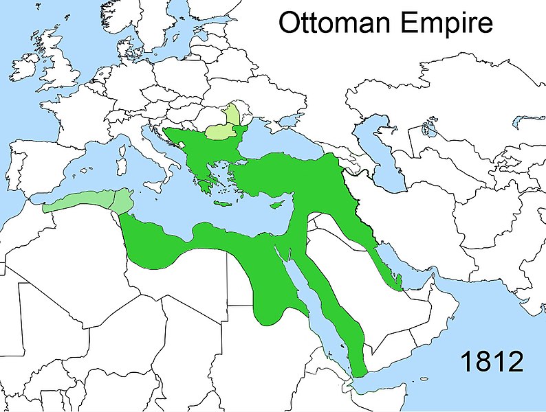
Territorial changes of the Ottoman Empire
Tarix
Mənbə
Öz işi
Müəllif
Esemono
İcazə (Faylın təkrar istifadəsi)
Own work, all rights released (Public domain)
Digər versiyalar
Derivative works of this file: Territorial changes of the Ottoman Empire c1812-ca.JPG
The factual accuracy of this map or the file name is disputed.
Reason: Please see the relevant discussion on the talk page.
Public domainPublic domainfalsefalse
Captions
Add a one-line explanation of what this file represents
{{Information |Description=Territorial changes of the Ottoman Empire |Source=Self made |Date=April, 2009 |Author=Esemono |Permission=Own work, all rights released (Public domain) |other_versions= }} {{PD-self}} [[Category:Maps of the B
Bu faylda fotoaparat və ya skanerlə əlavə olunmuş məlumatlar var. Əgər fayl sonradan redaktə olunubsa, bəzi parametrlər bu şəkildə göstərilənlərdən fərqli ola bilər.
Genişlik
1.104 px
Hündürlük
834 px
Bits per component
8
8
8
Rəng modeli
RGB
Orientasiya
Normal
Rəng komponentlərinin sayı
3
Üfüqi xətt
72 dpi
Şaquli xətt
72 dpi
Proqram təminatı
Adobe Photoshop CS3 Macintosh
Faylın dəyişməsi tarixi və vaxtı
23:36, 17 fevral 2020
Exif versiyası
2.21
Rəng sahəsi
sRGB
Şəkilin eni
1.104 px
Şəkilin hündürlüyü
834 px
Tarix və vaxt rəqəmləşdirilir
06:33, 24 aprel 2009
Date metadata was last modified
00:36, 18 fevral 2020
Unique ID of original document
uuid:C2D7DBE10230DE11BC20E521E45D679B
Statusun müəlliflik hüququ
Müəlliflik hüququ göstərilməyib
IIM versiya
64.456
Yanvar 23, 2023
fayl, territorial, changes, ottoman, empire, 1812, fayl, faylın, tarixçəsi, istifadə, edilən, səhifələr, faylın, qlobal, istifadəsi, metaməlumatlarsınaq, göstərişi, ölçüsü, piksel, digər, ölçülər, piksel, piksel, piksel, piksel, faylın, orijinalı, 8206, piksel. Fayl Faylin tarixcesi Istifade edilen sehifeler Faylin qlobal istifadesi MetamelumatlarSinaq gosterisi olcusu 794 600 piksel Diger olculer 318 240 piksel 636 480 piksel 1 017 768 piksel 1 104 834 piksel Faylin orijinali 8206 1 104 834 piksel fayl hecmi 433 KB MIME novu image jpeg Bu fayl Vikimedia Commons dadirve diger layihelerde istifade edile biler Faylin tesvir sehifesine get This historical map image could be re created using vector graphics as an SVG file This has several advantages see Commons Media for cleanup for more information If an SVG form of this image is available please upload it and afterwards replace this template with vector version available i new image name i It is recommended to name the SVG file Territorial changes of the Ottoman Empire 1812 svg then the template Vector version available or Vva does not need the new image name parameter This historical map image was uploaded in the JPEG format even though it consists of non photographic data This information could be stored more efficiently or accurately in the PNG or SVG format If possible please upload a PNG or SVG version of this image without compression artifacts derived from a non JPEG source or with existing artifacts removed After doing so please tag the JPEG version with Superseded NewImage ext and remove this tag This tag should not be applied to photographs or scans For more information see BadJPEG IzahTerritorial changes of the Ottoman Empire 1812 jpg Territorial changes of the Ottoman EmpireTarix aprel 2009Menbe Oz isiMuellif EsemonoIcaze Faylin tekrar istifadesi Own work all rights released Public domain Diger versiyalar Derivative works of this file Territorial changes of the Ottoman Empire c1812 ca JPG The factual accuracy of this map or the file name is disputed Reason Please see the relevant discussion on the talk page Public domain Public domain false falseMen bu eserin muellif huquqlarinin sahibi kimi eseri ictimai mulkiyyete verirem Bu icaze butun dunyada quvvededir In some countries this may not be legally possible if so Bunun qanunla mumkun olmadigi hallarda Istenilen sexse istenilen meqsed ucun qanunlar terefinden qadagan edilmeyince hec bir sert qoymadan bu isden istifade haqqini bagislayiram CaptionsazerbaycancaAdd a one line explanation of what this file representsItems portrayed in this filetesvir ediryaradiciSome value without a Vikiverilenler itemWikimedia username ingilis Esemonomuellifin qisa adi EsemonoURL ingilis https commons wikimedia org wiki user Esemonocopyright status ingiliscopyrighted dedicated to the public domain by copyright holder ingilislisenziyareleased into the public domain by the copyright holder ingilissource of file ingilisoriginal creation by uploader ingilisyaranma tarixiaprel 2009MIME type ingilisimage jpeg Faylin tarixcesi Faylin evvelki versiyasini gormek ucun gun tarix bolmesindeki tarixlere klikleyin Tarix VaxtKicik sekilOlculerIstifadeciSerh indiki00 02 18 fevral 20201 104 834 433 KB Claude ZygielOther mistakes corrected 21 45 28 dekabr 20141 104 834 412 KB HistoryofIranCorrected map these regions were under Iranian control until it was conquered by the Russians in 1813 and 1828 12 47 23 aprel 20091 104 834 412 KB Esemono Information Description Territorial changes of the Ottoman Empire Source Self made Date April 2009 Author Esemono Permission Own work all rights released Public domain other versions PD self Category Maps of the B Istifade edilen sehifeler Bu sekile olan kecidler Akkerman konvensiyasi Faylin qlobal istifadesi Bu fayl asagidaki vikilerde istifade olunur cs wikipedia org layihesinde istifadesi Blizky vychod en wikipedia org layihesinde istifadesi Talk Ashur god User Falcaorib fr wikipedia org layihesinde istifadesi Histoire de l Irak hr wikipedia org layihesinde istifadesi Bliski istok ka wikipedia org layihesinde istifadesi ახლო აღმოსავლეთი pt wikipedia org layihesinde istifadesi Evolucao territorial do Imperio Otomano ru wikipedia org layihesinde istifadesi Mahmud II sh wikipedia org layihesinde istifadesi Bliski istok sr wikipedia org layihesinde istifadesi Mehmed Emin Rauf pasha sr wiktionary org layihesinde istifadesi م ل ك tr wikipedia org layihesinde istifadesi II Mahmud Bukres Antlasmasi 1812 Akkerman Antlasmasi xmf wikipedia org layihesinde istifadesi არხო ბჟაეიოლიMetamelumatlar Bu faylda fotoaparat ve ya skanerle elave olunmus melumatlar var Eger fayl sonradan redakte olunubsa bezi parametrler bu sekilde gosterilenlerden ferqli ola biler Genislik1 104 pxHundurluk834 pxBits per component8 8 8Reng modeliRGBOrientasiyaNormalReng komponentlerinin sayi3Ufuqi xett72 dpiSaquli xett72 dpiProqram teminatiAdobe Photoshop CS3 MacintoshFaylin deyismesi tarixi ve vaxti23 36 17 fevral 2020Exif versiyasi2 21Reng sahesisRGBSekilin eni1 104 pxSekilin hundurluyu834 pxTarix ve vaxt reqemlesdirilir06 33 24 aprel 2009Date metadata was last modified00 36 18 fevral 2020Unique ID of original documentuuid C2D7DBE10230DE11BC20E521E45D679BStatusun muelliflik huququMuelliflik huququ gosterilmeyibIIM versiya64 456 Menbe https az wikipedia org wiki Fayl Territorial changes of the Ottoman Empire 1812 jpg, wikipedia, oxu, kitab, kitabxana, axtar, tap, hersey,
ne axtarsan burda
, en yaxsi meqale sayti, meqaleler, kitablar, oyrenmek, wiki, bilgi, tarix, seks, porno, indir, yukle, sex, azeri sex, azeri, seks yukle, sex yukle, izle, seks izle, porno izle, mobil seks, telefon ucun, chat, azeri chat, tanisliq, tanishliq, azeri tanishliq, sayt, medeni, medeni saytlar, chatlar, mekan, tanisliq mekani, mekanlari, yüklə, pulsuz, pulsuz yüklə, mp3, video, mp4, 3gp, jpg, jpeg, gif, png, şəkil, muisiqi, mahnı, kino, film, kitab, oyun, oyunlar.