This W3C-unspecified vector image was created with Inkscape…important .
Bu təsvirin redaktəsi, orijinala əsaslanaraq rəqəmsal qaydadadır. Dəyişiklik: Cropped, and prepared for geolocation.. İlkin təsvir buradadır: Tanzania map-fr.svg. Redaktə etdi Sémhur.
Graphic Lab
InfoField
Bu xəritə Qrafik emalatxanada (fr) yaradılmışdır. Siz həmçinin təsvirin yaxşılaşması ilə bağlı müraciət edə bilərsiniz.
Object location
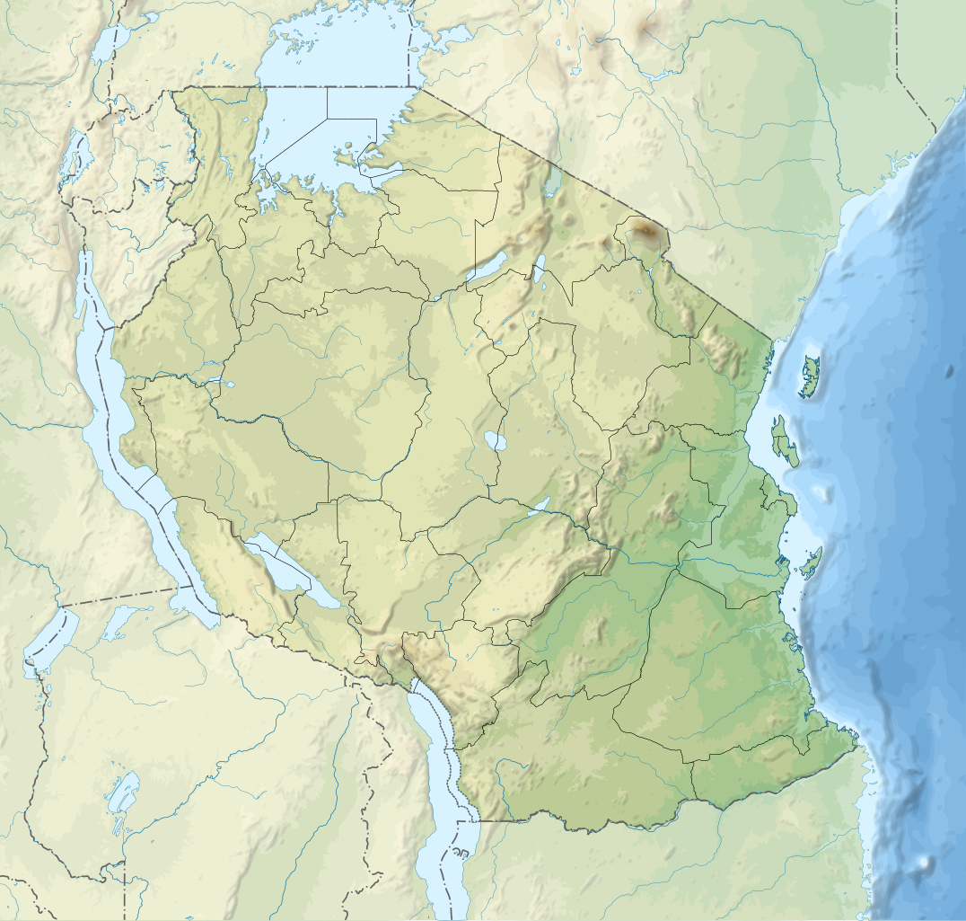
6° 22′ 30″ S, 35° 00′ 00″ E
View this and other nearby images on: OpenStreetMap
-6.375000; 35.000000
Lisenziya
I, the copyright holder of this work, hereby publish it under the following licenses:
Copyleft: This work of art is free; you can redistribute it and/or modify it according to terms of the Free Art License. You will find a specimen of this license on the Copyleft Attitude site as well as on other sites. http://artlibre.org/licence/lal/enFALFree Art Licensefalsetrue
This file is licensed under the Creative Commons Attribution-Share Alike 4.0 International, 3.0 Unported, 2.5 Generic, 2.0 Generic and 1.0 Generic license.
Azadsınız:
paylaşmaq – əsəri köçürmək, paylamaq və ötürmək üçün
remiks etmək – əsəri adaptasiya etmək
Aşağıdakı şərtlərə riayət etməklə:
istinad – Müvafiq kredit verməlisiniz, lisenziyaya bir keçid verməlisiniz və dəyişikliklərin olub olmadığını bildirməlisiniz. Bunu hər hansı bir ağlabatan şəkildə edə bilərsiniz, ancaq lisenziyalaşdırıcının sizi və ya istifadənizi təsdiqləməsini təklif edən bir şəkildə deyil.
bənzər paylaşma – Əsəri remix edirsinizsə, dəyişdirirsinizsə və ya üzərində iş aparırsınızsa, öz töhfələrinizi orijinalda olduğu kimi eyni və ya uyğun lisenziya altında yayımlamalısınız.
2009-03-19T17:08:18Z Sémhur 3096x3113 (3099244 Bytes) Oups ! It wasn't the valid one.
2009-03-19T17:05:02Z Sémhur 3096x3113 (3122421 Bytes) {{Information |Description={{en|1=Map of [[:en:Tanzania]].}} {{fr|1=Carte de la [[:fr:Tanzanie]].}} {{es|1=Mapa de [[:es:Tanzania]].}} |Source=travail personnel (own work). Sources of data: * Elevations : NASA SRTM3 (public d
Uploaded with derivativeFX
Captions
Add a one-line explanation of what this file represents
{{int:summary}} {{Information |Description={{en|1=Relief location map of en:Tanzania.}} {{fr|1=Carte de géolocalisation du relief de la fr:Tanzanie.}} {{es|1=Mapa de georreferenciación de es:Tanzania.}} Equirectangular projection. 0.25�
Bu faylda fotoaparat və ya skanerlə əlavə olunmuş məlumatlar var. Əgər fayl sonradan redaktə olunubsa, bəzi parametrlər bu şəkildə göstərilənlərdən fərqli ola bilər.
Qısa başlıq
Tanzania relief location map
Genişlik
3302.3999
Hündürlük
3143.4666
Dekabr 25, 2022
fayl, tanzania, relief, location, fayl, faylın, tarixçəsi, istifadə, edilən, səhifələr, faylın, qlobal, istifadəsi, metaməlumatlarbu, faylın, formatındakı, görünüşünün, ölçüsü, piksel, digər, ölçülər, piksel, piksel, piksel, piksel, piksel, piksel, faylın, ori. Fayl Faylin tarixcesi Istifade edilen sehifeler Faylin qlobal istifadesi MetamelumatlarBu SVG faylin PNG formatindaki bu gorunusunun olcusu 630 600 piksel Diger olculer 252 240 piksel 504 480 piksel 807 768 piksel 1 076 1 024 piksel 2 152 2 048 piksel 3 302 3 143 piksel Faylin orijinali 8206 SVG fayli nominal olaraq 3 302 3 143 piksel faylin olcusu 3 1 MB Bu fayl Vikimedia Commons dadirve diger layihelerde istifade edile biler Faylin tesvir sehifesine get Xulase IzahTanzania relief location map svg English Relief location map of Tanzania Equirectangular projection 1 N 28 W 42 E 13 S Center 6 375 35 Espanol Mapa de georreferenciacion de Tanzania 1 N 28 O 42 E 13 S Centro 6 375 35 Francais Carte de geolocalisation du relief de la Tanzanie Projection cylindrique equidistante 1 N 28 O 42 E 13 S Centre 6 375 35Tarix 1 may 2009 19 32 UTC Menbe Derived from Tanzania map fr svgMuellif SemhurDiger versiyalar redakte blgarski catala Deutsch English espanol francais SVG JPG italiano Kiswahili makedonski norsk bokmal russkij ukrayinska Topographic blank BlankIstinad required by the license InfoField c Semhur Wikimedia Commons CC BY SA 3 0 or Free Art LicenseInfoField c Semhur Wikimedia CommonsSVGInfoFieldi The source code of this SVG is valid This W3C unspecified vector image was created with Inkscape important Bu tesvirin redaktesi orijinala esaslanaraq reqemsal qaydadadir Deyisiklik Cropped and prepared for geolocation Ilkin tesvir buradadir Tanzania map fr svg Redakte etdi Semhur Graphic LabInfoFieldBu xerite Qrafik emalatxanada fr yaradilmisdir Siz hemcinin tesvirin yaxsilasmasi ile bagli muraciet ede bilersiniz Object location6 22 30 S 35 00 00 E View this and other nearby images on OpenStreetMap 6 375000 35 000000Lisenziya I the copyright holder of this work hereby publish it under the following licenses Copyleft This work of art is free you can redistribute it and or modify it according to terms of the Free Art License You will find a specimen of this license on the Copyleft Attitude site as well as on other sites http artlibre org licence lal en FAL Free Art License false trueThis file is licensed under the Creative Commons Attribution Share Alike 4 0 International 3 0 Unported 2 5 Generic 2 0 Generic and 1 0 Generic license Azadsiniz paylasmaq eseri kocurmek paylamaq ve oturmek ucun remiks etmek eseri adaptasiya etmek Asagidaki sertlere riayet etmekle istinad Muvafiq kredit vermelisiniz lisenziyaya bir kecid vermelisiniz ve deyisikliklerin olub olmadigini bildirmelisiniz Bunu her hansi bir aglabatan sekilde ede bilersiniz ancaq lisenziyalasdiricinin sizi ve ya istifadenizi tesdiqlemesini teklif eden bir sekilde deyil benzer paylasma Eseri remix edirsinizse deyisdirirsinizse ve ya uzerinde is aparirsinizsa oz tohfelerinizi orijinalda oldugu kimi eyni ve ya uygun lisenziya altinda yayimlamalisiniz https creativecommons org licenses by sa 4 0 CC BY SA 4 0 Creative Commons Attribution Share Alike 4 0 true trueIstediyiniz lisenziyani sece bilersiniz Orijinal yukleme gundeliyi This image is a derivative work of the following images File Tanzania map fr svg licensed with Cc by sa 3 0 2 5 2 0 1 0 GFDL 2009 03 20T13 30 18Z Semhur 3096x3113 3225659 Bytes Ol Doinyo Lengai was misplaced 2009 03 20T11 14 35Z Semhur 3096x3113 3224368 Bytes Add location map and few summits 2009 03 19T17 14 13Z Semhur 3096x3113 3099209 Bytes grrr 2009 03 19T17 08 18Z Semhur 3096x3113 3099244 Bytes Oups It wasn t the valid one 2009 03 19T17 05 02Z Semhur 3096x3113 3122421 Bytes Information Description en 1 Map of en Tanzania fr 1 Carte de la fr Tanzanie es 1 Mapa de es Tanzania Source travail personnel own work Sources of data Elevations NASA SRTM3 public dUploaded with derivativeFXCaptionsazerbaycancaAdd a one line explanation of what this file representserebTanzania mapurduMapa da TanzaniaItems portrayed in this filetesvir ediryaradiciSome value without a Vikiverilenler itemmuellifin qisa adi SemhurURL ingilis https commons wikimedia org wiki user S C3 A9mhurWikimedia username ingilis Semhurobyektin rolu fotoqrafcopyright status ingiliscopyrighted ingilislisenziyaCreative Commons Attribution ShareAlike 1 0 Generic ingilisCreative Commons Attribution ShareAlike 3 0 Unported ingilisFree Art License ingilisCreative Commons Attribution ShareAlike 4 0 International ingilisCreative Commons Attribution ShareAlike 2 5 Generic ingilisCreative Commons Attribution ShareAlike 2 0 Generic ingilisyaranma tarixi1 may 2009coordinates of depicted place ingilis6 S 35 Eheading ingilis 0 dereceMIME type ingilisimage svg xml Faylin tarixcesi Faylin evvelki versiyasini gormek ucun gun tarix bolmesindeki tarixlere klikleyin Tarix VaxtKicik sekilOlculerIstifadeciSerh indiki20 32 3 mart 20203 302 3 143 3 1 MB SemhurModifying Tanzanian border claim from https www nbs go tz index php en census surveys gis 385 2012 phc shapefiles level one and two 20 18 28 iyun 20173 302 3 143 3 09 MB SemhurUpdate with Songwe region 14 11 28 dekabr 20133 096 2 947 3 1 MB SemhurUpdated with the four new regions 15 17 3 may 20093 096 2 947 3 55 MB SemhurAdding border between Arusha and Manyara 18 58 1 may 20093 096 2 947 3 54 MB Semhur int summary Information Description en 1 Relief location map of en Tanzania fr 1 Carte de geolocalisation du relief de la fr Tanzanie es 1 Mapa de georreferenciacion de es Tanzania Equirectangular projection 0 25 Istifade edilen sehifeler Bu sekile olan kecidler Kilimancaro Kilimancaro Milli Parki Nqoronqoro Selus ov ehtiyati Serengeti Milli Parki Tanqanika Zenzibar bogazi Sablon Dag Sablon Dag doc Sablon Yer xeritesi Tanzaniya Faylin qlobal istifadesi Bu fayl asagidaki vikilerde istifade olunur af wikipedia org layihesinde istifadesi Sjabloon Liggingkaart Tanzanie Julius Nyerere Internasionale Lughawe als wikipedia org layihesinde istifadesi Vorlage Positionskarte Tansania ar wikipedia org layihesinde istifadesi قالب خريطة مواقع تنزانيا مدينة زنجبار الحجرية مسجد معمر القذافي مواقع كوندوا لفن النقوش والرسوم على الصخور غرق عبارة إم في نيرير بريسيجن إير الرحلة 494 ast wikipedia org layihesinde istifadesi Modulu Minimapa data Tanzania Modulu Minimapa data Tanzania usu as wikipedia org layihesinde istifadesi ম উণ ট ক ল ম ঞ জ ৰ avk wikipedia org layihesinde istifadesi TanzaniaDarEsSalaamGola Tawavopa va Tanzania Tanzania Favesik Nevatovol Tanzania av wikipedia org layihesinde istifadesi Halip BakӀKarta Tanzaniya Kilimandzharo megӀer azb wikipedia org layihesinde istifadesi موشی شهر تانقا تانزانیا موروقورو دارالسلام تانزانیا دودوما باقامویو امتوارا لیندی سانقی امبیا تابورا شینیانقا کیقوما آروشا موانزا سومباوانقا بوکوبا ban wikipedia org layihesinde istifadesi Taman Nasional Kilimanjaro Gunung Kilimanjaro bar wikipedia org layihesinde istifadesi Vorlog Positionskarte Tansania Kilimandscharo ba wikipedia org layihesinde istifadesi Ҡalyp PozKarta Tanzaniya be wikipedia org layihesinde istifadesi Kilimandzhara Tanganika Pemba Zanzibar Shablon Na karce Tanzaniya Ngorangora Mafiya vostray Ukereve Ukara Rufidzhy Bu faylin qlobal istifadesine baxin Metamelumatlar Bu faylda fotoaparat ve ya skanerle elave olunmus melumatlar var Eger fayl sonradan redakte olunubsa bezi parametrler bu sekilde gosterilenlerden ferqli ola biler Qisa basliqTanzania relief location mapGenislik3302 3999Hundurluk3143 4666 Menbe https az wikipedia org wiki Fayl Tanzania relief location map svg, wikipedia, oxu, kitab, kitabxana, axtar, tap, hersey,
ne axtarsan burda
, en yaxsi meqale sayti, meqaleler, kitablar, oyrenmek, wiki, bilgi, tarix, seks, porno, indir, yukle, sex, azeri sex, azeri, seks yukle, sex yukle, izle, seks izle, porno izle, mobil seks, telefon ucun, chat, azeri chat, tanisliq, tanishliq, azeri tanishliq, sayt, medeni, medeni saytlar, chatlar, mekan, tanisliq mekani, mekanlari, yüklə, pulsuz, pulsuz yüklə, mp3, video, mp4, 3gp, jpg, jpeg, gif, png, şəkil, muisiqi, mahnı, kino, film, kitab, oyun, oyunlar.