I, the copyright holder of this work, hereby publish it under the following licenses:
Permission is granted to copy, distribute and/or modify this document under the terms of the GNU Free Documentation License, Version 1.2 only as published by the Free Software Foundation; with no Invariant Sections, no Front-Cover Texts, and no Back-Cover Texts. A copy of the license is included in the section entitled GNU Free Documentation License.
yalnız 1.2http://www.gnu.org/licenses/old-licenses/fdl-1.2.htmlGFDL 1.2GNU Free Documentation License 1.2truetrue
Permission is granted to copy, distribute and/or modify this document under the terms of the GNU Free Documentation License, Version 1.3 or any later version published by the Free Software Foundation; with no Invariant Sections, no Front-Cover Texts, and no Back-Cover Texts. A copy of the license is included in the section entitled GNU Free Documentation License.
Bu faylda fotoaparat və ya skanerlə əlavə olunmuş məlumatlar var. Əgər fayl sonradan redaktə olunubsa, bəzi parametrlər bu şəkildə göstərilənlərdən fərqli ola bilər.
Üfüqi xətt
28,35 dpc
Şaquli xətt
28,35 dpc
Faylın dəyişməsi tarixi və vaxtı
19:26, 18 iyun 2012
PNG şəkil şərhi
Created with GIMP
Fevral 08, 2023
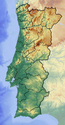
fayl, portugal, location, topographic, fayl, faylın, tarixçəsi, fayl, keçidləri, faylın, qlobal, istifadəsi, metaməlumatlarsınaq, göstərişi, ölçüsü, piksel, digər, ölçülər, piksel, piksel, piksel, piksel, piksel, faylın, orijinalı, 8206, piksel, fayl, həcmi, m. Fayl Faylin tarixcesi Fayl kecidleri Faylin qlobal istifadesi MetamelumatlarSinaq gosterisi olcusu 313 599 piksel Diger olculer 125 240 piksel 251 480 piksel 401 768 piksel 535 1 024 piksel 1 378 2 637 piksel Faylin orijinali 8206 1 378 2 637 piksel fayl hecmi 5 49 MB MIME novu image png Bu fayl Vikimedia Commons dadirve diger layihelerde istifade edile biler Faylin tesvir sehifesine get Xulase IzahPortugal location map Topographic png Deutsch Positionskarte von Portugal Quadratische Plattkarte N S Streckung 130 Geographische Begrenzung der Karte English Location map of Portugal Equirectangular projection N S stretching 130 Geographic limits of the map N 42 3 N S 36 7 N W 9 8 W E 6 0 WTarix 18 iyun 2012Menbe Oz isi backgroung http www maps for free com Muellif Dr Brains Lisenziya I the copyright holder of this work hereby publish it under the following licenses Permission is granted to copy distribute and or modify this document under the terms of the GNU Free Documentation License Version 1 2 only as published by the Free Software Foundation with no Invariant Sections no Front Cover Texts and no Back Cover Texts A copy of the license is included in the section entitled GNU Free Documentation License yalniz 1 2 http www gnu org licenses old licenses fdl 1 2 html GFDL 1 2 GNU Free Documentation License 1 2 true truePermission is granted to copy distribute and or modify this document under the terms of the GNU Free Documentation License Version 1 3 or any later version published by the Free Software Foundation with no Invariant Sections no Front Cover Texts and no Back Cover Texts A copy of the license is included in the section entitled GNU Free Documentation License www gnu org licenses fdl 1 3 html GFDL 1 3 GNU Free Documentation License 1 3 true true If this file is eligible for relicensing it may also be used under the Creative Commons Attribution ShareAlike 3 0 license The relicensing status of this image needs to be manually reviewed by an experienced user You can help العربي ة belaruskaya tarashkevica English francais magyar italiano 日本語 한국어 makedonski മലയ ള sicilianu ukrayinska 中文 Istediyiniz lisenziyani sece bilersiniz CaptionsazerbaycancaAdd a one line explanation of what this file representsItems portrayed in this filetesvir ediryaradiciSome value without a Vikiverilenler itemmuellifin qisa adi Dr BrainsWikimedia username ingilis Dr BrainsURL ingilis http commons wikimedia org wiki User Dr Brainscopyright status ingiliscopyrighted ingilislisenziyaGNU Free Documentation License version 1 2 or later ingilisGNU Free Documentation License version 1 2 ingilisGNU Free Documentation License version 1 3 or later ingilisyaranma tarixi18 iyun 2012source of file ingilisoriginal creation by uploader ingilis Faylin tarixcesi Faylin evvelki versiyasini gormek ucun gun tarix bolmesindeki tarixlere klikleyin Tarix VaxtKicik sekilOlculerIstifadeciSerh indiki19 28 18 iyun 20121 378 2 637 5 49 MB Dr Brains Fayl kecidleri Bu sekile olan kecidler Lissabon zelzelesi 1755 Roka burnu Sablon Yer xeritesi Portuqaliya Faylin qlobal istifadesi Bu fayl asagidaki vikilerde istifade olunur ar wikipedia org layihesinde istifadesi تونس شلب فاطمة مدينة قالب خريطة مواقع البرتغال المركز الإسلامي الثقافي في لشبونة جسر 25 أبريل bar wikipedia org layihesinde istifadesi Vorlog Positionskarte Portugal be wikipedia org layihesinde istifadesi Shablon Na karce Partugaliya Roka mys Kavadu Lima raka Avi Mandegu San Visenty mys bn wikipedia org layihesinde istifadesi মড উল অবস থ ন ম নচ ত র উপ ত ত পর ত গ ল মড উল অবস থ ন ম নচ ত র উপ ত ত পর ত গ ল নথ bs wikipedia org layihesinde istifadesi Sablon Lokacijska karta Portugal ca wikipedia org layihesinde istifadesi Modul Location map data Portugal Modul Location map data Portugal us ceb wikipedia org layihesinde istifadesi Plantilya Location map Portugal ce wikipedia org layihesinde istifadesi Kep Mettigan karta Portugali cs wikipedia org layihesinde istifadesi Sablona LocMap Portugalsko Torre Narodni park Peneda Geres Prirodni park Alvao cv wikipedia org layihesinde istifadesi Shablon PozKartti Portugali el wikipedia org layihesinde istifadesi Protypo Location map Portogalia en wikipedia org layihesinde istifadesi Module Location map data Portugal doc Module Location map data Portugal Lizandro River eo wikipedia org layihesinde istifadesi Madejro insulo Kabo de Sankta Vincento Ŝablono Situo sur mapo Portugalio Madejro Miranda do Douro Ponto Don Luis la 1 a Distrikto Lisbono Distrikto Beja Distrikto Braga Distrikto Braganca Distrikto Castelo Branco Distrikto Coimbra Distrikto Evora Distrikto Leiria Distrikto Portalegre Distrikto Porto Distrikto Santarem Distrikto Setubal Distrikto Viana do Castelo Distrikto Viseu Distrikto Aveiro Bu faylin qlobal istifadesine baxin Metamelumatlar Bu faylda fotoaparat ve ya skanerle elave olunmus melumatlar var Eger fayl sonradan redakte olunubsa bezi parametrler bu sekilde gosterilenlerden ferqli ola biler Ufuqi xett28 35 dpcSaquli xett28 35 dpcFaylin deyismesi tarixi ve vaxti19 26 18 iyun 2012PNG sekil serhiCreated with GIMP Menbe https az wikipedia org wiki Fayl Portugal location map Topographic png, wikipedia, oxu, kitab, kitabxana, axtar, tap, hersey,
ne axtarsan burda
, en yaxsi meqale sayti, meqaleler, kitablar, oyrenmek, wiki, bilgi, tarix, seks, porno, indir, yukle, sex, azeri sex, azeri, seks yukle, sex yukle, izle, seks izle, porno izle, mobil seks, telefon ucun, chat, azeri chat, tanisliq, tanishliq, azeri tanishliq, sayt, medeni, medeni saytlar, chatlar, mekan, tanisliq mekani, mekanlari, yüklə, pulsuz, pulsuz yüklə, mp3, video, mp4, 3gp, jpg, jpeg, gif, png, şəkil, muisiqi, mahnı, kino, film, kitab, oyun, oyunlar.