Bu fayl "Vikimedia Commons"dadır və digər layihələrdə istifadə edilə bilər.
Faylın təsvir səhifəsinə get
Xülasə
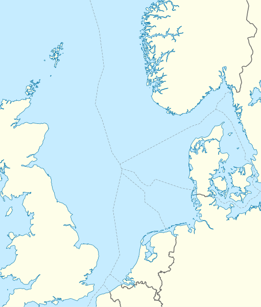
İzahNorth Sea location map.svg
Deutsch: Positionskarte der Nordsee
Quadratische Plattkarte, N-S-Streckung 180 %. Geographische Begrenzung der Karte:
N: 62.5° N
S: 50.5° N
W: 5.2° W
O: 13.2° O
English: Location map of the North Sea
Equirectangular projection, N/S stretching 180 %. Geographic limits of the map:
N: 62.5° N
S: 50.5° N
W: 5.2° W
E: 13.2° E
Tarix
Mənbə
own work, using World Data Base II data
Müəllif
NordNordWest
İcazə (Faylın təkrar istifadəsi)
I have published this file as author NordNordWest under the "CC-BY-SA-3.0-DE" in Wikipedia. This means that free, commercial usage outside of Wikipedia is permitted under the following licence terms:
Online media:
The author "NordNordWest/Wikipedia" is named
A weblink to the original file is provided: //commons.wikimedia.org/wiki/File:North_Sea_location_map.svg
Please send me a specimen copy or the URL of the website where the file is used.
Please write an email to nnwest[at]web.de if you
need my postal address for sending a specimen copy
have further questions about the terms of the licence
PS: In case of refusal of the above terms the author reserves the right to take legal action.
Bu fayl Creative Commons Attribution-Share Alike 3.0 Almaniya lisenziyası altında yayımlanır.
Azadsınız:
paylaşmaq – əsəri köçürmək, paylamaq və ötürmək üçün
remiks etmək – əsəri adaptasiya etmək
Aşağıdakı şərtlərə riayət etməklə:
istinad – Müvafiq kredit verməlisiniz, lisenziyaya bir keçid verməlisiniz və dəyişikliklərin olub olmadığını bildirməlisiniz. Bunu hər hansı bir ağlabatan şəkildə edə bilərsiniz, ancaq lisenziyalaşdırıcının sizi və ya istifadənizi təsdiqləməsini təklif edən bir şəkildə deyil.
bənzər paylaşma – Əsəri remix edirsinizsə, dəyişdirirsinizsə və ya üzərində iş aparırsınızsa, öz töhfələrinizi orijinalda olduğu kimi eyni və ya uyğun lisenziya altında yayımlamalısınız.
Bu xəritə alman Kartenwerkstatt tərəfindən yaxşılaşdırılmışdir. Siz həmçinin tələb olunan digər xəritələri də təklif edə bilərsiniz.
azərbaycanca ∙ Deutsch (Sie-Form) ∙ čeština ∙ Deutsch ∙ sicilianu ∙ italiano ∙ русский ∙ română ∙ português ∙ English ∙ magyar ∙ Nederlands ∙ slovenščina ∙ polski ∙ latviešu ∙ македонски ∙ español ∙ فارسی ∙ français ∙ suomi ∙ עברית ∙ Plattdüütsch ∙ ქართული ∙ հայերեն ∙ বাংলা ∙ ไทย ∙ 日本語 ∙ 中文 ∙ 中文(简体) ∙ 中文(繁體) ∙ العربية ∙ +/−
Captions
Add a one-line explanation of what this file represents
fayl, north, location, fayl, faylın, tarixçəsi, fayl, keçidləri, faylın, qlobal, istifadəsibu, faylın, formatındakı, görünüşünün, ölçüsü, piksel, digər, ölçülər, piksel, piksel, piksel, piksel, piksel, piksel, faylın, orijinalı, 8206, faylı, nominal, olaraq, p. Fayl Faylin tarixcesi Fayl kecidleri Faylin qlobal istifadesiBu SVG faylin PNG formatindaki bu gorunusunun olcusu 511 599 piksel Diger olculer 205 240 piksel 409 480 piksel 655 768 piksel 873 1 024 piksel 1 746 2 048 piksel 988 1 159 piksel Faylin orijinali 8206 SVG fayli nominal olaraq 988 1 159 piksel faylin olcusu 582 KB Bu fayl Vikimedia Commons dadirve diger layihelerde istifade edile biler Faylin tesvir sehifesine get Xulase IzahNorth Sea location map svg Deutsch Positionskarte der Nordsee Quadratische Plattkarte N S Streckung 180 nbsp Geographische Begrenzung der Karte N 62 5 N S 50 5 N W 5 2 W O 13 2 O English Location map of the North Sea Equirectangular projection N S stretching 180 nbsp Geographic limits of the map N 62 5 N S 50 5 N W 5 2 W E 13 2 E Tarix 18 iyun 2010 Menbe own work using World Data Base II data Muellif NordNordWest Icaze Faylin tekrar istifadesi I have published this file as author NordNordWest under the CC BY SA 3 0 DE in Wikipedia This means that free commercial usage outside of Wikipedia is permitted under the following licence terms Online media The author NordNordWest Wikipedia is named A weblink to the original file is provided commons wikimedia org wiki File North Sea location map svg A copy of or the Uniform Resource Identifier https creativecommons org licenses by sa 3 0 de legalcode for this licence with every copy Print media The author NordNordWest Wikipedia is named A copy of or the Uniform Resource Identifier https creativecommons org licenses by sa 3 0 de legalcode for this licence with every copy Please send me a specimen copy or the URL of the website where the file is used Please write an email to nnwest at web de if you need my postal address for sending a specimen copy have further questions about the terms of the licence PS In case of refusal of the above terms the author reserves the right to take legal action Bu fayl Creative Commons Attribution Share Alike 3 0 Almaniya lisenziyasi altinda yayimlanir Azadsiniz paylasmaq eseri kocurmek paylamaq ve oturmek ucun remiks etmek eseri adaptasiya etmek Asagidaki sertlere riayet etmekle istinad Muvafiq kredit vermelisiniz lisenziyaya bir kecid vermelisiniz ve deyisikliklerin olub olmadigini bildirmelisiniz Bunu her hansi bir aglabatan sekilde ede bilersiniz ancaq lisenziyalasdiricinin sizi ve ya istifadenizi tesdiqlemesini teklif eden bir sekilde deyil benzer paylasma Eseri remix edirsinizse deyisdirirsinizse ve ya uzerinde is aparirsinizsa oz tohfelerinizi orijinalda oldugu kimi eyni ve ya uygun lisenziya altinda yayimlamalisiniz https creativecommons org licenses by sa 3 0 de deed en CC BY SA 3 0 de Creative Commons Attribution Share Alike 3 0 de true true Bu fayl Creative Commons Attribution Share Alike 3 0 Almaniya lisenziyasi altinda yayimlanir Azadsiniz paylasmaq eseri kocurmek paylamaq ve oturmek ucun remiks etmek eseri adaptasiya etmek Asagidaki sertlere riayet etmekle istinad Muvafiq kredit vermelisiniz lisenziyaya bir kecid vermelisiniz ve deyisikliklerin olub olmadigini bildirmelisiniz Bunu her hansi bir aglabatan sekilde ede bilersiniz ancaq lisenziyalasdiricinin sizi ve ya istifadenizi tesdiqlemesini teklif eden bir sekilde deyil benzer paylasma Eseri remix edirsinizse deyisdirirsinizse ve ya uzerinde is aparirsinizsa oz tohfelerinizi orijinalda oldugu kimi eyni ve ya uygun lisenziya altinda yayimlamalisiniz https creativecommons org licenses by sa 3 0 de deed en CC BY SA 3 0 de Creative Commons Attribution Share Alike 3 0 de true true Diger versiyalar Derivative works of this file Skagerak i Kategat svg Skagerrak Kattegat hr svg Equivalent physical map Tjesnaci Skagerrak i Kattegat Bu xerite alman Kartenwerkstatt terefinden yaxsilasdirilmisdir Siz hemcinin teleb olunan diger xeriteleri de teklif ede bilersiniz azerbaycanca nbsp Deutsch Sie Form nbsp cestina nbsp Deutsch nbsp sicilianu nbsp italiano nbsp russkij nbsp romană nbsp portugues nbsp English nbsp magyar nbsp Nederlands nbsp slovenscina nbsp polski nbsp latviesu nbsp makedonski nbsp espanol nbsp فارسی nbsp francais nbsp suomi nbsp עברית nbsp Plattduutsch nbsp ქართული nbsp հայերեն nbsp ব ল nbsp ithy nbsp 日本語 nbsp 中文 nbsp 中文 简体 nbsp 中文 繁體 nbsp العربية nbsp CaptionsazerbaycancaAdd a one line explanation of what this file representsItems portrayed in this filetesvir ediryaradiciSome value without a Vikiverilenler itemWikimedia username nbsp ingilis NordNordWestmuellifin qisa adi NordNordWestURL nbsp ingilis https commons wikimedia org wiki user NordNordWestcopyright status nbsp ingiliscopyrighted nbsp ingilislisenziyaCreative Commons Attribution ShareAlike 3 0 Germany nbsp ingilisyaranma tarixi18 iyun 2010 Faylin tarixcesi Faylin evvelki versiyasini gormek ucun gun tarix bolmesindeki tarixlere klikleyin Tarix VaxtKicik sekilOlculerIstifadeciSerh indiki08 49 18 iyun 2010988 1 159 582 KB NordNordWest int filedesc Information Description de Positionskarte der Nordsee Quadratische Plattkarte N S Streckung 180 Geographische Begrenzung der Karte N 62 5 N S 50 5 N W 5 2 W O 13 2 O en Location map Fayl kecidleri Bu sekile olan kecidler SMS Blucher Sablon Yer xeritesi Simal denizi Faylin qlobal istifadesi Bu fayl asagidaki vikilerde istifade olunur ar wikipedia org layihesinde istifadesi قالب خريطة مواقع بحر الشمال ast wikipedia org layihesinde istifadesi Modulu Minimapa data Mar del Norte usu Modulu Minimapa data Mar del Norte be wikipedia org layihesinde istifadesi Shablon Na karce Paynochnae mora Rymskaya krepasc parka Streta ca wikipedia org layihesinde istifadesi Frontera entre el Regne Unit i Noruega Modul Location map data Mar del Nord Modul Location map data Mar del Nord us ceb wikipedia org layihesinde istifadesi Plantilya Location map North Sea cs wikipedia org layihesinde istifadesi Buise Neuwerk Scharhorn Sablona LocMap Severni more Schiermonnikoog da wikipedia org layihesinde istifadesi Skabelon Kortpositioner Nordsoen Luftskib L 19 Odo Lowe Luftskib L 20 de wikipedia org layihesinde istifadesi Piper Alpha Troll A HGU Troll Ekofisk Offshore Windpark Butendiek Wikipedia Kartenwerkstatt Positionskarten Andere Offshore Windpark Rhyl Flats Offshore Windpark North Hoyle Offshore Windpark Borkum Riffgrund Offshore Windpark Sandbank Offshore Windpark DanTysk Offshore Windpark Nordlicher Grund Offshore Windpark Global Tech I Trianel Windpark Borkum Offshore Windpark Hohe See Offshore Windpark He dreiht BorWin1 Offshore Windpark Gwynt y Mor Vorlage Positionskarte Nordsee Offshore Windpark Riffgat Gannet Alpha Offshore Windpark Albatros Offshore Windpark Greater Gabbard Elgin Wellhead Platform Alvheim Wikipedia Auskunft Archiv 2013 Woche 27 Offshore Windpark Merkur Offshore Windpark Nordergrunde Offshore Windpark Gemini Offshore Windpark Borssele Offshore Windpark Westermost Rough Offshore Windpark Humber Gateway Bu faylin qlobal istifadesine baxin Menbe https az wikipedia org wiki Fayl North Sea location map svg, wikipedia, oxu, kitab, kitabxana, axtar, tap, hersey,
ne axtarsan burda
, en yaxsi meqale sayti, meqaleler, kitablar, oyrenmek, wiki, bilgi, tarix, seks, porno, indir, yukle, sex, azeri sex, azeri, seks yukle, sex yukle, izle, seks izle, porno izle, mobil seks, telefon ucun, chat, azeri chat, tanisliq, tanishliq, azeri tanishliq, sayt, medeni, medeni saytlar, chatlar, mekan, tanisliq mekani, mekanlari, yüklə, pulsuz, pulsuz yüklə, mp3, video, mp4, 3gp, jpg, jpeg, gif, png, şəkil, muisiqi, mahnı, kino, film, kitab, oyun, oyunlar.