Bu fayl "Vikimedia Commons"dadır və digər layihələrdə istifadə edilə bilər.
Faylın təsvir səhifəsinə get
This locator map image could be re-created using vector graphics as an SVG file. This has several advantages; see Commons:Media for cleanup for more information. If an SVG form of this image is available, please upload it and afterwards replace this template with {{vector version available|new image name}}. It is recommended to name the SVG file "Map of USA with county outlines.svg" – then the template Vector version available (or Vva) does not need the new image name parameter.
Xülasə
İzahMap of USA with county outlines.png
Deutsch: Karte der Vereinigten Staaten mit den Staats- und Kreisgrenzen.
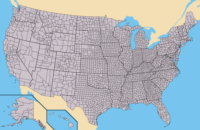
English: Map of the USA showing borders of states and counties. Colored version of adapted one by Wapcaplet from a public-domain map courtesy of the U.S. Census Bureau website first published in English language version of Wikipedia.
Español: Mapa de los es:Estados Unidos mostrando los los límites de estados miembros y sus condados. Versión a colores de la adaptación hecha por Wapcaplet del mapa de dominio público del sitio web de la Oficina de Censo de los EE.UU..
Derivative works of this file: Emancipation Proclamation.PNG
Lisenziya
Bu sənədi GNU Azad Sənədləşdirmə Lisenziyası, Versiya 1.2 və ya Azad Proqram Fondu tərəfindən nəşr olunan hər hansı sonrakı versiya şərtlərinə əsasən dəyişməz bölmələr, ön qapaq mətnləri və arxa qapaq mətnləri olmadan köçürmək, yayımlamaq və / və ya dəyişdirmək üçün icazə verilir; Lisenziyanın bir nüsxəsi GNU Azad Sənədləşdirmə Lisenziyası adlı hissəyə daxil edilmişdir.http://www.gnu.org/copyleft/fdl.htmlGFDLGNU Free Documentation Licensetruetrue
Bu fayl Creative Commons Attribution-Share Alike 3.0 Sinqapur lisenziyası altında yayımlanır.
Azadsınız:
paylaşmaq – əsəri köçürmək, paylamaq və ötürmək üçün
remiks etmək – əsəri adaptasiya etmək
Aşağıdakı şərtlərə riayət etməklə:
istinad – Müvafiq kredit verməlisiniz, lisenziyaya bir keçid verməlisiniz və dəyişikliklərin olub olmadığını bildirməlisiniz. Bunu hər hansı bir ağlabatan şəkildə edə bilərsiniz, ancaq lisenziyalaşdırıcının sizi və ya istifadənizi təsdiqləməsini təklif edən bir şəkildə deyil.
bənzər paylaşma – Əsəri remix edirsinizsə, dəyişdirirsinizsə və ya üzərində iş aparırsınızsa, öz töhfələrinizi orijinalda olduğu kimi eyni və ya uyğun lisenziya altında yayımlamalısınız.
This licensing tag was added to this file as part of the GFDL licensing update.http://creativecommons.org/licenses/by-sa/3.0/CC BY-SA 3.0Creative Commons Attribution-Share Alike 3.0truetrue
Captions
Add a one-line explanation of what this file represents
Items portrayed in this file
təsvir edir
copyright status ingilis
copyrighted ingilis
lisenziya
GNU Free Documentation License, version 1.2 or later ingilis
Creative Commons Attribution-ShareAlike 3.0 Unported ingilis
yaranma tarixi
25 avqust 2005
Faylın tarixçəsi
Faylın əvvəlki versiyasını görmək üçün gün/tarix bölməsindəki tarixlərə klikləyin.
*{{es}} Mapa de los Estados Unidos de América mostrando los los límites de estados miembros y sus condados. Versión a colores de la adaptación hecha por Wapcaplet del mapa de dominio público del [http://www.census.gov/ sitio
Bu faylda fotoaparat və ya skanerlə əlavə olunmuş məlumatlar var. Əgər fayl sonradan redaktə olunubsa, bəzi parametrlər bu şəkildə göstərilənlərdən fərqli ola bilər.
Üfüqi xətt
47,24 dpc
Şaquli xətt
47,24 dpc
May 13, 2023
fayl, with, county, outlines, fayl, faylın, tarixçəsi, fayl, keçidləri, faylın, qlobal, istifadəsi, metaməlumatlarsınaq, göstərişi, ölçüsü, piksel, digər, ölçülər, piksel, piksel, piksel, piksel, faylın, orijinalı, 8206, piksel, fayl, həcmi, mime, növü, image,. Fayl Faylin tarixcesi Fayl kecidleri Faylin qlobal istifadesi MetamelumatlarSinaq gosterisi olcusu 800 520 piksel Diger olculer 320 208 piksel 640 416 piksel 1 024 665 piksel 1 513 983 piksel Faylin orijinali 8206 1 513 983 piksel fayl hecmi 581 KB MIME novu image png Bu fayl Vikimedia Commons dadirve diger layihelerde istifade edile biler Faylin tesvir sehifesine get This locator map image could be re created using vector graphics as an SVG file This has several advantages see nbsp Commons Media for cleanup for more information If nbsp an nbsp SVG nbsp form nbsp of nbsp this nbsp image is available please upload it and afterwards replace this template with vector version available i new image name i It is recommended to name the SVG file Map of USA with county outlines svg then the template Vector version available or Vva does not need the new image name parameter Xulase IzahMap of USA with county outlines png Deutsch Karte der Vereinigten Staaten mit den Staats und Kreisgrenzen English Map of the USA showing borders of states and counties Colored version of adapted one by Wapcaplet from a public domain map courtesy of the U S Census Bureau website first published in English language version of Wikipedia Espanol Mapa de los es Estados Unidos mostrando los los limites de estados miembros y sus condados Version a colores de la adaptacion hecha por Wapcaplet del mapa de dominio publico del sitio web de la Oficina de Censo de los EE UU Tarix 25 avqust 2005 Menbe https www census gov Muellif This file is lacking author information Diger versiyalar Derivative works of this file nbsp Emancipation Proclamation PNG Lisenziya Bu senedi GNU Azad Senedlesdirme Lisenziyasi Versiya 1 2 ve ya Azad Proqram Fondu terefinden nesr olunan her hansi sonraki versiya sertlerine esasen deyismez bolmeler on qapaq metnleri ve arxa qapaq metnleri olmadan kocurmek yayimlamaq ve ve ya deyisdirmek ucun icaze verilir Lisenziyanin bir nusxesi GNU Azad Senedlesdirme Lisenziyasi adli hisseye daxil edilmisdir http www gnu org copyleft fdl html GFDL GNU Free Documentation License true true Bu fayl Creative Commons Attribution Share Alike 3 0 Sinqapur lisenziyasi altinda yayimlanir Azadsiniz paylasmaq eseri kocurmek paylamaq ve oturmek ucun remiks etmek eseri adaptasiya etmek Asagidaki sertlere riayet etmekle istinad Muvafiq kredit vermelisiniz lisenziyaya bir kecid vermelisiniz ve deyisikliklerin olub olmadigini bildirmelisiniz Bunu her hansi bir aglabatan sekilde ede bilersiniz ancaq lisenziyalasdiricinin sizi ve ya istifadenizi tesdiqlemesini teklif eden bir sekilde deyil benzer paylasma Eseri remix edirsinizse deyisdirirsinizse ve ya uzerinde is aparirsinizsa oz tohfelerinizi orijinalda oldugu kimi eyni ve ya uygun lisenziya altinda yayimlamalisiniz This licensing tag was added to this file as part of the GFDL licensing update http creativecommons org licenses by sa 3 0 CC BY SA 3 0 Creative Commons Attribution Share Alike 3 0 true trueCaptionsazerbaycancaAdd a one line explanation of what this file representsItems portrayed in this filetesvir edircopyright status nbsp ingiliscopyrighted nbsp ingilislisenziyaGNU Free Documentation License version 1 2 or later nbsp ingilisCreative Commons Attribution ShareAlike 3 0 Unported nbsp ingilisyaranma tarixi25 avqust 2005 Faylin tarixcesi Faylin evvelki versiyasini gormek ucun gun tarix bolmesindeki tarixlere klikleyin Tarix VaxtKicik sekilOlculerIstifadeciSerh indiki16 25 31 may 20151 513 983 581 KB CmdrjamesonCompressed with pngout Reduced by 484kB 45 decrease 14 02 21 sentyabr 20101 513 983 1 04 MB Kmusserfix Pamlico Sound 23 31 25 noyabr 20091 513 983 166 KB Reywas92Make borders more visible 04 41 23 yanvar 20081 513 983 98 KB SpeightFix San Francisco Bay and Puget Sound 22 53 23 noyabr 20061 513 983 165 KB Ibaglimore fixes 22 53 23 noyabr 20061 513 983 165 KB IbagliReverted to earlier revision 22 52 23 noyabr 20061 513 983 180 KB Ibaglimore fixes 02 16 23 noyabr 20061 513 983 165 KB Ibaglifix lake St Clair 20 57 28 avqust 20051 513 983 165 KB Huhsunqu es Mapa de los Estados Unidos de America mostrando los los limites de estados miembros y sus condados Version a colores de la adaptacion hecha por Wapcaplet del mapa de dominio publico del http www census gov sitio Fayl kecidleri Bu sekile olan kecidler ABS federal hokumeti Faylin qlobal istifadesi Bu fayl asagidaki vikilerde istifade olunur ang wikipedia org layihesinde istifadesi Scir bar wikipedia org layihesinde istifadesi County Vaeinigte Staatn bg wikipedia org layihesinde istifadesi Okrg ca wikipedia org layihesinde istifadesi Comtat dels Estats Units Comtat divisio administrativa Usuari JaumeBG Traduccio 2 cs wikipedia org layihesinde istifadesi Okresy ve Spojenych statech americkych de wikipedia org layihesinde istifadesi County Vereinigte Staaten Benutzer Sinuhe20 Benutzer TheAmerikaner Artikelentwurf Wikipedia Kartenwerkstatt Archiv 2021 03 en wikipedia org layihesinde istifadesi Talk Bigfoot Archive 5 Talk Manhattan Talk Los Angeles County California Talk List of counties in Nevada Wikipedia WikiProject U S counties Wikipedia talk WikiProject U S counties Talk Lancaster County Pennsylvania Talk Frederick County Maryland Talk Franklin County Tennessee Talk Trumbull County Ohio Talk Tuscarawas County Ohio Talk Union County Ohio Talk Van Wert County Ohio Talk Vinton County Ohio Talk Warren County Ohio Talk Washington County Ohio Talk Wayne County Ohio Talk Williams County Ohio Talk Wood County Ohio Talk Wyandot County Ohio Talk Adair County Oklahoma Talk Alfalfa County Oklahoma Talk Atoka County Oklahoma Talk Blaine County Oklahoma Talk Bryan County Oklahoma Talk Caddo County Oklahoma Talk Carter County Oklahoma Talk Cherokee County Oklahoma Talk Nantucket Talk Potter County South Dakota Talk Weston County Wyoming Talk Washakie County Wyoming Talk Uinta County Wyoming Talk Teton County Wyoming Talk Sweetwater County Wyoming Talk Sublette County Wyoming Talk Sheridan County Wyoming Talk Platte County Wyoming Talk Park County Wyoming Bu faylin qlobal istifadesine baxin Metamelumatlar Bu faylda fotoaparat ve ya skanerle elave olunmus melumatlar var Eger fayl sonradan redakte olunubsa bezi parametrler bu sekilde gosterilenlerden ferqli ola biler Ufuqi xett47 24 dpcSaquli xett47 24 dpc Menbe https az wikipedia org wiki Fayl Map of USA with county outlines png, wikipedia, oxu, kitab, kitabxana, axtar, tap, hersey,
ne axtarsan burda
, en yaxsi meqale sayti, meqaleler, kitablar, oyrenmek, wiki, bilgi, tarix, seks, porno, indir, yukle, sex, azeri sex, azeri, seks yukle, sex yukle, izle, seks izle, porno izle, mobil seks, telefon ucun, chat, azeri chat, tanisliq, tanishliq, azeri tanishliq, sayt, medeni, medeni saytlar, chatlar, mekan, tanisliq mekani, mekanlari, yüklə, pulsuz, pulsuz yüklə, mp3, video, mp4, 3gp, jpg, jpeg, gif, png, şəkil, muisiqi, mahnı, kino, film, kitab, oyun, oyunlar.