Bu fayl "Vikimedia Commons"dadır və digər layihələrdə istifadə edilə bilər.
təsvir səhifəsi
Faylın təsvir səhifəsinə get
Xülasə
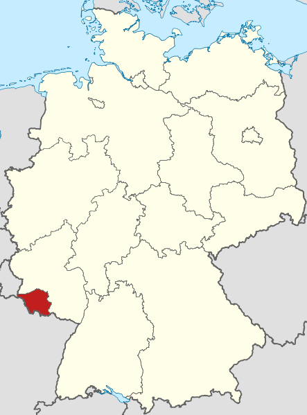
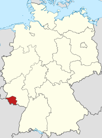
İzahLocator map Saarland in Germany.svg
Deutsch: Lage von Saarland in Deutschland
English: Locator map of Saarland in Germany.
Tarix
Mənbə
Own work based on: Germany location map.svg by NordNordWest
Müəllif
TUBS
Digər versiyalar
This SVG map is part of a locator map series applying the widespread location map scheme. Please see root category to browse for more.
More ▼
Afrika
Algeria • Angola • Benin • Botswana • Burkina Faso • Burundi • Cameroon • Cape Verde • Central African Republic • Chad • Comoros • Côte d'Ivoire • Democratic Republic of the Congo • Republic of the Congo • Djibouti • Egypt • Equatorial Guinea • Eritrea • Eswatini • Ethiopia • Gabon • Gambia • Ghana • Guinea-Bissau • Guinea • Kenya • Lesotho • Liberia • Libya • Madagascar • Malawi • Mali • Mauritania • Mauritius • Morocco • Mozambique • Namibia • Niger • Nigeria • Rwanda • (Sahrawi Arab Democratic Republic) • Senegal • Seychelles • Sierre Leone • Somalia • Somaliland • South Africa • South Sudan • Sudan • São Tomé and Príncipe • Tanzania • Togo • Tunisia • Uganda • Yemen • Zambia • Zimbabwe
Asiya
(Abkhazia) • Afghanistan • Armenia • Azerbaijan • Bahrain • Bangladesh • Bhutan • Brunei • Cambodia • China • Republic of China • Cyprus • East Timor • Egypt • Georgia • India • Indonesia • Iran • Iraq • Israel • Japan • Jordan • Kazakhstan • Kuwait • Kyrgyzstan • Laos • Lebanon • Malaysia • Maldives • Mongolia • Myanmar • Nepal • North Korea • (Northern Cyprus) • Oman • Pakistan • (Palestine) • Papua New Guinea • Philippines • Qatar • Russia • Saudi Arabia • Singapore • South Korea • (South Ossetia) • Sri Lanka • Syria • Tajikistan • Thailand • Turkey • Turkmenistan • United Arab Emirates • Uzbekistan • Vietnam • Yemen
Avropa
(European Union) • (Abkhazia) • Albania • Andorra • Armenia • Austria • Azerbaijan • Belarus • Belgium • Bosnia and Herzegovina • Bulgaria • Czech Republic • Croatia • Cyprus • Denmark • Estonia • Finland • France • Georgia • Germany • Greece • (Guernsey) • Hungary • Iceland • Ireland • Italy • (Jersey) • Kazakhstan • (Kosovo) • Latvia • Liechtenstein • Lithuania • Luxembourg • Malta • (Isle of Man) • Moldova • Monaco • Montenegro • Netherlands • North Macedonia • (Northern Cyprus) • Norway • Poland • Portugal • Romania • Russia • San Marino • Serbia • Slovakia • Slovenia • (South Ossetia) • Spain • Sweden • Switzerland • Turkey • Ukraine • United Kingdom • Vatican City
Şimali Amerika
Antigua and Barbuda • Bahamas • Barbados • Belize • Canada • Costa Rica • Cuba • Dominica • Dominican Republic • El Salvador • Grenada • Guatemala • Haiti • Honduras • Iceland • Jamaica • Mexico • Nicaragua • Panama • Saint Kitts and Nevis • Saint Lucia • Saint Vincent and the Grenadines • Trinidad and Tobago • United States
Okeaniya
Australia • (Cook Islands) • Fiji • Indonesia • Kiribati • Marshall Islands • Micronesia • Nauru • New Zealand • (Niue) • Palau • Papua New Guinea • Samoa • Solomon Islands • Tonga • Tuvalu • Vanuatu
Cənubi Amerika
Argentina • Bolivia • Brazil • Chile • Colombia • Ecuador • Guyana • Panama • Paraguay • Peru • Suriname • Trinidad and Tobago • Uruguay • Venezuela
Antarktida
-
Locator maps design recommendations ▼
Principles
Design Guidelines are based on ▸location map design of the German map shop (in German). It's preferable to derive new locator maps from existing location maps. Please keep both size and ratio in this case. Thus the new locator maps may still be applied as location map (▸Guide). Marker color is supposed to be darkred. Waterbodies may be transparent, to show other objects better. Please be aware that this guide is only a recommendation. It’s not an inevitable law!
Color template
Template toolbox
Other optional map elements
Subdivision of a country
Country within an international organization
Country without context projected on the globe
Country without context
Highlight small areas
Marker
Merged markers
“Glowing” edges
Zoom
Zoom
Zoom
“Remote” areas and mini maps
Mini maps show where the depicted area actually is situated. Check out ▸Vorlage:Positionskarte+ (in German) and ▸Modèle:Carte en coin (in French) of how to insert a mini map in virtually every map.
Small maps apply different scales
Small map applies same scale as main map
Mini map with box
Depicted continent dark grey
Zoomed box on a world map also showing the remote part of country
Disputed areas
rest of Serbia: foreign or the same country?
Kosovo: part of Serbia?
Whether South Ossetia or Abkhazia form a part of Georgia is disputed. The marked Georgian administrative region however is partly under Georgian control (solid red) while other parts are part break-away "country" South Ossetia (hatched).
India claims some northern areas (hatched) while other areas are controlled by India but challenged by other countries. India claims all of Kashmir (red areas), while it controls only the southern part of it (cf. broad red stripes vs. narrow red stripes).
Western Sahara: part of Morocco?
Like above. However, the map differentiates whether the disputed area is controlled by Morocco or not.
Locator map of Taiwan in China. Map hatches all areas that are claimed but not controlled by China. Hence, highlighted Taiwan is also hatched grey/red.
Greyed special objects
Glaciers
Urbanized areas
Backgrounds
Relief
Relief (like before, but outlines highlighted)
Satellite view
Land cover
Relief
Corresponding imagemaps ▼
Afrika
Algeria • Angola • Benin • Botswana • Burkina Faso • Burundi • Cameroon • Cape Verde • Central African Republic • Chad • Comoros • Côte d'Ivoire • Democratic Republic of the Congo • Repbulic of the Congo • Djibouti • Egypt • Equatorial Guinea • Eritrea • Ethiopia • Gabon • Gambia • Ghana • Guinea-Bissau • Guinea • Kenya • Lesotho • Liberia • Libya • Madagascar • Malawi • Mali • Mauritania • Mauritius • Morocco • Mozambique • Namibia • Niger • Nigeria • Rwanda • (Sahrawi Arab Democratic Republic) • Senegal • Seychelles • Sierre Leone • Somalia • South Africa • South Sudan • Sudan • Swaziland • São Tomé and Príncipe • Tanzania • Togo • Tunisia • Uganda • Yemen • Zambia • Zimbabwe
Asiya
(Abkhazia) • Afghanistan • Armenia • Azerbaijan • Bahrain • Bangladesh • Bhutan • Brunei • Cambodia • China• Republic of China • Cyprus • East Timor • Egypt • Georgia • India • Indonesia • Iran • Iraq • Israel • Japan • Jordan • Kazakhstan • Kuwait • Kyrgyzstan • Laos • Lebanon • Malaysia • Maldives • Mongolia • Myanmar • Nepal • North Korea • (Northern Cyprus) • Oman • Pakistan • (Palestine) • Papua New Guinea• Philippines • Qatar • Russia • Saudi Arabia • Singapore • South Korea • (South Ossetia) • Sri Lanka • Syria • Tajikistan • Thailand • Turkey • Turkmenistan• United Arab Emirates • Uzbekistan • Vietnam • Yemen
Avropa
(Abkhazia) • Albania • Andorra • Armenia • Austria • Azerbaijan • Belarus • Belgium • Bosnia and Herzegovina • Bulgaria • Czech Republic • Croatia • Cyprus • Denmark • Estonia • Finland • France • Georgia • Germany • Greece • (Guernsey) • Hungary • Iceland • Ireland • Italy • (Jersey) • Kazakhstan • (Kosovo) • Latvia • Liechtenstein • Lithuania • Luxembourg • Macedonia • Malta • (Isle of Man) • Moldova • Monaco • Montenegro • Netherlands • (Northern Cyprus) • Norway • Poland • Portugal • Romania • Russia • San Marino • Serbia • Slovakia • Slovenia • (South Ossetia) • Spain • Sweden • Switzerland • Turkey • Ukraine • United Kingdom • Vatican City
Şimali Amerika
Antigua and Barbuda • Bahamas • Barbados • Belize • Canada • Costa Rica • Cuba • Dominica • Dominican Republic • El Salvador • Grenada • Guatemala • Haiti • Honduras • Iceland • Jamaica • Mexico • Nicaragua • Panama • Saint Kitts and Nevis • Saint Lucia • Saint Vincent and the Grenadines • Trinidad and Tobago • United States
Okeaniya
Australia • Brunei • (Cook Islands) • East Timor • Fiji • Indonesia • Kiribati • Marshall Islands • Micronesia • Nauru • New Zealand • (Niue) • Palau • Papua New Guinea • Samoa • Solomon Islands • Tonga • Tuvalu • Vanuatu
Cənubi Amerika
Argentina • Bolivia • Brazil • Chile • Colombia • Ecuador • Guyana • Panama • Paraguay • Peru • Suriname • Trinidad and Tobago • Uruguay • Venezuela
Other
Antarktida
World map
Qlobus
SVG genesis
InfoField
The SVG code is valid.
This locator map was created with Adobe Illustrator by NordNordWest.
Lisenziya
I, the copyright holder of this work, hereby publish it under the following licenses:
Bu sənədi GNU Azad Sənədləşdirmə Lisenziyası, Versiya 1.2 və ya Azad Proqram Fondu tərəfindən nəşr olunan hər hansı sonrakı versiya şərtlərinə əsasən dəyişməz bölmələr, ön qapaq mətnləri və arxa qapaq mətnləri olmadan köçürmək, yayımlamaq və / və ya dəyişdirmək üçün icazə verilir; Lisenziyanın bir nüsxəsi GNU Azad Sənədləşdirmə Lisenziyası adlı hissəyə daxil edilmişdir.http://www.gnu.org/copyleft/fdl.htmlGFDLGNU Free Documentation Licensetruetrue
This file is licensed under the Creative Commons Attribution-Share Alike 3.0 Unported, 2.5 Generic, 2.0 Generic and 1.0 Generic license.
Azadsınız:
paylaşmaq – əsəri köçürmək, paylamaq və ötürmək üçün
remiks etmək – əsəri adaptasiya etmək
Aşağıdakı şərtlərə riayət etməklə:
istinad – Müvafiq kredit verməlisiniz, lisenziyaya bir keçid verməlisiniz və dəyişikliklərin olub olmadığını bildirməlisiniz. Bunu hər hansı bir ağlabatan şəkildə edə bilərsiniz, ancaq lisenziyalaşdırıcının sizi və ya istifadənizi təsdiqləməsini təklif edən bir şəkildə deyil.
bənzər paylaşma – Əsəri remix edirsinizsə, dəyişdirirsinizsə və ya üzərində iş aparırsınızsa, öz töhfələrinizi orijinalda olduğu kimi eyni və ya uyğun lisenziya altında yayımlamalısınız.
=={{int:filedesc}}== {{Information |Description= {{de|Lage von Saarland in Deutschland}} {{en|Locator map of Saarland in Germany.}} |Source= {{de|Eigene Arbeit}} {{en|Own work}} |Date=2
fayl, locator, saarland, germany, fayl, faylın, tarixçəsi, fayl, keçidləri, faylın, qlobal, istifadəsibu, faylın, formatındakı, görünüşünün, ölçüsü, piksel, digər, ölçülər, piksel, piksel, piksel, piksel, piksel, piksel, faylın, orijinalı, 8206, faylı, nominal. Fayl Faylin tarixcesi Fayl kecidleri Faylin qlobal istifadesiBu SVG faylin PNG formatindaki bu gorunusunun olcusu 443 599 piksel Diger olculer 177 240 piksel 355 480 piksel 567 768 piksel 757 1 024 piksel 1 513 2 048 piksel 592 801 piksel Faylin orijinali 8206 SVG fayli nominal olaraq 592 801 piksel faylin olcusu 668 KB Bu fayl Vikimedia Commons dadirve diger layihelerde istifade edile biler tesvir sehifesi Faylin tesvir sehifesine get Xulase IzahLocator map Saarland in Germany svg Deutsch Lage von Saarland in Deutschland English Locator map of Saarland in Germany Tarix 2009 Menbe Own work based on Germany location map svg nbsp by NordNordWest Muellif TUBS Diger versiyalar This SVG map is part of a locator map series applying the widespread location map scheme Please see root category to browse for more More AfrikaAlgeria Angola Benin Botswana Burkina Faso Burundi Cameroon Cape Verde Central African Republic Chad Comoros Cote d Ivoire Democratic Republic of the Congo Republic of the Congo Djibouti Egypt Equatorial Guinea Eritrea Eswatini Ethiopia Gabon Gambia Ghana Guinea Bissau Guinea Kenya Lesotho Liberia Libya Madagascar Malawi Mali Mauritania Mauritius Morocco Mozambique Namibia Niger Nigeria Rwanda Sahrawi Arab Democratic Republic Senegal Seychelles Sierre Leone Somalia Somaliland South Africa South Sudan Sudan Sao Tome and Principe Tanzania Togo Tunisia Uganda Yemen Zambia ZimbabweAsiya Abkhazia Afghanistan Armenia Azerbaijan Bahrain Bangladesh Bhutan Brunei Cambodia China Republic of China Cyprus East Timor Egypt Georgia India Indonesia Iran Iraq Israel Japan Jordan Kazakhstan Kuwait Kyrgyzstan Laos Lebanon Malaysia Maldives Mongolia Myanmar Nepal North Korea Northern Cyprus Oman Pakistan Palestine Papua New Guinea Philippines Qatar Russia Saudi Arabia Singapore South Korea South Ossetia Sri Lanka Syria Tajikistan Thailand Turkey Turkmenistan United Arab Emirates Uzbekistan Vietnam YemenAvropa European Union Abkhazia Albania Andorra Armenia Austria Azerbaijan Belarus Belgium Bosnia and Herzegovina Bulgaria Czech Republic Croatia Cyprus Denmark Estonia Finland France Georgia Germany Greece Guernsey Hungary Iceland Ireland Italy Jersey Kazakhstan Kosovo Latvia Liechtenstein Lithuania Luxembourg Malta Isle of Man Moldova Monaco Montenegro Netherlands North Macedonia Northern Cyprus Norway Poland Portugal Romania Russia San Marino Serbia Slovakia Slovenia South Ossetia Spain Sweden Switzerland Turkey Ukraine United Kingdom Vatican CitySimali AmerikaAntigua and Barbuda Bahamas Barbados Belize Canada Costa Rica Cuba Dominica Dominican Republic El Salvador Grenada Guatemala Haiti Honduras Iceland Jamaica Mexico Nicaragua Panama Saint Kitts and Nevis Saint Lucia Saint Vincent and the Grenadines Trinidad and Tobago United StatesOkeaniyaAustralia Cook Islands Fiji Indonesia Kiribati Marshall Islands Micronesia Nauru New Zealand Niue Palau Papua New Guinea Samoa Solomon Islands Tonga Tuvalu VanuatuCenubi AmerikaArgentina Bolivia Brazil Chile Colombia Ecuador Guyana Panama Paraguay Peru Suriname Trinidad and Tobago Uruguay VenezuelaAntarktida Locator maps design recommendations Principles Design Guidelines are based on location map design of the German map shop in German It s preferable to derive new locator maps from existing location maps Please keep both size and ratio in this case Thus the new locator maps may still be applied as location map Guide Marker color is supposed to be darkred Waterbodies may be transparent to show other objects better Please be aware that this guide is only a recommendation It s not an inevitable law Color template Template toolbox Other optional map elements Subdivision of a country Country within an international organization Country without context projected on the globe Country without context Highlight small areas Marker Merged markers Glowing edges Zoom Zoom Zoom Remote areas and mini maps Mini maps show where the depicted area actually is situated Check out Vorlage Positionskarte in German and Modele Carte en coin in French of how to insert a mini map in virtually every map Small maps apply different scales Small map applies same scale as main map Mini map with box Depicted continent dark grey Zoomed box on a world map also showing the remote part of country Disputed areas rest of Serbia foreign or the same country Kosovo part of Serbia Whether South Ossetia or Abkhazia form a part of Georgia is disputed The marked Georgian administrative region however is partly under Georgian control solid red while other parts are part break away country South Ossetia hatched India claims some northern areas hatched while other areas are controlled by India but challenged by other countries India claims all of Kashmir red areas while it controls only the southern part of it cf broad red stripes vs narrow red stripes Western Sahara part of Morocco Like above However the map differentiates whether the disputed area is controlled by Morocco or not Locator map of Taiwan in China Map hatches all areas that are claimed but not controlled by China Hence highlighted Taiwan is also hatched grey red Greyed special objects Glaciers Urbanized areas Backgrounds Relief Relief like before but outlines highlighted Satellite view Land cover ReliefCorresponding imagemaps AfrikaAlgeria Angola Benin Botswana Burkina Faso Burundi Cameroon Cape Verde Central African Republic Chad Comoros Cote d Ivoire Democratic Republic of the Congo Repbulic of the Congo Djibouti Egypt Equatorial Guinea Eritrea Ethiopia Gabon Gambia Ghana Guinea Bissau Guinea Kenya Lesotho Liberia Libya Madagascar Malawi Mali Mauritania Mauritius Morocco Mozambique Namibia Niger Nigeria Rwanda Sahrawi Arab Democratic Republic Senegal Seychelles Sierre Leone Somalia South Africa South Sudan Sudan Swaziland Sao Tome and Principe Tanzania Togo Tunisia Uganda Yemen Zambia ZimbabweAsiya Abkhazia Afghanistan Armenia Azerbaijan Bahrain Bangladesh Bhutan Brunei Cambodia China Republic of China Cyprus East Timor Egypt Georgia India Indonesia Iran Iraq Israel Japan Jordan Kazakhstan Kuwait Kyrgyzstan Laos Lebanon Malaysia Maldives Mongolia Myanmar Nepal North Korea Northern Cyprus Oman Pakistan Palestine Papua New Guinea Philippines Qatar Russia Saudi Arabia Singapore South Korea South Ossetia Sri Lanka Syria Tajikistan Thailand Turkey Turkmenistan United Arab Emirates Uzbekistan Vietnam YemenAvropa Abkhazia Albania Andorra Armenia Austria Azerbaijan Belarus Belgium Bosnia and Herzegovina Bulgaria Czech Republic Croatia Cyprus Denmark Estonia Finland France Georgia Germany Greece Guernsey Hungary Iceland Ireland Italy Jersey Kazakhstan Kosovo Latvia Liechtenstein Lithuania Luxembourg Macedonia Malta Isle of Man Moldova Monaco Montenegro Netherlands Northern Cyprus Norway Poland Portugal Romania Russia San Marino Serbia Slovakia Slovenia South Ossetia Spain Sweden Switzerland Turkey Ukraine United Kingdom Vatican CitySimali AmerikaAntigua and Barbuda Bahamas Barbados Belize Canada Costa Rica Cuba Dominica Dominican Republic El Salvador Grenada Guatemala Haiti Honduras Iceland Jamaica Mexico Nicaragua Panama Saint Kitts and Nevis Saint Lucia Saint Vincent and the Grenadines Trinidad and Tobago United StatesOkeaniyaAustralia Brunei Cook Islands East Timor Fiji Indonesia Kiribati Marshall Islands Micronesia Nauru New Zealand Niue Palau Papua New Guinea Samoa Solomon Islands Tonga Tuvalu VanuatuCenubi AmerikaArgentina Bolivia Brazil Chile Colombia Ecuador Guyana Panama Paraguay Peru Suriname Trinidad and Tobago Uruguay VenezuelaOtherAntarktida World map Qlobus SVG nbsp genesisInfoField nbsp The SVG code is valid nbsp This locator map was created with Adobe Illustrator by NordNordWest Lisenziya I the copyright holder of this work hereby publish it under the following licenses Bu senedi GNU Azad Senedlesdirme Lisenziyasi Versiya 1 2 ve ya Azad Proqram Fondu terefinden nesr olunan her hansi sonraki versiya sertlerine esasen deyismez bolmeler on qapaq metnleri ve arxa qapaq metnleri olmadan kocurmek yayimlamaq ve ve ya deyisdirmek ucun icaze verilir Lisenziyanin bir nusxesi GNU Azad Senedlesdirme Lisenziyasi adli hisseye daxil edilmisdir http www gnu org copyleft fdl html GFDL GNU Free Documentation License true trueThis file is licensed under the Creative Commons Attribution Share Alike 3 0 Unported 2 5 Generic 2 0 Generic and 1 0 Generic license Azadsiniz paylasmaq eseri kocurmek paylamaq ve oturmek ucun remiks etmek eseri adaptasiya etmek Asagidaki sertlere riayet etmekle istinad Muvafiq kredit vermelisiniz lisenziyaya bir kecid vermelisiniz ve deyisikliklerin olub olmadigini bildirmelisiniz Bunu her hansi bir aglabatan sekilde ede bilersiniz ancaq lisenziyalasdiricinin sizi ve ya istifadenizi tesdiqlemesini teklif eden bir sekilde deyil benzer paylasma Eseri remix edirsinizse deyisdirirsinizse ve ya uzerinde is aparirsinizsa oz tohfelerinizi orijinalda oldugu kimi eyni ve ya uygun lisenziya altinda yayimlamalisiniz https creativecommons org licenses by sa 3 0 CC BY SA 3 0 Creative Commons Attribution Share Alike 3 0 true trueIstediyiniz lisenziyani sece bilersiniz CaptionsazerbaycancaAdd a one line explanation of what this file representsItems portrayed in this filetesvir ediryaradicisome valueURL https commons wikimedia org wiki user TUBSWikimedia username nbsp ingilis TUBSmuellifin qisa adi TUBScopyright status nbsp ingiliscopyrighted nbsp ingilislisenziyaCreative Commons Attribution ShareAlike 2 0 Generic nbsp ingilisCreative Commons Attribution ShareAlike 3 0 Unported nbsp ingilisCreative Commons Attribution ShareAlike 2 5 Generic nbsp ingilisGNU Free Documentation License version 1 2 or later nbsp ingilisCreative Commons Attribution ShareAlike 1 0 Generic nbsp ingilisyaranma tarixi2009 Faylin tarixcesi Faylin evvelki versiyasini gormek ucun gun tarix bolmesindeki tarixlere klikleyin Tarix VaxtKicik sekilOlculerIstifadeciSerh indiki18 02 11 mart 2009592 801 668 KB TUBS int filedesc Information Description de Lage von Saarland in Deutschland en Locator map of Saarland in Germany Source de Eigene Arbeit en Own work Date 2 Fayl kecidleri Bu sekile olan kecidler Saarland Xristian Demokrat Ittifaqi Almaniya Faylin qlobal istifadesi Bu fayl asagidaki vikilerde istifade olunur af wikipedia org layihesinde istifadesi Saarland ar wikipedia org layihesinde istifadesi سارلاند arz wikipedia org layihesinde istifadesi زارلاند ast wikipedia org layihesinde istifadesi Sarre ay wikipedia org layihesinde istifadesi Saarland suyu bar wikipedia org layihesinde istifadesi Saarland be wikipedia org layihesinde istifadesi Saar bs wikipedia org layihesinde istifadesi Saarland ca wikipedia org layihesinde istifadesi Saarland ceb wikipedia org layihesinde istifadesi Saarland crh wikipedia org layihesinde istifadesi Saar cs wikipedia org layihesinde istifadesi Sarsko Seznam vlajek nemeckych spolkovych zemi Seznam hymen nemeckych spolkovych zemi de wikipedia org layihesinde istifadesi Saarland Okologisch Demokratische Partei Liste der Ministerprasidenten der deutschen Lander Piratenpartei Deutschland Liste von Schulen der Sekundarstufe I im Saarland Christlich Demokratische Union Deutschlands Wikipedia Landtagsprojekt Saarland Interesse Wikipedia Landtagsprojekt Saarland Wikipedia Landtagsprojekt Saarland Ergebnisse Wikipedia Landtagsprojekt Saarland Blog Wikipedia Landtagsprojekt Saarland Aktueller Stand Wikipedia Landtagsprojekt Saarland Titelleiste Kurz Wikipedia Landtagsprojekt Saarland FAQ V Partei Liste der Landtagsprasidenten der deutschen Lander de wikivoyage org layihesinde istifadesi Saarland diq wikipedia org layihesinde istifadesi Saarland el wikipedia org layihesinde istifadesi Saarlant eml wikipedia org layihesinde istifadesi Sarland en wikipedia org layihesinde istifadesi Flags of German states Saarland Police Volt Germany en wiktionary org layihesinde istifadesi Saar es wikipedia org layihesinde istifadesi Sarre et wikipedia org layihesinde istifadesi Saarimaa fi wiktionary org layihesinde istifadesi Saarland frr wikipedia org layihesinde istifadesi Saarlun Saarlun fe Saarloon Saarloun fr wikinews org layihesinde istifadesi Allemagne large victoire du SPD aux elections regionales en Sarre ga wikipedia org layihesinde istifadesi An tSarlainn gl wikipedia org layihesinde istifadesi Sarre hsb wikipedia org layihesinde istifadesi Posaarska hy wikipedia org layihesinde istifadesi Սաար ia wikipedia org layihesinde istifadesi Appendice Lista de statos de Germania Bu faylin qlobal istifadesine baxin Menbe https az wikipedia org wiki Fayl Locator map Saarland in Germany svg, wikipedia, oxu, kitab, kitabxana, axtar, tap, hersey,
ne axtarsan burda
, en yaxsi meqale sayti, meqaleler, kitablar, oyrenmek, wiki, bilgi, tarix, seks, porno, indir, yukle, sex, azeri sex, azeri, seks yukle, sex yukle, izle, seks izle, porno izle, mobil seks, telefon ucun, chat, azeri chat, tanisliq, tanishliq, azeri tanishliq, sayt, medeni, medeni saytlar, chatlar, mekan, tanisliq mekani, mekanlari, yüklə, pulsuz, pulsuz yüklə, mp3, video, mp4, 3gp, jpg, jpeg, gif, png, şəkil, muisiqi, mahnı, kino, film, kitab, oyun, oyunlar.