fbpx
Wikipedia

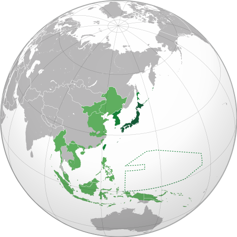
Japanese Empire (orthographic projection)

Faylın orijinalı(SVG faylı, nominal olaraq 600 × 600 piksel, faylın ölçüsü: 797 KB)

Bu fayl "Vikimedia Commons"dadır
və digər layihələrdə istifadə edilə bilər.
Faylın təsvir səhifəsinə get

Xülasə

İzah
English: Japanese Empire.
 
Territory (1870–1895).
 
Acquisitions (1895–1930).
 
Acquisitions (1930–1942).
 
South Seas Mandate (1919–1947).
Español: Imperio Japonés.
 
Territorio (1870–1895).
 
Adquisiciones (1895–1930)
 
Adquisiciones (1930–1942).
 
Mandato del Pacífico Sur (1919–1947).
Українська: Японська імперія.
 
Територія (1870–1895).
 
Нові території (1895–1930).
 
Нові території (1930–1942).
 
Південний Тихоокеанський мандат (1919–1947).
Tarix (UTC)
Mənbə
  • File:Japan (orthographic projection).svg
  • File:BlankMap-World-WWII.PNG
  • File:Greater Japanese empire.png
  • File:Pacific Area - The Imperial Powers 1939 - Map.svg
  • 1942 Map of Japanese Empire.jpg
  • File:Imperio Japonés.JPG
  • File:Japanese Empire - 1942.svg
  • File:Occupied Japan.png
Müəllif Milenioscuro
Digər versiyalar
This is a Grey & green orthographic projection map.
  • More information here.
العربية: الرجاء، قراءة الميثاق.
বাংলা: দয়া করে, রীতিনীতিটি পড়ুন।
Deutsch: Bitte lies die Konventionen.
English: Please, read the conventions.
Español: Por favor, lea las convenciones.
Filipino: Paki-basa ang mga kumbensyon.
Français : S'il vous plaît, lisez les conventions.
हिन्दी: कृपया सभागमों को पढ़ लें.
Bahasa Indonesia: Silakan, baca konvensi.
Italiano: Si prega di leggere le convenzioni.
日本語: 規約をご確認ください。
ქართული: გთხოვთ, გაეცნოთ კონვენციებს.
Македонски: Ве молиме, прочитајте ги општоприфатените правила.
Português: Por favor, leia as convenções.
Русский: Пожалуйста, прочитайте соглашения.
Tagalog: Paki-basa ang mga kumbensyon.
Українська: Будь ласка, прочитайте конвенції.
Tiếng Việt: Hãy đọc công văn trước khi đăng.
World maps

Africa

हिन्दी: अफ्रीका
ქართული: აფრიკა.

Eastern Africa

हिन्दी: पूर्वी अफ्रीका

Southern Africa

Central Africa

Northern Africa

Western Africa

Americas

ქართული: ამერიკა.
हिन्दी: अमेरिका

North America

हिन्दी: उत्तरी अमेरिका

Central America

Caribbean

South America

हिन्दी: दक्षिण अमेरिका

Asia

हिन्दी: एशिया (जम्भूद्वीप)
ქართული: აზია.
Português: Ásia.
Українська: Азія.

East

हिन्दी: पूर्वी एशिया
ქართული: აღმოსავლეთი აზია.
Português: Ásia Oriental.
Українська: Східна Азія.

Central

हिन्दी: मध्य एशिया
ქართული: ცენტრალური აზია.
Português: Ásia Central.
Українська: Центральна Азія.

Southeast

Filipino: Timog-silangang Asya.
हिन्दी: दक्षिण-पूर्वी एशिया
Bahasa Indonesia: Asia tenggara
ქართული: სამხრეთ-აღმოსავლეთი აზია.
Português: Sudeste Asiático.
Tagalog: Timog-silangang Asya.
Українська: Південно-Східна Азія.

South

हिन्दी: दक्षिण एशिया
(भारतीय उपमहाद्वीप)
ქართული: სამხრეთი აზია.
Português: Sul da Ásia.
Українська: Південна Азія.

Western

हिन्दी: पश्चिमी एशिया
ქართული: დასავლეთ აზია.
Português: Sudoeste da Ásia.
Українська: Передня Азія.

Europe

हिन्दी: यूरोप
ქართული: ევროპა.
Português: Europa.
Română: Europa.
Русский: Европа.
Українська: Європа.

Countries

Oceania

हिन्दी: ओशिआनिया
ქართული: ოკეანეთი.
Português: Oceania.
Українська: Океанія.

Intercontinental

हिन्दी: अंतर्महाद्वीपिय
ქართული: კონტინენთშორისი.
Português: Intercontinental.
Українська: Міжконтинентальні.

Historical

English: Unions, Organizations, Kingdoms, Empires
Español: Uniones, Organizaciones, Reinos, Imperios
Filipino: Mga Unyon, Organisasyon, Kaharian, Imperyo
Français : Unions, Organisations, Royaumes, Empires
हिन्दी: संघ, संगठन, राज्य, साम्राज्य व ऐतिहासिक देश
ქართული: გაერთიანებები, ორგანიზაციები, სამეფოები, იმპერიები
Português: Estados extintos.
Tagalog: Mga Unyon, Organisasyon, Kaharian, Imperyo
Українська: Союзи, Організації, Королівства, Імперії

Subnationals

हिन्दी: उपराष्ट्रीय इकाईयाँ
ქართული: სუბეროვნული ერთეულები.
Português: Entidades subnacionais.
Українська: Субнаціональні утворення.
SVG genesis
InfoField
 
The SVG code is valid.
 
This world map was created with Inkscape.

Lisenziya

I, the copyright holder of this work, hereby publish it under the following licenses:
Bu sənədi GNU Azad Sənədləşdirmə Lisenziyası, Versiya 1.2 və ya Azad Proqram Fondu tərəfindən nəşr olunan hər hansı sonrakı versiya şərtlərinə əsasən dəyişməz bölmələr, ön qapaq mətnləri və arxa qapaq mətnləri olmadan köçürmək, yayımlamaq və / və ya dəyişdirmək üçün icazə verilir; Lisenziyanın bir nüsxəsi GNU Azad Sənədləşdirmə Lisenziyası adlı hissəyə daxil edilmişdir.

Bu fayl Creative Commons Attribution-Share Alike 3.0 Sinqapur lisenziyası altında yayımlanır.
Azadsınız:
  • paylaşmaq – əsəri köçürmək, paylamaq və ötürmək üçün
  • remiks etmək – əsəri adaptasiya etmək
Aşağıdakı şərtlərə riayət etməklə:
  • istinad – Müvafiq kredit verməlisiniz, lisenziyaya bir keçid verməlisiniz və dəyişikliklərin olub olmadığını bildirməlisiniz. Bunu hər hansı bir ağlabatan şəkildə edə bilərsiniz, ancaq lisenziyalaşdırıcının sizi və ya istifadənizi təsdiqləməsini təklif edən bir şəkildə deyil.
  • bənzər paylaşma – Əsəri remix edirsinizsə, dəyişdirirsinizsə və ya üzərində iş aparırsınızsa, öz töhfələrinizi orijinalda olduğu kimi eyni və ya uyğun lisenziya altında yayımlamalısınız.
İstədiyiniz lisenziyanı seçə bilərsiniz.

Orijinal yükləmə gündəliyi

This image is a derivative work of the following images:

  • File:Japan (orthographic projection).svg licensed with Cc-by-sa-3.0, GFDL

Uploaded with derivativeFX

Captions

Add a one-line explanation of what this file represents

Items portrayed in this file

təsvir edir

copyright status ingilis

copyrighted ingilis

lisenziya

GNU Free Documentation License, version 1.2 or lateral ingilis

Creative Commons Attribution-ShareAlike 3.0 Unported ingilis

yaranma tarixi

16 oktyabr 2011

MIME type ingilis

image/svg+xml

Faylın tarixçəsi

Faylın əvvəlki versiyasını görmək üçün gün/tarix bölməsindəki tarixlərə klikləyin.

(ən yeni | ən əvvəlki) Göstər (10 daha yeni) (10 daha köhnə) (10 | 20 | 50 | 100 | 250 | 500).
Tarix/VaxtKiçik şəkilÖlçülərİstifadəçiŞərh
indiki14:54, 21 aprel 2023600 × 600 (797 KB)LCJapan2034Reverted to version as of 19:32, 15 June 2021 (UTC)
04:21, 2 may 2022600 × 600 (665 KB)TheMysteriousStarReverted to version as of 12:51, 14 June 2021 (UTC) Japan never controlled Thailand
19:32, 15 iyun 2021600 × 600 (797 KB)MilenioscuroReverted to version as of 21:19, 16 April 2021 (UTC)
12:51, 14 iyun 2021600 × 600 (665 KB)CommymonoReverted to version as of 11:13, 23 January 2015 (UTC)
21:19, 16 aprel 2021600 × 600 (797 KB)Milenioscurocorrected size of Dalian/Port Arthur
21:42, 14 noyabr 2020600 × 600 (847 KB)Milenioscuroresolving some really, really, REALLY bad editions of this guys
16:19, 6 avqust 2020600 × 600 (1,37 MB)Hell - llliobetter borders, added christimas, spratly and paracel islands.
18:07, 6 iyul 2020600 × 600 (1,24 MB)Hell - lllioFixed Borders in South Yunnan, added Guam, Bonin Islands, Volcano Islands, Wake Islands, Gilbert Islands, Minami-Tori-shima, Okinotorishima and Pescadores.
20:08, 5 iyul 2020600 × 600 (1,24 MB)Hell - lllioadded Thailand (Under Massive Japanese Influence), Attu and Kiska (Aleutian Islands Campaign) and Parts on the South of the Yunnan Region.
11:31, 21 iyun 2020600 × 600 (665 KB)Dag13Reverted to version as of 11:13, 23 January 2015 (UTC) Siberian ocupation doesnt happend in timeline whitch is stated in legend (Acquisitions (1930–1942).
(ən yeni | ən əvvəlki) Göstər (10 daha yeni) (10 daha köhnə) (10 | 20 | 50 | 100 | 250 | 500).

Bu şəkilə olan keçidlər:

Faylın qlobal istifadəsi

Bu fayl aşağıdakı vikilərdə istifadə olunur:

  • Japannese Keiserryk
  • الإمبراطورية الاستعمارية اليابانية
  • منطقة شرقى أسيا الكبرى للرفاهية المتبادلة
  • بوابة:إمبراطورية اليابان
  • مستخدم:Srahmadi/ملعب
  • بوابة:إمبراطورية اليابان/مقدمة
  • العلاقات الدولية (1919-1939)
  • قائمة القوى العظمى الحديثة
  • Muyeres de consuelu
  • ژاپون یؤنتیمینده تایوان
  • ایمپیراتورلوق
  • Japonská okupace Koreje
  • Storøstasiatiske velstandssfære
  • Japanisches Kaiserreich
  • Großostasiatische Wohlstandssphäre
  • Benutzer:Bdf/Weltkrieg
  • Liste der Satellitenstaaten des Japanischen Kaiserreiches
  • Empire
  • Imperialism
  • Japan
  • Empire of Japan
  • Japanese militarism
  • Japanese occupation of Singapore
  • Portal:Japan
  • State Shinto
  • Colonial empire
  • Timeline of Korean history
  • Portal:World War II
  • History of Japan
  • Japanese colonial empire
  • Continental Policy (Japan)
  • Bu faylın qlobal istifadəsinə baxın.

    Metaməlumatlar

    fayl, japanese, empire, orthographic, projection, fayl, faylın, tarixçəsi, fayl, keçidləri, faylın, qlobal, istifadəsi, metaməlumatlarbu, faylın, formatındakı, görünüşünün, ölçüsü, piksel, digər, ölçülər, piksel, piksel, piksel, piksel, piksel, faylın, orijina. Fayl Faylin tarixcesi Fayl kecidleri Faylin qlobal istifadesi MetamelumatlarBu SVG faylin PNG formatindaki bu gorunusunun olcusu 600 600 piksel Diger olculer 240 240 piksel 480 480 piksel 768 768 piksel 1 024 1 024 piksel 2 048 2 048 piksel Faylin orijinali 8206 SVG fayli nominal olaraq 600 600 piksel faylin olcusu 797 KB Bu fayl Vikimedia Commons dadirve diger layihelerde istifade edile biler Faylin tesvir sehifesine get Mundericat 1 Xulase 2 Africa 2 1 Eastern Africa 2 2 Southern Africa 2 3 Central Africa 2 4 Northern Africa 2 5 Western Africa 3 Americas 3 1 North America 3 1 1 Central America 3 1 2 Caribbean 3 2 South America 4 Asia 4 1 East 4 2 Central 4 3 Southeast 4 4 South 4 5 Western 5 Europe 5 1 Countries 6 Oceania 7 Intercontinental 8 Historical 9 Subnationals 10 Lisenziya 11 Orijinal yukleme gundeliyi Xulase IzahJapanese Empire orthographic projection svg English Japanese Empire nbsp Territory 1870 1895 nbsp Acquisitions 1895 1930 nbsp Acquisitions 1930 1942 nbsp South Seas Mandate 1919 1947 Espanol Imperio Japones nbsp Territorio 1870 1895 nbsp Adquisiciones 1895 1930 nbsp Adquisiciones 1930 1942 nbsp Mandato del Pacifico Sur 1919 1947 Ukrayinska Yaponska imperiya nbsp Teritoriya 1870 1895 nbsp Novi teritoriyi 1895 1930 nbsp Novi teritoriyi 1930 1942 nbsp Pivdennij Tihookeanskij mandat 1919 1947 Tarix 16 oktyabr 2011 09 29 UTC Menbe File Japan orthographic projection svg File BlankMap World WWII PNG File Greater Japanese empire png File Pacific Area The Imperial Powers 1939 Map svg 1942 Map of Japanese Empire jpg File Imperio Japones JPG File Japanese Empire 1942 svg File Occupied Japan png Muellif Milenioscuro Diger versiyalar This is a Grey amp green orthographic projection map More information here dd dd العربية الرجاء قراءة الميثاق ব ল দয কর র ত ন ত ট পড ন Deutsch Bitte lies die Konventionen English Please read the conventions Espanol Por favor lea las convenciones Filipino Paki basa ang mga kumbensyon Francais nbsp S il vous plait lisez les conventions ह न द क पय सभ गम क पढ ल Bahasa Indonesia Silakan baca konvensi Italiano Si prega di leggere le convenzioni 日本語 規約をご確認ください ქართული გთხოვთ გაეცნოთ კონვენციებს Makedonski Ve molime prochitaјte gi opshtoprifatenite pravila Portugues Por favor leia as convencoes Russkij Pozhalujsta prochitajte soglasheniya Tagalog Paki basa ang mga kumbensyon Ukrayinska Bud laska prochitajte konvenciyi Tiếng Việt Hay đọc cong văn trước khi đăng World maps Africa ह न द अफ र क ქართული აფრიკა Africa Eastern Africa ह न द प र व अफ र क Burundi Comoros Djibouti Eritrea Ethiopia Kenya Madagascar Malawi Mauritius Mayotte Mozambique Tanzania Somalia Uganda Southern Africa Lesotho South Africa Zambia Zimbabwe Central Africa Angola Cameroon Central African Republic Chad Republic of the Congo Democratic Republic of the Congo Gabon South Sudan Northern Africa Algeria Egypt Libya Morocco Morocco amp Western Sahara Sahrawri Arab Democratic Republic Sudan Tunisia Western Sahara Western Africa Azawad Benin Burkina Faso Cape Verde Cote d Ivoire Gambia Ghana Guinea Liberia Mali Mali without Azawad Mauritania Niger Nigeria Senegal Sierra Leone Americas ქართული ამერიკა ह न द अम र क Americas Northern North America North America Central America South America Southern South America North America ह न द उत तर अम र क Greenland Canada United States of America Mexico Central America Guatemala El Salvador Honduras Nicaragua Costa Rica Panama Caribbean Trinidad and Tobago Cuba Dominican Republic Haiti Jamaica South America ह न द दक ष ण अम र क Argentina Bolivia Brazil Chile Colombia Ecuador French Guiana Guyana Paraguay Peru Suriname Uruguay Venezuela Asia ह न द एश य जम भ द व प ქართული აზია Portugues Asia Ukrayinska Aziya Asia orthographic projection svg frequently subject to lame edit wars over the Caucasus boundary East ह न द प र व एश य ქართული აღმოსავლეთი აზია Portugues Asia Oriental Ukrayinska Shidna Aziya East Asia China Japan Mongolia North Korea excluding claimed South Korea excluding claimed Jiangxi Taiwan Republic of China including claimed Republic of Korea including claimed Democratic People s Republic of Korea including claimed Korea Central ह न द मध य एश य ქართული ცენტრალური აზია Portugues Asia Central Ukrayinska Centralna Aziya Central Asia Kazakhstan Tajikistan Kyrgyzstan Uzbekistan Southeast Filipino Timog silangang Asya ह न द दक ष ण प र व एश य Bahasa Indonesia Asia tenggara ქართული სამხრეთ აღმოსავლეთი აზია Portugues Sudeste Asiatico Tagalog Timog silangang Asya Ukrayinska Pivdenno Shidna Aziya Southeast Asia Association of Southeast Asian Nations The Philippines and ASEAN Indonesia Malaysia Philippines Thailand South ह न द दक ष ण एश य भ रत य उपमह द व प ქართული სამხრეთი აზია Portugues Sul da Asia Ukrayinska Pivdenna Aziya South Asia Afghanistan Bangladesh Bhutan India Maldives Nepal Pakistan Sri Lanka Western ह न द पश च म एश य ქართული დასავლეთ აზია Portugues Sudoeste da Asia Ukrayinska Perednya Aziya Western Asia Levant Georgia Georgia with inset showing breakaway states Georgia with inset without breakaway states Armenia Azerbaijan Nagorno Karabakh Republic Iran Iraq Israel Jordan Saudi Arabia State of Palestine Syria Lebanon Turkey United Arab Emirates Europe ह न द य र प ქართული ევროპა Portugues Europa Romană Europa Russkij Evropa Ukrayinska Yevropa Europe Caucasus Urals boundary Europe unclear boundary somewhere in the mid Caucasus suffering from edit wars Europe Caucasus Urals boundary with state borders Northern Europe Southern Europe Western Europe Northwestern Europe Mainland Europe Latin Europe Council of Europe European Union European Union with internal borders Benelux Visegrad Group British Isles Great Britain Island of Cyprus Iberia Countries Albania Armenia Azerbaijan Belarus Belgium Bosnia and Herzegovina Bulgaria Republic of Cyprus Czech Republic Denmark Finland France Georgia Georgia with inset showing breakaway states Georgia with inset without breakaway states Germany Iceland Italy Kazakhstan Kosovo North Macedonia Montenegro Netherlands Norway Northern Cyprus Poland Portugal Romania Russia Serbia Spain Sweden Switzerland Turkey United Kingdom Oceania ह न द ओश आन य ქართული ოკეანეთი Portugues Oceania Ukrayinska Okeaniya Oceania Australia New Guinea Australia Fiji New Zealand Papua New Guinea Intercontinental ह न द अ तर मह द व प य ქართული კონტინენთშორისი Portugues Intercontinental Ukrayinska Mizhkontinentalni The Americas Afro eurasia Arctic Antarctica Kingdom of the Netherlands Organization for Security and Co operation in Europe Eurasia Eurasian Economic Union Greater Middle East Ibero America Middle East North Atlantic Treaty Organization Arab World Arab League Latin America Anglo America Franco America Hispanic America Shanghai Cooperation Organization Historical English Unions Organizations Kingdoms Empires Espanol Uniones Organizaciones Reinos Imperios Filipino Mga Unyon Organisasyon Kaharian Imperyo Francais nbsp Unions Organisations Royaumes Empires ह न द स घ स गठन र ज य स म र ज य व ऐत ह स क द श ქართული გაერთიანებები ორგანიზაციები სამეფოები იმპერიები Portugues Estados extintos Tagalog Mga Unyon Organisasyon Kaharian Imperyo Ukrayinska Soyuzi Organizaciyi Korolivstva Imperiyi Almoravid Empire Austro Hungary Aztec Empire Aztec Empire with dominance between Teozapotlan and Xoconochco Biafra Benin Separatist state in Nigeria Captaincy General of Chile Chincha Country Confederate States of America Dominion of Pakistan with Indian Controlled Kashmir Eurasian Economic Community European Economic Community Empire of Brazil Federal Republic of Central America First Mexican Empire Frankish Empire German Reich German Reich With Occupations Great Colombia Granadine Confederation Italian Empire Japanese Empire Inca Empire Mughal Empire New France New Granada Peru Bolivia Confederation Roman Empire Russian Empire Second Mexican Empire Songhai Empire Union of Soviet Socialist Republics United Arab Republic United Provinces of Central America United States of Colombia Viceroyalty of New Granada Viceroyalty of New Spain Viceroyalty of Peru Viceroyalty of the Rio de la Plata Wilsonian Armenia Subnationals ह न द उपर ष ट र य इक ईय ქართული სუბეროვნული ერთეულები Portugues Entidades subnacionais Ukrayinska Subnacionalni utvorennya Canary Islands Spain Catalan Countries French Guiana Greenland Quebec Canada Puerto Rico U S Great Britain Dagestan Federal subject of Russia SVG nbsp genesisInfoField nbsp The SVG code is valid nbsp This world map was created with Inkscape Lisenziya I the copyright holder of this work hereby publish it under the following licenses Bu senedi GNU Azad Senedlesdirme Lisenziyasi Versiya 1 2 ve ya Azad Proqram Fondu terefinden nesr olunan her hansi sonraki versiya sertlerine esasen deyismez bolmeler on qapaq metnleri ve arxa qapaq metnleri olmadan kocurmek yayimlamaq ve ve ya deyisdirmek ucun icaze verilir Lisenziyanin bir nusxesi GNU Azad Senedlesdirme Lisenziyasi adli hisseye daxil edilmisdir http www gnu org copyleft fdl html GFDL GNU Free Documentation License true trueBu fayl Creative Commons Attribution Share Alike 3 0 Sinqapur lisenziyasi altinda yayimlanir Azadsiniz paylasmaq eseri kocurmek paylamaq ve oturmek ucun remiks etmek eseri adaptasiya etmek Asagidaki sertlere riayet etmekle istinad Muvafiq kredit vermelisiniz lisenziyaya bir kecid vermelisiniz ve deyisikliklerin olub olmadigini bildirmelisiniz Bunu her hansi bir aglabatan sekilde ede bilersiniz ancaq lisenziyalasdiricinin sizi ve ya istifadenizi tesdiqlemesini teklif eden bir sekilde deyil benzer paylasma Eseri remix edirsinizse deyisdirirsinizse ve ya uzerinde is aparirsinizsa oz tohfelerinizi orijinalda oldugu kimi eyni ve ya uygun lisenziya altinda yayimlamalisiniz https creativecommons org licenses by sa 3 0 CC BY SA 3 0 Creative Commons Attribution Share Alike 3 0 true trueIstediyiniz lisenziyani sece bilersiniz Orijinal yukleme gundeliyi This image is a derivative work of the following images File Japan orthographic projection svg licensed with Cc by sa 3 0 GFDL Uploaded with derivativeFX 143 360 51 87 600 600 Thailand invaded by Japanese forces in 1941 Japanese ally and protectorate in 1942CaptionsazerbaycancaAdd a one line explanation of what this file representsItems portrayed in this filetesvir edircopyright status nbsp ingiliscopyrighted nbsp ingilislisenziyaGNU Free Documentation License version 1 2 or lateral nbsp ingilisCreative Commons Attribution ShareAlike 3 0 Unported nbsp ingilisyaranma tarixi16 oktyabr 2011MIME type nbsp ingilisimage svg xml Faylin tarixcesi Faylin evvelki versiyasini gormek ucun gun tarix bolmesindeki tarixlere klikleyin en yeni en evvelki Goster 10 daha yeni 10 daha kohne 10 20 50 100 250 500 Tarix VaxtKicik sekilOlculerIstifadeciSerh indiki14 54 21 aprel 2023600 600 797 KB LCJapan2034Reverted to version as of 19 32 15 June 2021 UTC 04 21 2 may 2022600 600 665 KB TheMysteriousStarReverted to version as of 12 51 14 June 2021 UTC Japan never controlled Thailand 19 32 15 iyun 2021600 600 797 KB MilenioscuroReverted to version as of 21 19 16 April 2021 UTC 12 51 14 iyun 2021600 600 665 KB CommymonoReverted to version as of 11 13 23 January 2015 UTC 21 19 16 aprel 2021600 600 797 KB Milenioscurocorrected size of Dalian Port Arthur 21 42 14 noyabr 2020600 600 847 KB Milenioscuroresolving some really really REALLY bad editions of this guys 16 19 6 avqust 2020600 600 1 37 MB Hell llliobetter borders added christimas spratly and paracel islands 18 07 6 iyul 2020600 600 1 24 MB Hell lllioFixed Borders in South Yunnan added Guam Bonin Islands Volcano Islands Wake Islands Gilbert Islands Minami Tori shima Okinotorishima and Pescadores 20 08 5 iyul 2020600 600 1 24 MB Hell lllioadded Thailand Under Massive Japanese Influence Attu and Kiska Aleutian Islands Campaign and Parts on the South of the Yunnan Region 11 31 21 iyun 2020600 600 665 KB Dag13Reverted to version as of 11 13 23 January 2015 UTC Siberian ocupation doesnt happend in timeline whitch is stated in legend Acquisitions 1930 1942 en yeni en evvelki Goster 10 daha yeni 10 daha kohne 10 20 50 100 250 500 Fayl kecidleri Bu sekile olan kecidler Yaponiya imperiyasi Faylin qlobal istifadesi Bu fayl asagidaki vikilerde istifade olunur af wikipedia org layihesinde istifadesi Tweede Wereldoorlog Japannese Keiserryk ar wikipedia org layihesinde istifadesi إمبراطورية اليابان الإمبراطورية الاستعمارية اليابانية منطقة شرقى أسيا الكبرى للرفاهية المتبادلة بوابة إمبراطورية اليابان مستخدم Srahmadi ملعب بوابة إمبراطورية اليابان مقدمة العلاقات الدولية 1919 1939 قائمة القوى العظمى الحديثة arz wikipedia org layihesinde istifadesi امبراطوريه اليابان ast wikipedia org layihesinde istifadesi Imperiu del Xapon Muyeres de consuelu azb wikipedia org layihesinde istifadesi ژاپون ایمپیراتورلوغو ژاپون یؤنتیمینده تایوان ایمپیراتورلوق be wikipedia org layihesinde istifadesi Yaponskaya imperyya bg wikipedia org layihesinde istifadesi Yaponska imperiya bjn wikipedia org layihesinde istifadesi Kakaisaran Japang bn wikipedia org layihesinde istifadesi জ প ন স ম র জ য br wikipedia org layihesinde istifadesi Impalaeriezh Japan bxr wikipedia org layihesinde istifadesi Yapon ezente gүren ca wikipedia org layihesinde istifadesi Imperi Japones cdo wikipedia org layihesinde istifadesi Dai nĭk buōng Da guok cs wikipedia org layihesinde istifadesi Japonske cisarstvi Japonska okupace Koreje cy wikipedia org layihesinde istifadesi Japan da wikipedia org layihesinde istifadesi Kejserriget Japan Storostasiatiske velstandssfaere de wikipedia org layihesinde istifadesi Zweiter Weltkrieg Japanisches Kaiserreich Grossostasiatische Wohlstandssphare Benutzer Bdf Weltkrieg Liste der Satellitenstaaten des Japanischen Kaiserreiches el wikipedia org layihesinde istifadesi Aytokratoria ths Iapwnias en wikipedia org layihesinde istifadesi Emperor of Japan Empire Imperialism Japan Empire of Japan Japanese militarism Japanese occupation of Singapore Portal Japan State Shinto Colonial empire Timeline of Korean history Portal World War II History of Japan Japanese colonial empire Continental Policy Japan Bu faylin qlobal istifadesine baxin Metamelumatlar Bu faylda fotoaparat ve ya skanerle elave olunmus melumatlar var Eger fayl sonradan redakte olunubsa bezi parametrler bu sekilde gosterilenlerden ferqli ola biler Genislik600Hundurluk600 Menbe https az wikipedia org wiki Fayl Japanese Empire orthographic projection svg, wikipedia, oxu, kitab, kitabxana, axtar, tap, hersey,

    ne axtarsan burda

    , en yaxsi meqale sayti, meqaleler, kitablar, oyrenmek, wiki, bilgi, tarix, seks, porno, indir, yukle, sex, azeri sex, azeri, seks yukle, sex yukle, izle, seks izle, porno izle, mobil seks, telefon ucun, chat, azeri chat, tanisliq, tanishliq, azeri tanishliq, sayt, medeni, medeni saytlar, chatlar, mekan, tanisliq mekani, mekanlari, yüklə, pulsuz, pulsuz yüklə, mp3, video, mp4, 3gp, jpg, jpeg, gif, png, şəkil, muisiqi, mahnı, kino, film, kitab, oyun, oyunlar.