This map is part of a series of location maps with unified standards: SVG as file format, standardised colours and name scheme. The boundaries on these maps always show the de facto situation and do not imply any endorsement or acceptance. In case of changes of the shown area the file is updated. The old version will be uploaded as a new file and thus is still available.
Tarix
Mənbə
Own work using:
United States National Imagery and Mapping Agency data
Bu xəritə alman Kartenwerkstatt tərəfindən yaxşılaşdırılmışdir. Siz həmçinin tələb olunan digər xəritələri də təklif edə bilərsiniz.
azərbaycanca ∙ Deutsch (Sie-Form) ∙ čeština ∙ Deutsch ∙ sicilianu ∙ italiano ∙ русский ∙ română ∙ português ∙ English ∙ magyar ∙ Nederlands ∙ slovenščina ∙ polski ∙ latviešu ∙ македонски ∙ español ∙ فارسی ∙ français ∙ suomi ∙ עברית ∙ Plattdüütsch ∙ ქართული ∙ հայերեն ∙ বাংলা ∙ ไทย ∙ 日本語 ∙ 中文 ∙ 中文(简体) ∙ 中文(繁體) ∙ العربية ∙ +/−
Lisenziya
Usage of this file with:
Map: NordNordWest, Licence: Creative Commons by-sa-3.0 de
explanatory notes: Legally binding is only the full legalcode. For a free usage I recommend to respect the following licence conditions: 1. Provide my name as given above: NordNordWest, 2. a copy of, or the URI for, the applicable license: https://creativecommons.org/licenses/by-sa/3.0/de/legalcode, 3. the title of the work, 4. in the case of an adaptation, a credit identifying the use of the work in the adaptation. This license and the rights granted hereunder will terminate automatically upon any breach by you of the terms of this license. Any of the above conditions can be waived if you get permission from the copyright holder. If you have questions or wish differing conditions, please contact me through nnwestt-online.de or my discussion page
Bu fayl Creative Commons Attribution-Share Alike 3.0 Almaniya lisenziyası altında yayımlanır.
İstinad: Karte: NordNordWest, Lizenz: Creative Commons by-sa-3.0 de
Azadsınız:
paylaşmaq – əsəri köçürmək, paylamaq və ötürmək üçün
remiks etmək – əsəri adaptasiya etmək
Aşağıdakı şərtlərə riayət etməklə:
istinad – Müvafiq kredit verməlisiniz, lisenziyaya bir keçid verməlisiniz və dəyişikliklərin olub olmadığını bildirməlisiniz. Bunu hər hansı bir ağlabatan şəkildə edə bilərsiniz, ancaq lisenziyalaşdırıcının sizi və ya istifadənizi təsdiqləməsini təklif edən bir şəkildə deyil.
bənzər paylaşma – Əsəri remix edirsinizsə, dəyişdirirsinizsə və ya üzərində iş aparırsınızsa, öz töhfələrinizi orijinalda olduğu kimi eyni və ya uyğun lisenziya altında yayımlamalısınız.
This file has been released under a license which is incompatible with Facebook's licensing terms. It is not permitted to upload this file to Facebook.
Captions
Add a one-line explanation of what this file represents
Items portrayed in this file
təsvir edir
copyright status ingilis
copyrighted ingilis
lisenziya
Creative Commons Attribution-ShareAlike 3.0 Germany ingilis
yaranma tarixi
9 avqust 2017
Faylın tarixçəsi
Faylın əvvəlki versiyasını görmək üçün gün/tarix bölməsindəki tarixlərə klikləyin.
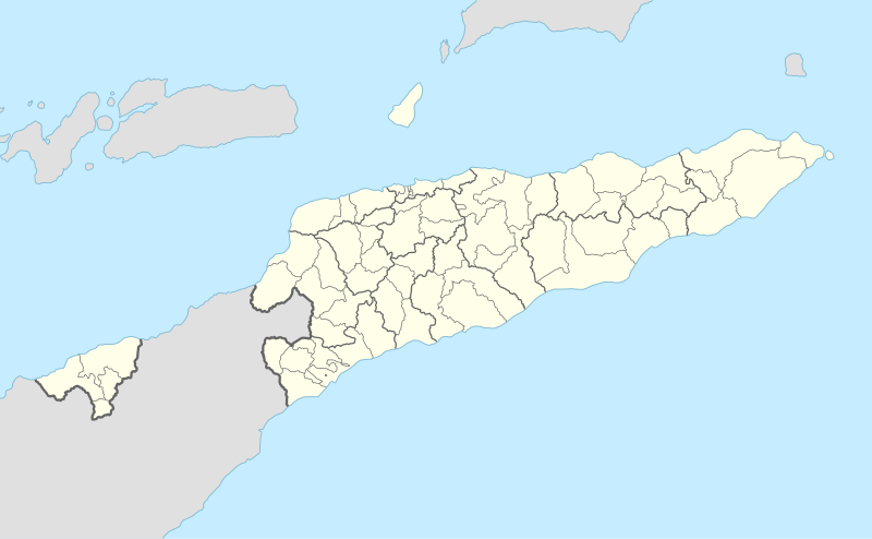
== {{int:filedesc}} == {{Information |Description= {{de|1=Positionskarte von Osttimor}} {{en|1=Location map of East Timor}} {{Location map series N |stretching=101 |top=-7.8 |bottom=-10.0 |left=123.9 |right=127.5 }} |Source={{Own using}} * United State...
Bu faylda fotoaparat və ya skanerlə əlavə olunmuş məlumatlar var. Əgər fayl sonradan redaktə olunubsa, bəzi parametrlər bu şəkildə göstərilənlərdən fərqli ola bilər.
Genişlik
1700.77px
Hündürlük
1049.746px
May 17, 2023
fayl, east, timor, location, fayl, faylın, tarixçəsi, fayl, keçidləri, faylın, qlobal, istifadəsi, metaməlumatlarbu, faylın, formatındakı, görünüşünün, ölçüsü, piksel, digər, ölçülər, piksel, piksel, piksel, piksel, piksel, piksel, faylın, orijinalı, 8206, fay. Fayl Faylin tarixcesi Fayl kecidleri Faylin qlobal istifadesi MetamelumatlarBu SVG faylin PNG formatindaki bu gorunusunun olcusu 800 494 piksel Diger olculer 320 198 piksel 640 395 piksel 1 024 632 piksel 1 280 790 piksel 2 560 1 580 piksel 1 701 1 050 piksel Faylin orijinali 8206 SVG fayli nominal olaraq 1 701 1 050 piksel faylin olcusu 114 KB Bu fayl Vikimedia Commons dadirve diger layihelerde istifade edile biler Faylin tesvir sehifesine get Xulase IzahEast Timor adm 2 location map svg Deutsch Positionskarte von Osttimor English Location map of East Timor Equirectangular projection vertical stretching 101 nbsp Border coordinates 7 8123 9 127 5 10 0 nbsp Melumat This map is part of a series of location maps with unified standards SVG as file format standardised colours and name scheme The boundaries on these maps always show the de facto situation and do not imply any endorsement or acceptance In case of changes of the shown area the file is updated The old version will be uploaded as a new file and thus is still available Tarix 9 avqust 2017 Menbe Own work using United States National Imagery and Mapping Agency data World Data Base II data http www estatal gov tl pt inicio Muellif NordNordWest Diger versiyalar Bu xerite alman Kartenwerkstatt terefinden yaxsilasdirilmisdir Siz hemcinin teleb olunan diger xeriteleri de teklif ede bilersiniz azerbaycanca nbsp Deutsch Sie Form nbsp cestina nbsp Deutsch nbsp sicilianu nbsp italiano nbsp russkij nbsp romană nbsp portugues nbsp English nbsp magyar nbsp Nederlands nbsp slovenscina nbsp polski nbsp latviesu nbsp makedonski nbsp espanol nbsp فارسی nbsp francais nbsp suomi nbsp עברית nbsp Plattduutsch nbsp ქართული nbsp հայերեն nbsp ব ল nbsp ithy nbsp 日本語 nbsp 中文 nbsp 中文 简体 nbsp 中文 繁體 nbsp العربية nbsp Lisenziya Usage of this file with Map NordNordWest Licence Creative Commons by sa 3 0 de explanatory notes Legally binding is only the full legalcode For a free usage I recommend to respect the following licence conditions 1 Provide my name as given above NordNordWest 2 a copy of or the URI for the applicable license https creativecommons org licenses by sa 3 0 de legalcode 3 the title of the work 4 in the case of an adaptation a credit identifying the use of the work in the adaptation This license and the rights granted hereunder will terminate automatically upon any breach by you of the terms of this license Any of the above conditions can be waived if you get permission from the copyright holder If you have questions or wish differing conditions please contact me through span class nowrap nnwestt online de span or my discussion pageBu fayl Creative Commons Attribution Share Alike 3 0 Almaniya lisenziyasi altinda yayimlanir Istinad Karte NordNordWest Lizenz Creative Commons by sa 3 0 deAzadsiniz paylasmaq eseri kocurmek paylamaq ve oturmek ucun remiks etmek eseri adaptasiya etmek Asagidaki sertlere riayet etmekle istinad Muvafiq kredit vermelisiniz lisenziyaya bir kecid vermelisiniz ve deyisikliklerin olub olmadigini bildirmelisiniz Bunu her hansi bir aglabatan sekilde ede bilersiniz ancaq lisenziyalasdiricinin sizi ve ya istifadenizi tesdiqlemesini teklif eden bir sekilde deyil benzer paylasma Eseri remix edirsinizse deyisdirirsinizse ve ya uzerinde is aparirsinizsa oz tohfelerinizi orijinalda oldugu kimi eyni ve ya uygun lisenziya altinda yayimlamalisiniz https creativecommons org licenses by sa 3 0 de deed en CC BY SA 3 0 de Creative Commons Attribution Share Alike 3 0 de true true This file has been released under a license which is incompatible with Facebook s licensing terms It is not permitted to upload this file to Facebook CaptionsazerbaycancaAdd a one line explanation of what this file representsItems portrayed in this filetesvir edircopyright status nbsp ingiliscopyrighted nbsp ingilislisenziyaCreative Commons Attribution ShareAlike 3 0 Germany nbsp ingilisyaranma tarixi9 avqust 2017 Faylin tarixcesi Faylin evvelki versiyasini gormek ucun gun tarix bolmesindeki tarixlere klikleyin Tarix VaxtKicik sekilOlculerIstifadeciSerh indiki07 56 9 avqust 20171 701 1 050 114 KB NordNordWest int filedesc Information Description de 1 Positionskarte von Osttimor en 1 Location map of East Timor Location map series N stretching 101 top 7 8 bottom 10 0 left 123 9 right 127 5 Source Own using United State Fayl kecidleri Bu sekile olan kecidler Dili Manufaxi Sablon Yer xeritesi Serqi Timor Faylin qlobal istifadesi Bu fayl asagidaki vikilerde istifade olunur af wikipedia org layihesinde istifadesi Dili Sjabloon Liggingkaart Oos Timor Ermera an wikipedia org layihesinde istifadesi Plantilla Mapa de localizacion Timor Oriental ar wikipedia org layihesinde istifadesi قالب خريطة مواقع تيمور الشرقية ast wikipedia org layihesinde istifadesi Lospalos Modulu Minimapa data Timor Oriental Aeropuertu d Oecusse Aeropuertu de Suai Modulu Minimapa data Timor Oriental usu Dili bar wikipedia org layihesinde istifadesi Vorlog Positionskarte Osttimor Oat im Distrikt Aileu Oat im Distrikt Ainaro Oat im Distrikt Baucau Oat im Distrikt Bobonaro Oat im Distrikt Cova Lima Oat im Distrikt Dili Oat im Distrikt Ermera Oat im Distrikt Lautem Oat im Distrikt Liquica Oat im Distrikt Manatuto Oat im Distrikt Manufahi Oat im Distrikt Oecusse Oat im Distrikt Viqueque ba wikipedia org layihesinde istifadesi Ҡalyp PozKarta Konsygysh Timor Dili bcl wikipedia org layihesinde istifadesi Dili Module Mapa nin kinamumugtakan datos East Timor Module Mapa nin kinamumugtakan datos Subangan na Timor Module Mapa nin kinamumugtakan datos Subangan na Timor doc be tarask wikipedia org layihesinde istifadesi Dyli Shablyon Lyakalizacyjnaya mapa Ўshodnyaga Tymoru Tymor be wikipedia org layihesinde istifadesi Dyli Shablon Na karce Ushodni Tymor Ajnaru bg wikipedia org layihesinde istifadesi Shablon PK Iztochen Timor Atauro bn wikipedia org layihesinde istifadesi মড উল অবস থ ন ম নচ ত র উপ ত ত প র ব ত ম র মড উল অবস থ ন ম নচ ত র উপ ত ত প র ব ত ম র নথ bs wikipedia org layihesinde istifadesi Dili Sablon Lokacijska karta Istocni Timor ceb wikipedia org layihesinde istifadesi Plantilya Location map East Timor Seli Ossu Dili Coa Vila Salazar Bandeira Bu faylin qlobal istifadesine baxin Metamelumatlar Bu faylda fotoaparat ve ya skanerle elave olunmus melumatlar var Eger fayl sonradan redakte olunubsa bezi parametrler bu sekilde gosterilenlerden ferqli ola biler Genislik1700 77pxHundurluk1049 746px Menbe https az wikipedia org wiki Fayl East Timor adm 2 location map svg, wikipedia, oxu, kitab, kitabxana, axtar, tap, hersey,
ne axtarsan burda
, en yaxsi meqale sayti, meqaleler, kitablar, oyrenmek, wiki, bilgi, tarix, seks, porno, indir, yukle, sex, azeri sex, azeri, seks yukle, sex yukle, izle, seks izle, porno izle, mobil seks, telefon ucun, chat, azeri chat, tanisliq, tanishliq, azeri tanishliq, sayt, medeni, medeni saytlar, chatlar, mekan, tanisliq mekani, mekanlari, yüklə, pulsuz, pulsuz yüklə, mp3, video, mp4, 3gp, jpg, jpeg, gif, png, şəkil, muisiqi, mahnı, kino, film, kitab, oyun, oyunlar.