Bu fayl "Vikimedia Commons"dadır və digər layihələrdə istifadə edilə bilər.
təsvir səhifəsi
Faylın təsvir səhifəsinə get
File:Blank Map World Secondary Political Divisions.svg is a vector version of this file. It should be used in place of this PNG file when not inferior.
File:BlankMap-World-Subdivisions.PNG → File:Blank Map World Secondary Political Divisions.svg
For more information, see Help:SVG.
In other languages
Alemannisch ∙ Bahasa Indonesia ∙ Bahasa Melayu ∙ British English ∙ català ∙ čeština ∙ dansk ∙ Deutsch ∙ eesti ∙ English ∙ español ∙ Esperanto ∙ euskara ∙ français ∙ Frysk ∙ galego ∙ hrvatski ∙ Ido ∙ italiano ∙ lietuvių ∙ magyar ∙ Nederlands ∙ norsk bokmål ∙ norsk nynorsk ∙ occitan ∙ Plattdüütsch ∙ polski ∙ português ∙ português do Brasil ∙ română ∙ Scots ∙ sicilianu ∙ slovenčina ∙ slovenščina ∙ suomi ∙ svenska ∙ Tiếng Việt ∙ Türkçe ∙ vèneto ∙ Ελληνικά ∙ беларуская (тарашкевіца) ∙ български ∙ македонски ∙ нохчийн ∙ русский ∙ српски / srpski ∙ татарча/tatarça ∙ українська ∙ ქართული ∙ հայերեն ∙ বাংলা ∙ தமிழ் ∙ മലയാളം ∙ ไทย ∙ 한국어 ∙ 日本語 ∙ 简体中文 ∙ 繁體中文 ∙ עברית ∙ العربية ∙ فارسی ∙ +/−
h
Xülasə
İzahBlankMap-World-Subdivisions.PNG
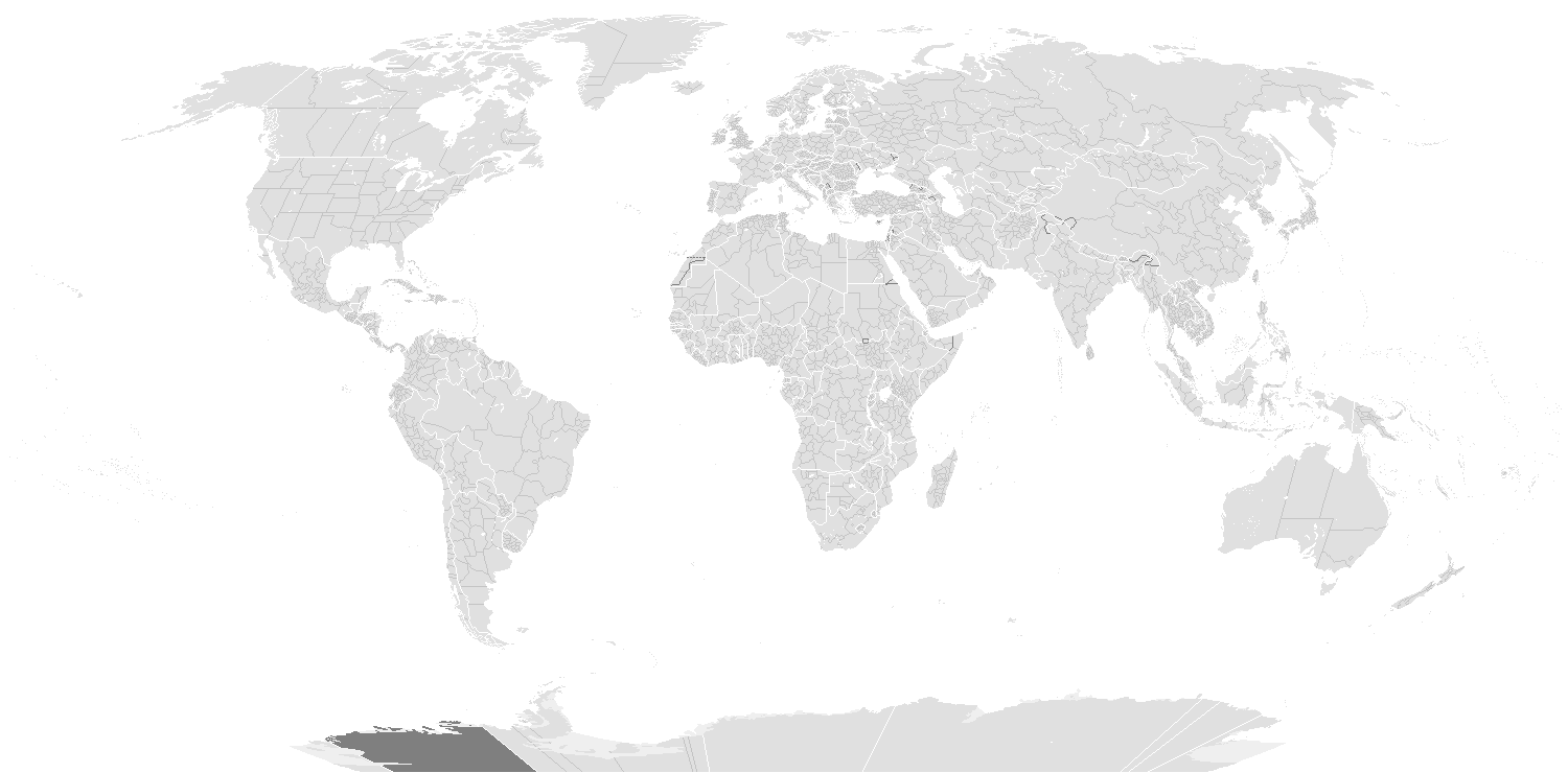
English: A blank world map showing subdivisions of the world. Areas in black boxes are unrecognized countries or disputed territories (Kashmir). Feel free to fix subdivisions (mainly Russia, Mongolia, and Kazakhstan. If you use the subdivision maps for any other image I strongly advise changing the subdivision colours to suit your purposes (eg. In Photoshop use the bucket of paint thing with contiguous and anti-alias turned off and click on any subdivision border with your preferred colour.) The colours chosen here are to differentiate the types of borders, not dictate use.
Français : Carte du monde vierge montrant les subdivisions de premier niveau de chaque pays. Les régions encadrées en noir montrent des États non reconnus ou des territoires disputés (comme le Cachemire. Ne vous gênez pas pour arranger certaines limites de subdivisions — notamment en Russie, en Mongolie et au Kazakhstan. Si vous utilisez cette carte pour faire une autre image, il vous est vivement conseillé d’en changer les couleurs pour qu’elles conviennent à votre usage ; ces couleurs-ci ne sont choisies que pour distinguer les différents types de frontières.
Tarix
Mənbə
Provinces of South Africa (see reference)
Provinces of Argentina (see reference)
States and territories of Australia (see reference)
Administrative divisions of Belarus (see reference)
Subdivisions of Bosnia and Herzegovina (see reference)
States of Brazil (see reference)
Provinces and territories of Canada (see reference)
Subdivisions of China (see reference)
Provinces of the Democratic Republic of the Congo (see reference)
States and territories of India (see reference)
Provinces of Kazakhstan (see reference)
Political divisions of Mexico (see reference)
Subdivisions of Russia (see reference)
Subdivisions of Serbia (see reference; a 2005 CIA wall map of the former Serbia and Montenegro)
Governorates of Syria (see reference)
Provinces of Turkmenistan (see reference)
Provinces of Uzbekistan (see reference)
Home Nations of the United Kingdom (see reference)
U.S. states (see reference)
Müəllif
English: see upload log?
İcazə (Faylın təkrar istifadəsi)
Public domainPublic domainfalsefalse
Digər versiyalar
Derivative works of this file: BlankMap-World-Subdivisions1.png
Key
English (en):
Water-bodies
Landmasses
Unclaimed Landmasses
National Borders
Subnational Borders
Colours
Name
Decimal
Hex
Water-bodies:
255,255,255
#FFFFFF
Landmasses:
224,224,224
#E0E0E0
Unclaimed Landmasses:
127,127,127
#7F7F7F
National Borders:
255,255,255
#FFFjjj
Subnational Borders:
202,202,202
#CACACA
Annotations
InfoField
This image is annotated: View the annotations at Commons
2
553
237
185
1480
740
Republic of China claims
222
709
30
30
1480
740
Current Republic of China control
1336
651
41
33
1480
740
Somaliland
1354
683
22
22
1480
740
Northern Cyprus
1378
655
46
43
1480
740
Sahrawi Arab Democratic Republic
1334
683
20
22
1480
740
Kosovo
1334
701
24
22
1480
740
Transnistria
1354
707
20
19
1480
740
Abkhazia
1339
725
17
13
1480
740
Nagorno-Karabakh
1356
727
20
11
1480
740
South Ossetia
1378
701
26
37
1480
740
As Israel claims
1406
703
22
35
1480
740
As Palestine claims
1428
659
50
44
1480
740
Pakistani claims on Kashmir
1425
699
54
39
1480
740
Indian claims on Kashmir
Captions
Add a one-line explanation of what this file represents
Items portrayed in this file
təsvir edir
copyright status ingilis
copyrighted, dedicated to the public domain by copyright holder ingilis
lisenziya
released into the public domain by the copyright holder ingilis
yaranma tarixi
19 dekabr 2006
MIME type ingilis
image/png
checksum ingilis
845622a6a23d31270c51493ed413b059302e0d19
təyinetmə üsulu: SHA-1 ingilis
data size ingilis
120.914 Bayt
hündürlüyü/boyu
740 piksel
eni
1.500 piksel
Faylın tarixçəsi
Faylın əvvəlki versiyasını görmək üçün gün/tarix bölməsindəki tarixlərə klikləyin.
(ən yeni | ən əvvəlki) Göstər (10 daha yeni) (10 daha köhnə) (10 | 20 | 50 | 100 | 250 | 500).
Major overhall to the projection! Continents, coastlines, national boundary and internal boundaries fixed. Islands, atolls and reefs added or adjusted!
fayl, blankmap, world, subdivisions, fayl, faylın, tarixçəsi, fayl, keçidləri, faylın, qlobal, istifadəsisınaq, göstərişi, ölçüsü, piksel, digər, ölçülər, piksel, piksel, piksel, faylın, orijinalı, 8206, piksel, fayl, həcmi, mime, növü, image, fayl, vikimedia,. Fayl Faylin tarixcesi Fayl kecidleri Faylin qlobal istifadesiSinaq gosterisi olcusu 800 395 piksel Diger olculer 320 158 piksel 640 316 piksel 1 500 740 piksel Faylin orijinali 8206 1 500 740 piksel fayl hecmi 118 KB MIME novu image png Bu fayl Vikimedia Commons dadirve diger layihelerde istifade edile biler tesvir sehifesi Faylin tesvir sehifesine get File Blank Map World Secondary Political Divisions svg is a vector version of this file It should be used in place of this PNG file when not inferior File BlankMap World Subdivisions PNG File Blank Map World Secondary Political Divisions svg For more information see Help SVG In other languages Alemannisch nbsp Bahasa Indonesia nbsp Bahasa Melayu nbsp British English nbsp catala nbsp cestina nbsp dansk nbsp Deutsch nbsp eesti nbsp English nbsp espanol nbsp Esperanto nbsp euskara nbsp francais nbsp Frysk nbsp galego nbsp hrvatski nbsp Ido nbsp italiano nbsp lietuviu nbsp magyar nbsp Nederlands nbsp norsk bokmal nbsp norsk nynorsk nbsp occitan nbsp Plattduutsch nbsp polski nbsp portugues nbsp portugues do Brasil nbsp romană nbsp Scots nbsp sicilianu nbsp slovencina nbsp slovenscina nbsp suomi nbsp svenska nbsp Tiếng Việt nbsp Turkce nbsp veneto nbsp Ellhnika nbsp belaruskaya tarashkevica nbsp blgarski nbsp makedonski nbsp nohchijn nbsp russkij nbsp srpski srpski nbsp tatarcha tatarca nbsp ukrayinska nbsp ქართული nbsp հայերեն nbsp ব ল nbsp தம ழ nbsp മലയ ള nbsp ithy nbsp 한국어 nbsp 日本語 nbsp 简体中文 nbsp 繁體中文 nbsp עברית nbsp العربية nbsp فارسی nbsp nbsp hXulase IzahBlankMap World Subdivisions PNG English A blank world map showing subdivisions of the world Areas in black boxes are unrecognized countries or disputed territories Kashmir Feel free to fix subdivisions mainly Russia Mongolia and Kazakhstan If you use the subdivision maps for any other image I strongly advise changing the subdivision colours to suit your purposes eg In Photoshop use the bucket of paint thing with contiguous and anti alias turned off and click on any subdivision border with your preferred colour The colours chosen here are to differentiate the types of borders not dictate use Francais nbsp Carte du monde vierge montrant les subdivisions de premier niveau de chaque pays Les regions encadrees en noir montrent des Etats non reconnus ou des territoires disputes comme le Cachemire Ne vous genez pas pour arranger certaines limites de subdivisions notamment en Russie en Mongolie et au Kazakhstan Si vous utilisez cette carte pour faire une autre image il vous est vivement conseille d en changer les couleurs pour qu elles conviennent a votre usage nbsp ces couleurs ci ne sont choisies que pour distinguer les differents types de frontieres Tarix 19 dekabr 2006 Menbe Provinces of South Africa see reference Provinces of Argentina see reference States and territories of Australia see reference Administrative divisions of Belarus see reference Subdivisions of Bosnia and Herzegovina see reference States of Brazil see reference Provinces and territories of Canada see reference Subdivisions of China see reference Provinces of the Democratic Republic of the Congo see reference States and territories of India see reference Provinces of Kazakhstan see reference Political divisions of Mexico see reference Subdivisions of Russia see reference Subdivisions of Serbia see reference a 2005 CIA wall map of the former Serbia and Montenegro Governorates of Syria see reference Provinces of Turkmenistan see reference Provinces of Uzbekistan see reference Home Nations of the United Kingdom see reference U S states see reference Muellif English see upload log Icaze Faylin tekrar istifadesi Public domain Public domain false false Men bu eserin muellif huquqlarinin sahibi kimi eseri ictimai mulkiyyete verirem Bu icaze butun dunyada quvvededir In some countries this may not be legally possible if so Bunun qanunla mumkun olmadigi hallarda Istenilen sexse istenilen meqsed ucun qanunlar terefinden qadagan edilmeyince hec bir sert qoymadan bu isden istifade haqqini bagislayiram Diger versiyalar Derivative works of this file nbsp BlankMap World Subdivisions1 png Key English en nbsp Water bodies nbsp Landmasses nbsp Unclaimed Landmasses nbsp National Borders nbsp Subnational Borders Colours Name nbsp Decimal Hex Water bodies nbsp 255 255 255 FFFFFF Landmasses nbsp 224 224 224 E0E0E0 Unclaimed Landmasses nbsp 127 127 127 7F7F7F National Borders nbsp 255 255 255 FFFjjj Subnational Borders nbsp 202 202 202 CACACA AnnotationsInfoFieldThis image is annotated View the annotations at Commons2 553 237 185 1480 740 Republic of China claims 222 709 30 30 1480 740 Current Republic of China control 1336 651 41 33 1480 740 Somaliland 1354 683 22 22 1480 740 Northern Cyprus 1378 655 46 43 1480 740 Sahrawi Arab Democratic Republic 1334 683 20 22 1480 740 Kosovo 1334 701 24 22 1480 740 Transnistria 1354 707 20 19 1480 740 Abkhazia 1339 725 17 13 1480 740 Nagorno Karabakh 1356 727 20 11 1480 740 South Ossetia 1378 701 26 37 1480 740 As Israel claims 1406 703 22 35 1480 740 As Palestine claims 1428 659 50 44 1480 740 Pakistani claims on Kashmir 1425 699 54 39 1480 740 Indian claims on KashmirCaptionsazerbaycancaAdd a one line explanation of what this file representsItems portrayed in this filetesvir edircopyright status nbsp ingiliscopyrighted dedicated to the public domain by copyright holder nbsp ingilislisenziyareleased into the public domain by the copyright holder nbsp ingilisyaranma tarixi19 dekabr 2006MIME type nbsp ingilisimage pngchecksum nbsp ingilis845622a6a23d31270c51493ed413b059302e0d19teyinetme usulu SHA 1 nbsp ingilisdata size nbsp ingilis120 914 Baythundurluyu boyu740 pikseleni1 500 piksel Faylin tarixcesi Faylin evvelki versiyasini gormek ucun gun tarix bolmesindeki tarixlere klikleyin en yeni en evvelki Goster 10 daha yeni 10 daha kohne 10 20 50 100 250 500 Tarix VaxtKicik sekilOlculerIstifadeciSerh indiki22 36 14 mart 20201 500 740 118 KB DylmurReverted to version as of 18 58 14 March 2020 UTC hopefully this works again 19 00 14 mart 20201 500 740 91 KB DylmurReverted to version as of 00 56 29 October 2017 UTC didn t work 18 58 14 mart 20201 500 740 118 KB DylmurLadakh 2019 00 56 29 oktyabr 20171 500 740 91 KB ErhikGolan Heights 00 25 29 oktyabr 20171 500 740 91 KB ErhikMinor adjustments in Oceania Ukraine 11 27 10 oktyabr 20171 500 740 104 KB Expertseeker90Major overhall to the projection Continents coastlines national boundary and internal boundaries fixed Islands atolls and reefs added or adjusted 21 34 4 iyul 20171 500 740 100 KB ForthrunnerCatalonia isn 039 t independent 09 47 21 iyul 20161 500 740 67 KB SimonsyoAdded British Regions 18 21 19 yanvar 20161 500 740 67 KB UserbokerAdded new French regions as of 2016 fixed Catalonia being represented as independent 14 58 16 dekabr 20141 500 740 83 KB RansewikiDid not work last time en yeni en evvelki Goster 10 daha yeni 10 daha kohne 10 20 50 100 250 500 Fayl kecidleri Bu fayli istifade eden sehife yoxdur Faylin qlobal istifadesi Bu fayl asagidaki vikilerde istifade olunur de wikipedia org layihesinde istifadesi Vorwahlergebnisse der Prasidentschaftswahl in den Vereinigten Staaten 2008 Vorwahlergebnisse der Prasidentschaftswahl in den Vereinigten Staaten 2016 Vorwahlergebnisse der Prasidentschaftswahl in den Vereinigten Staaten 2020 Vorwahlergebnisse der Prasidentschaftswahl in den Vereinigten Staaten 2024 Benutzer Sarkana Vorwahlergebnisse 2024 en wikipedia org layihesinde istifadesi Wikipedia Blank maps File talk H1N1 map svg Archive 3 Talk 2009 swine flu pandemic Archive 7 Wikipedia Graphics Lab Map workshop Archive May 2011 fr wikipedia org layihesinde istifadesi Wikipedia Atelier graphique Cartes Archives juillet 2010 sv wikipedia org layihesinde istifadesi Resultat i primarvalen till presidentvalet i USA 2008 zh wikipedia org layihesinde istifadesi User 玖巧仔 沙盒3 Menbe https az wikipedia org wiki Fayl BlankMap World Subdivisions PNG, wikipedia, oxu, kitab, kitabxana, axtar, tap, hersey,
ne axtarsan burda
, en yaxsi meqale sayti, meqaleler, kitablar, oyrenmek, wiki, bilgi, tarix, seks, porno, indir, yukle, sex, azeri sex, azeri, seks yukle, sex yukle, izle, seks izle, porno izle, mobil seks, telefon ucun, chat, azeri chat, tanisliq, tanishliq, azeri tanishliq, sayt, medeni, medeni saytlar, chatlar, mekan, tanisliq mekani, mekanlari, yüklə, pulsuz, pulsuz yüklə, mp3, video, mp4, 3gp, jpg, jpeg, gif, png, şəkil, muisiqi, mahnı, kino, film, kitab, oyun, oyunlar.